Ranton No. 1 / Rantone / Rantun
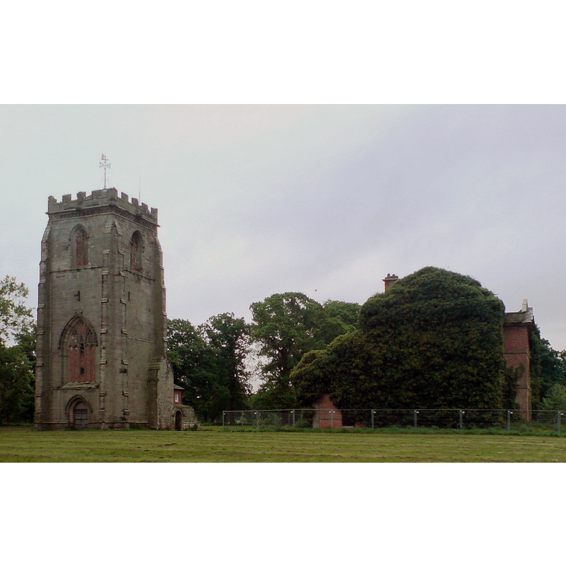
Image copyright © [in the public domain]
PD-user
Results: 2 records
view of church exterior in context - southwest view
Copyright Statement: Image copyright © [in the public domain]
Image Source: digital photograph taken 20 May 2008 by Peter Morrell [https://commons.wikimedia.org/wiki/File:Ranton_abbey.JPG] [accessed 12 July 2019]
Copyright Instructions: PD-user
view of church exterior in context
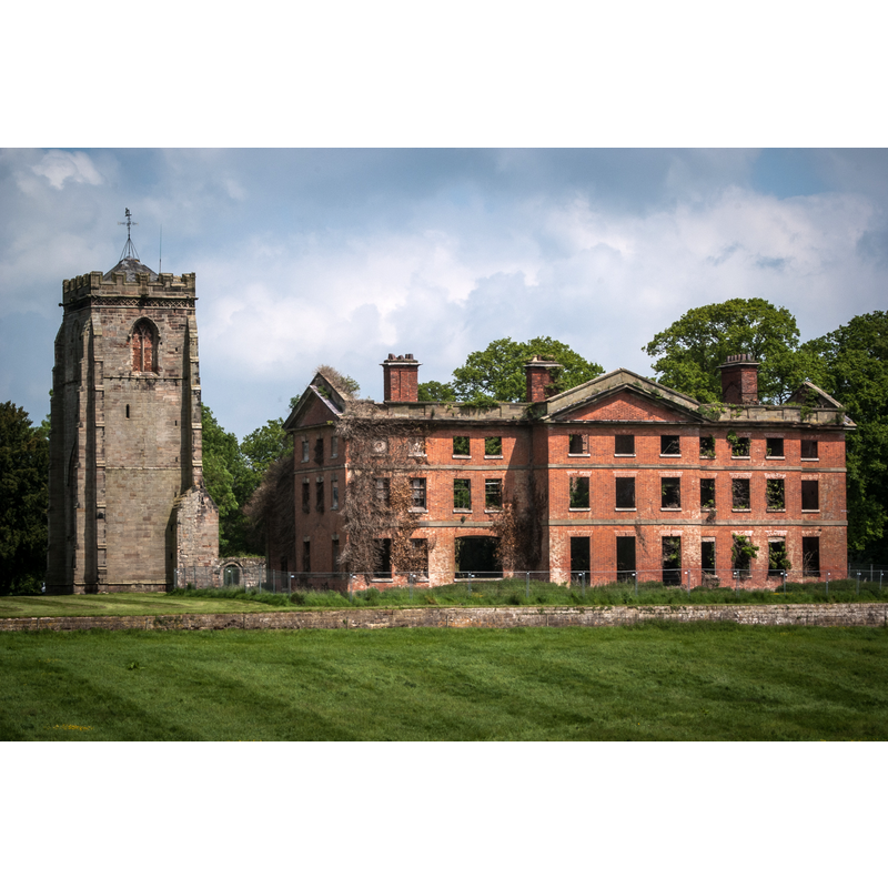
Scene Description: Source caption: "Ranton Abbey / Abbey House remains. Ranton Abbey "was founded by Robert and Celestia Noel of Ellenhall about 1150 for Augustinian canons from Haughmond. In 1820 Thomas, 1st Earl of Lichfield, built a large house, a hunting lodge or weekend retreat, adjacent to the abbey...all that remains of the abbey is the large imposing tower (of the 15th century) and a little of the nave wall with a Norman doorway decorated with roll moulding. The house...is now in ruins...it was accidentally burned down in 1942, during the Second World War, when troops of Queen Wilhelmina's bodyguard were quartered here."
Copyright Statement: Image copyright © Brian Deegan, 2009
Image Source: digital photograph taken 29 May 2009 by Brian Deegan [www.geograph.org.uk/photo/5108453] [accessed 12 July 2019]
Copyright Instructions: CC-BY-SA-2.0
INFORMATION
Font ID: 22233RAN
Object Type: Baptismal Font1?
Font Century and Period/Style: 12th century (mid?), Late Norman
Church / Chapel Name: Augustinian Priory of Ranton [aka Ranton Abbey] disappeared]
Font Location in Church: [disappeared]
Church Address: Ranton Abbey, Stafford ST20 0JQ, UK
Site Location: Staffordshire, West Midlands, England, United Kingdom
Directions to Site: Located off (S) the B5405, 6-7 km WNW of Stafford
Ecclesiastic Region: [Diocese of Lichfield]
Historical Region: Hundred of Pirehill
Additional Comments: disappeared font? (the one from the 12thC priory church here)
Font Notes:
Click to view
There is an entry for Ranton [variant spelling] in the Domesday survey [https://opendomesday.org/place/SJ8524/ranton/] [accessed 12 July 2019] but it mentions neither cleric nor church in it. The entry for this priory in the Victoria County History (Stafford, vol. 3, 1970) notes: "The priory of Ranton was founded about the mid 12th century by Robert fitz Noel of Ellenhal [...] The foundation charter states that the canons of Ranton were living 'under the rule and obedience' of Haughmond Abbey (Salop.), and this helps to fix the date of foundation. Ranton must have been founded after the establishment of the mother-house at Haughmond (between 1130 and 1138) [...] and by 1166 when some of the witnesses to the foundation charter were dead. [...] [dissolved in 1537] [...] The chief remains of the monastic buildings are a fine western tower of the 14th century, which is intact, and a portion of the adjoining south wall of the church. References in 1663 to 'the cloister at Ranton Abbey', 'the great chamber window', and 'another chamber window' [...] indicate that other parts of the priory were then still standing."
COORDINATES
UTM: 30U 551120 5852045
Latitude & Longitude (Decimal): 52.81576, -2.24149
Latitude & Longitude (DMS): 52° 48′ 56.74″ N, 2° 14′ 29.36″ W
REFERENCES
- Victoria County History [online], University of London, 1993-. URL: https://www.british-history.ac.uk.