Rocester No. 2 / Rouecestre / Rowcestre / Rowecestre
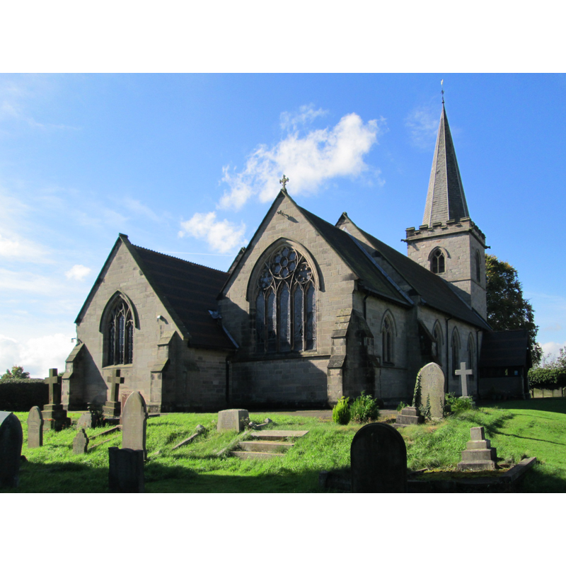
Image copyright © AtticTapestry, 2017
CC-BY-SA-3.0
Results: 1 records
view of church exterior - northeast view
Scene Description: "Parish Church. C13, but mostly rebuilt in 1870-72" [cf. FontNotes]
Copyright Statement: Image copyright © AtticTapestry, 2017
Image Source: digital photograph taken 28 September 2017 by AtticTapestry [https://commons.wikimedia.org/wiki/File:Rocester_Church_2.jpg] [accessed 10 July 2019]
Copyright Instructions: CC-BY-SA-3.0
INFORMATION
Font ID: 22232ROC
Object Type: Baptismal Font1?
Font Century and Period/Style: 13th century, Early English
Church / Chapel Name: Parish Church of St. Michael
Font Location in Church: [disappeared]
Church Patron Saint(s): St. Michael
Church Address: Rocester, Uttoxeter ST14 5JY, UK
Site Location: Staffordshire, West Midlands, England, United Kingdom
Directions to Site: Located off (E) the B5030, about 7 km NNE of Uttoxeter, near the county border with Derbyshire
Ecclesiastic Region: Diocese of Lichfield
Historical Region: Hundred of Totmonslow
Additional Comments: disappeared font? (the one from the 13thC church here)
Font Notes:
Click to view
There are two entries for Rocester [variant spellings] in the Domesday survey [https://opendomesday.org/place/SK1039/rocester/] [accessed 10 July 2019] neither of which mentions cleric or church in it. The entry for this church in Historic England [Listing NGR: SK1117039373] notes: "Parish Church. C13, but mostly rebuilt in 1870-72 [...] C19 stone font with octagonal shaft to moulded base and circular bowl inscribed around top: "SUFFER LITTLE CHILDREN TO COME UNTO ME AND FORBID THEM NOT FOR OF SUCH IS THE KINGDOM OF HEAVEN"".
COORDINATES
UTM: 30U 578335 5867601
Latitude & Longitude (Decimal): 52.9523, -1.834
Latitude & Longitude (DMS): 52° 57′ 8.28″ N, 1° 50′ 2.4″ W