Abbey Hulton / Heltone / Hilton / Hulton Abbey
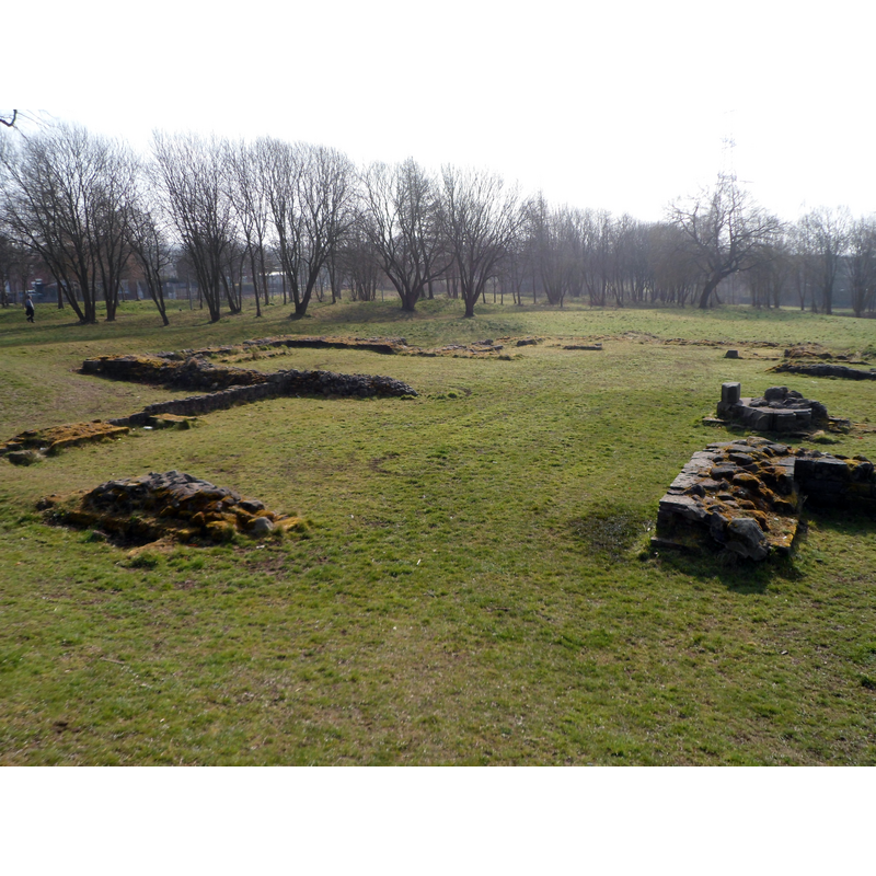
Image copyright © Chris Beaver, 2015
CC-BY-SA-2.0
Results: 2 records
view of church exterior - detail
Scene Description: Source caption: "Ruined foundations of Hulton Abbey. All that remains of Hulton Abbey which was dissolved in 1538."
Copyright Statement: Image copyright © Chris Beaver, 2015
Image Source: digital photograph taken 19 March 2015 by Chris Beaver [www.geograph.org.uk/photo/4393311] [accessed 10 July 2019]
Copyright Instructions: CC-BY-SA-2.0
view of church exterior - detail
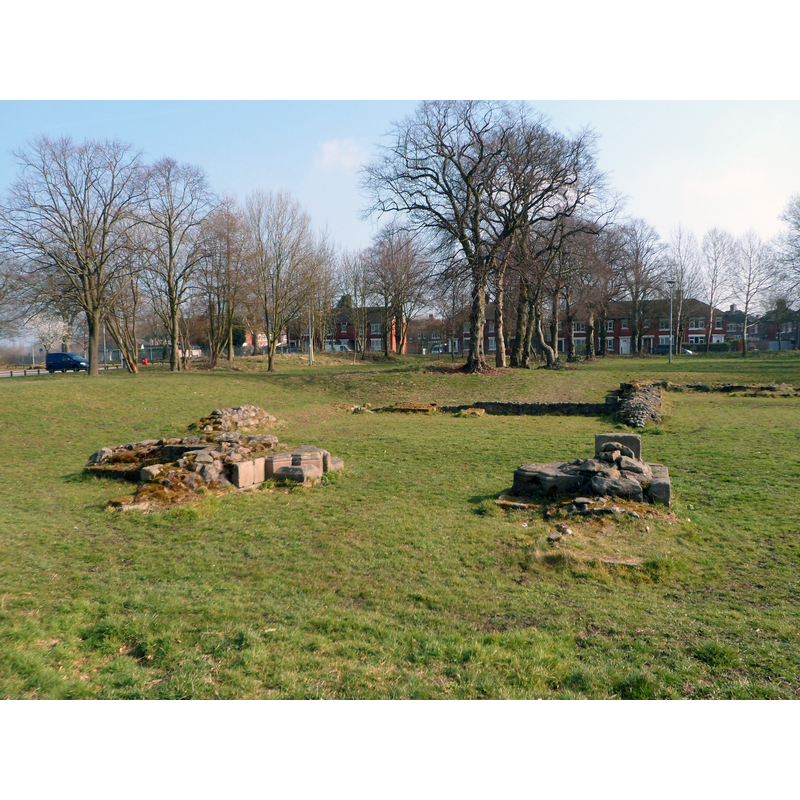
Scene Description: Source caption: "Ruined foundations of Hulton Abbey. All that remains of Hulton Abbey which was dissolved in 1538."
Copyright Statement: Image copyright © Chris Beaver, 2015
Image Source: digital photograph taken 19 March 2015 by Chris Beaver [www.geograph.org.uk/photo/4393311] [accessed 10 July 2019]
Copyright Instructions: CC-BY-SA-2.0
INFORMATION
Font ID: 22228HUL
Object Type: Baptismal Font1?
Font Century and Period/Style: 13th century, Early English
Church / Chapel Name: Cistercian Abbey Church [ruins]
Font Location in Church: [disappeared]
Church Address: 1434 Leek Rd, Stoke-on-Trent ST2 8DB, UK
Site Location: Staffordshire, West Midlands, England, United Kingdom
Directions to Site: The site of the ruined abbey, now a scheduled monument, is off the junction of the A5009 Leek Rd and Woodhead, in the village known as Abbey Hulton, now a suburb of Stoke-on-Trent
Ecclesiastic Region: [Diocese of Lichfield]
Historical Region: Hundred of Pirehill
Additional Comments: disappeared font? (the one from the 13thC abbey church here)
Font Notes:
Click to view
There is an entry for [Abbey] Hulton [variant spelling] in the Domesday survey [https://opendomesday.org/place/SJ9148/abbey-hulton/] [accessed 10 July 2019] but it mentions neither cleric nor church in it. The entry for this abbey in the Victoria County History (Stafford, vol. 3, 1970) notes: "The Cistercian abbey of St. Mary at Hulton, a daughter-house of Combermere Abbey in Cheshire, was founded by Henry de Audley [...] The site, in what was then a remote part of the county, is just over 2 miles east of Burslem in a valley beside the Trent not far from its source. The first brethren were professed in 1219, [...] but Henry's foundation charter was not issued until 1223 [...] The site and the manor of Hulton were sold with other neighbouring lands of the abbey to Sir Edward Aston in 1543. [...] The abbey site is on the east side of the road from Stoke to Leek by Carmountside Junior High School. The conventual buildings lay on the south side of the church which consisted of nave, aisles, chancel, transepts (each with two east chapels), and a tower over the crossing." The entry for this abbey in Historic England [Legacy System number: 35857] notes: "Hulton Abbey is a good example of a small Cistercian monastery. [...] The monument includes the standing structural and buried remains of a Cistercian monastery, known as Hulton Abbey, and associated earthwork and buried remains of water management features. The abbey occupies a slightly elevated position on the eastern side of the upper Trent valley at Abbey Hulton, a suburb of Stoke on Trent. [...] buildings included the church, the chapter house (used for the regulation of religous duties and business), dormitories, a kitchen and a refectory. They were laid out around a square cloister, with the church on the northern side [...] Human burials were also discovered in the church. [...] Archaeological excavations indicate that the church is of basic cruciform design. It is about 41.5m long and 32m wide across the transepts and has a relatively short nave. The most recent archaeological work has demonstrated that the chancel and the south transept were built first, with the remainder of the church constructed later in the 13th century. The rectangular chapter house to the south of the church was built about 1270. [...] The eastern part of the church remains visible, with bases of walls standing up to 0.8m high. All the walls are constructed of red sandstone and some retain their ashlar facings. Column bases at the eastern end of the nave and the altar plinths in the chancel and transepts are also visible. All other parts of the church and the other claustral buildings survive as buried features.
COORDINATES
UTM: 30U 557494 5877002
Latitude & Longitude (Decimal): 53.039444, -2.1425
Latitude & Longitude (DMS): 53° 2′ 22″ N, 2° 8′ 33″ W
REFERENCES
- Victoria County History [online], University of London, 1993-. URL: https://www.british-history.ac.uk.