Croxden / Crochesdene
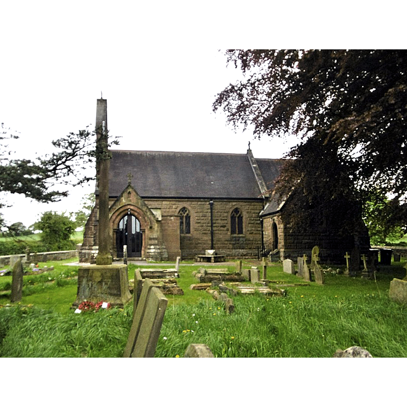
Image copyright © Mike Faherty, 2018
CC-BY-SA-2.0
Results: 4 records
view of church exterior - south view
Scene Description: this is the present parish church of Croxden; it is a 19thC re-building of a chapel [not the abbey church] of the old abbey
Copyright Statement: Image copyright © Mike Faherty, 2018
Image Source: digital photograph taken 12 May 2018 by Mike Faherty [www.geograph.org.uk/photo/5775350] [accessed 9 July 2019]
Copyright Instructions: CC-BY-SA-2.0
view of church exterior - west portal
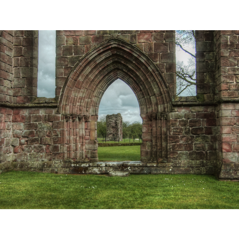
Scene Description: ruins of the Abbey of the Vale of St. Mary at Croxden
Copyright Statement: Image copyright © Alun Salt, 2010
Image Source: edited detail of a igital photograph taken 26 April 2010 by Alun Salt [https://commons.wikimedia.org/wiki/File:X-westdoor2.jpg] [accessed 9 July 2019]
Copyright Instructions: CC-BY-SA-2.0
view of church exterior - west façade
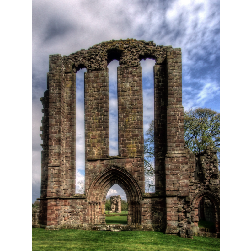
Scene Description: ruins of the Abbey of the Vale of St. Mary at Croxden
Copyright Statement: Image copyright © Alun Salt, 2010
Image Source: edited detail of a digital photograph taken 26 April 2010 by Alun Salt [https://commons.wikimedia.org/wiki/File:X-entry-v.jpg] [accessed 9 July 2019]
Copyright Instructions: CC-BY-SA-2.0
view of church interior - east side
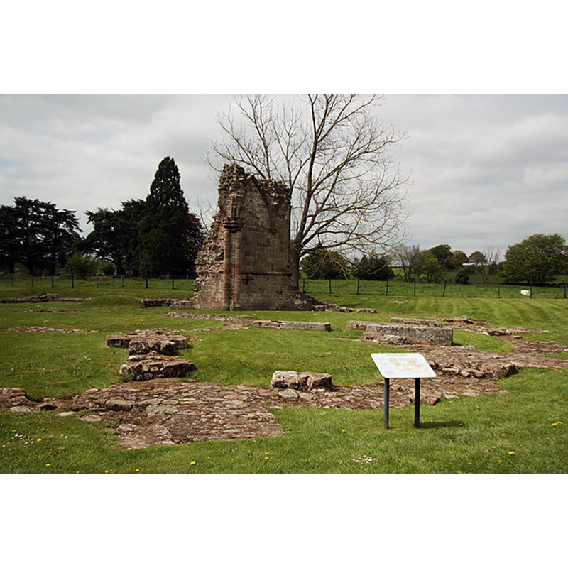
Scene Description: Source caption: "Fragmentary remains of the five radiating apsidal chapels at the eastern end of Croxden Abbey church".
Copyright Statement: Image copyright © Richard Croft, 2013
Image Source: digital photograph taken 22 May 2013 by Richard Croft [www.geograph.org.uk/photo/3471557] [accessed 9 July 2019
Copyright Instructions: CC-BY-SA-2.0
INFORMATION
Font ID: 22226CRO
Object Type: Baptismal Font1?
Font Century and Period/Style: 12th - 13th century, Transitional / Early English
Church / Chapel Name: Cistercian Abbey Church / Abbey of the Vale of St. Mary at Croxden [in ruins]
Font Location in Church: [disappeared]
Church Patron Saint(s): St. Mary
Church Notes: abbey church dedicated 1253; abandoned at the Dissolution; a chapel off the abbey gatehouse became parish church, replaced in 1886 by the present church
Church Address: [NB: address and coordinates given are for the abbey ruins] Croxden Ln, Croxden, Uttoxeter ST14 5JF, UK -- Tel.: +44 370 333 1181
Site Location: Staffordshire, West Midlands, England, United Kingdom
Directions to Site: Located off (N) the A50, between Alton (NNE) and Uttoxeter (SSE), SSE of Stoke-on-Trent, NNW of Derby
Ecclesiastic Region: [Diocese of Lichfield]
Historical Region: Hundred of Totmonslow
Additional Comments: disappeared font? (the one from the late-12th or early 13thC abbey church here)
Font Notes:
Click to view
There is an entry for Croxden [variant spelling] in the Domesday survey [https://opendomesday.org/place/SK0639/croxden/] [accessed 9 July 2019] but it mentions neither cleric nor church in it. The entry for this abbey in the Victoria County History (Stafford, vol. 3, 1970) notes: "In 1176 Bertram de Verdun, lord of Alton, a baron of the Exchequer and a royal justice, granted land at 'Chotes', probably Cotton near Alton, to the Cistercians of Aunay-sur-Odon in Normandy as the site for an abbey. (fn. 1) The first abbot, an Englishman, was elected in 1178, but the following year the monks moved to a new site at Croxden a few miles to the south. This was in a remote but fertile valley beside a tributary of the Dove, and the house was styled the abbey of the Vale of St. Mary of Croxden. The site (locus) was not dedicated until 1181 [...] The first abbot, Thomas of Woodstock (1178-1229), was noted for his building, while under the energetic (strenuissimus) Walter London (1242-68) the church was completed [...] the church was not dedicated until 1253 [...] Croxden came within the terms of the Act of 1536 for the suppression of religious houses worth less than £200 a year, but in 1537 the abbey received a licence to continue for a fine of £100. [...] In August 1538 Archbishop Cranmer wrote to Cromwell asking for a commission to be sent to Croxden, and on 17 September Dr. Thomas Legh and William Cavendish received the surrender of the abbey from the abbot and twelve other monks. [...] A month later parts of the fabric were sold for £9 9s. 8d.; the largest items were the roofs of the church and dorter, which realized £6 and £1 13s. 4d. respectively [...] The modern road runs diagonally across the nave and south transept of the abbey church [...] To the south of the road much of the south wall of the church has survived, incorporating evidence that the south aisle was originally vaulted. The west wall, with two west doorways and three tall lancet windows above them, is almost complete. Also standing to their full height are the west and south walls of the south transept. All this work is of the 13th century with no sign of later alterations [...] there was a chapel to the east of the gatehouse. [...] The chapel, a mid-13th-century building about 50 ft. long, survived as Croxden parish church until 1886, when it was replaced by the present church on a site a little further north."
COORDINATES
UTM: 30U 573655 5867765
Latitude & Longitude (Decimal): 52.954444, -1.903611
Latitude & Longitude (DMS): 52° 57′ 16″ N, 1° 54′ 13″ W
REFERENCES
- Victoria County History [online], University of London, 1993-. URL: https://www.british-history.ac.uk.