Brewood No. 2 / Breude
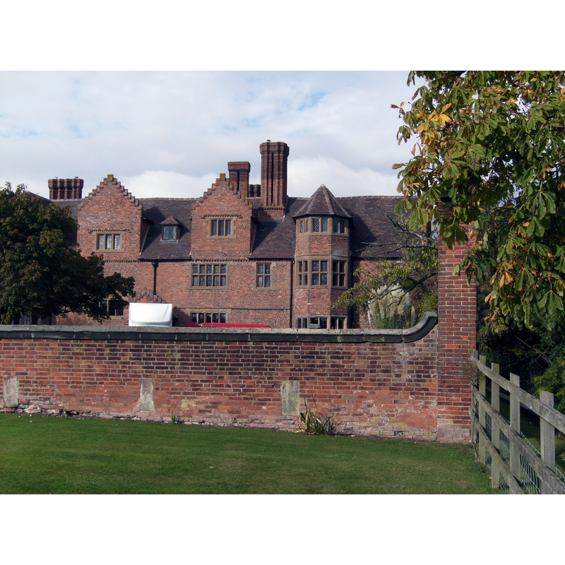
Image copyright © Sjwells53, 2011
CC-BY-SA-3.0
Results: 1 records
view of context
Scene Description: Source caption: "Black Ladies, a large private residence, partly of 16th and 17th century construction, on the site of of a former Benedictine priory. 4km west of Brewood, Staffordshire."
Copyright Statement: Image copyright © Sjwells53, 2011
Image Source: digital photograph taken 12 October 2011 by Sjwells53 [https://commons.wikimedia.org/wiki/File:Brewood_Black_Ladies_01.jpg] [accessed 8 July 2019]
Copyright Instructions: CC-BY-SA-3.0
INFORMATION
Font ID: 22223BRE
Object Type: Baptismal Font1?
Font Century and Period/Style: 12th century, Late Norman
Church / Chapel Name: Benedictine Priory Church of St. Mary [aka Black Ladies Priory] [disappeared]
Font Location in Church: [disappeared]
Church Patron Saint(s): St. Mary the Virgin
Church Notes: documentary evidence of the priory starts 1170
Church Address: Tudor Barn, Bishop's Wood, Brewood, Stafford ST19 9AT, UK
Site Location: Staffordshire, West Midlands, England, United Kingdom
Directions to Site: The site of the disappeared priory church is located 4 km W of Brewood, about 13 km NW of Wolverhampton, on the E banks of the Shropshire Union Canal
Ecclesiastic Region: [Diocese of Lichfield]
Historical Region: Hundred of Cuttlestone -- formerly Staffordshire
Additional Comments: disappeared font? (the one from the 12thC priory church here)
Font Notes:
Click to view
There is an entry for Brewood [variant spelling] in the Domesday survey [https://opendomesday.org/place/SJ8808/brewood/] [accessed 8 July 2019; it reports a priest but not a church in it, though there must have been one there. The entry for this priory in the Victoria County History (Stafford, vol. 3, 1970) notes: "The priory of Benedictine nuns at Brewood, dedicated to St. Mary but often known as Black Ladies, [...] may have been founded by Roger de Clinton, Bishop of Coventry and Lichfield (1129-48), who was founder of the nunnery at Farewell, but there is no positive evidence. [...] The site and precinct of the priory, with the church, churchyard, a water-mill within the site, and certain pastures in Brewood, valued in all at £7 9s. 1d. a year, were sold in 1539 to Thomas Giffard of Stretton (in Penkridge) for £134 1s. 8d. [...] There were three bells in the tower of the church [...] No part of the priory buildings has survived." [NB: the nearby priory of Blithbury may have shared in this priory's facilities, etc. cf. its own entry in the same VCH volume].
COORDINATES
UTM: 30U 552250 5837121
Latitude & Longitude (Decimal): 52.6815, -2.2271
Latitude & Longitude (DMS): 52° 40′ 53.4″ N, 2° 13′ 37.56″ W
REFERENCES
- Victoria County History [online], University of London, 1993-. URL: https://www.british-history.ac.uk.