Canwell / Canoll
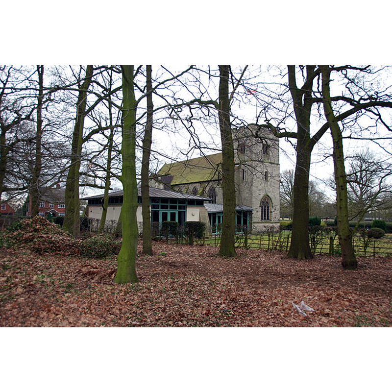
Image copyright © Mick Malpass, 2012
CC-BY-SA-2.0
Results: 2 records
view of church exterior in context - southwest view
Scene Description: the modern (1910s) Parish Church of St. Mary, St. Giles and All Saints on the site of the disappeared medieval priory
Copyright Statement: Image copyright © Mick Malpass, 2012
Image Source: digital photograph taken 17 February 2012 by Mick Malpass [www.geograph.org.uk/photo/2816210] [accessed 8 July 2019]
Copyright Instructions: CC-BY-SA-2.0
view of context
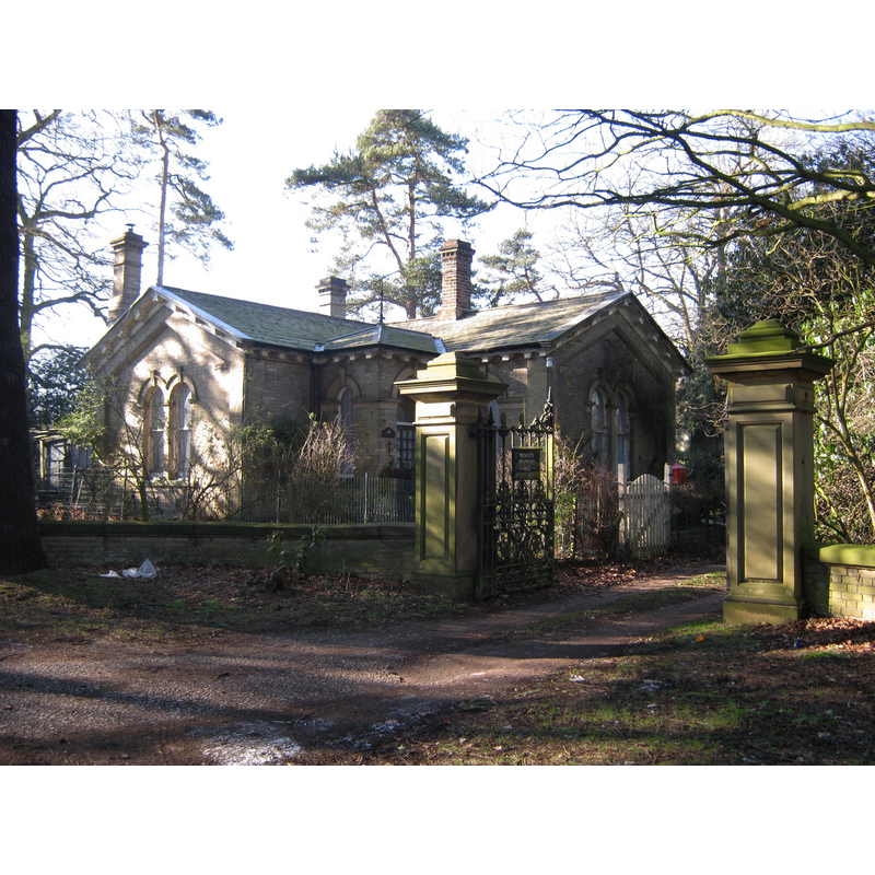
Scene Description: Source caption: "Gatehouse at entrance to grounds of Canwell Hall, and remains of old priory".
Copyright Statement: Image copyright © Michael Westley, 2012
Image Source: digital photograph taken 11 February 2012 by Michael Westley [www.geograph.org.uk/photo/2803256] [accessed 8 July 2019]
Copyright Instructions: CC-BY-SA-2.0
INFORMATION
Font ID: 22221CAN
Object Type: Baptismal Font1?
Font Century and Period/Style: 12th century (mid?), Late Norman
Church / Chapel Name: Benedictione Priory Church [disappeared]
Font Location in Church: [disappeared]
Church Patron Saint(s): St. Giles
Church Notes: present church built as a extraparochial estate church, consecrated 1911; a new parish of Canwell St Mary, St Giles and All Saints was formed from the previously extra parochial area in 1927
Church Address: Coordinates and address of the present church: Canwell, Sutton Coldfield B75 5SE, UK
Site Location: Staffordshire, West Midlands, England, United Kingdom
Directions to Site: Canwell is located 9-10 km SW of Tamworth. The present church is located off the A38-A453 crossroads, just N of Sutton Coldfield. The site of the old priory church is said to have been built over by the stables of Canwell Hall
Ecclesiastic Region: Diocese of Lichfield
Historical Region: Hundred of South Offlow
Additional Comments: disappeared font? (the one from the disappeared priory church here)
Font Notes:
Click to view
No individual entry found for Canwell in the Domesday survey. The entry for this priory in the Victoria County Histoty (Stafford, vol. 3, 1970) notes: "The priory of monks at Canwell, in the parish of Hints, was founded by Geva, illegitimate daughter of Hugh I, Earl of Chester, and widow of Geoffrey Ridel, a justice under Henry I who was drowned in 1120 in the wreck of the White Ship. [...] The exact date of the foundation is unknown, but it can be assigned to about 1140. The priory was a Benedictine house dedicated to St. Giles. [...] A survey of Canwell manor made in 1526 [...] described the priory church as 84 feet long and 23 feet wide, the nave and chancel being under a single roof covered with tile. [...] In the later 18th century the new stables of Canwell Hall were erected on what was said to be the site of the priory, using the remaining ruins."
COORDINATES
UTM: 30U 582287 5828792
Latitude & Longitude (Decimal): 52.602909, -1.784951
Latitude & Longitude (DMS): 52° 36′ 10.47″ N, 1° 47′ 5.83″ W
REFERENCES
- Victoria County History [online], University of London, 1993-. URL: https://www.british-history.ac.uk.