Islington nr. Highbury Fields / Iseldone / Isendone
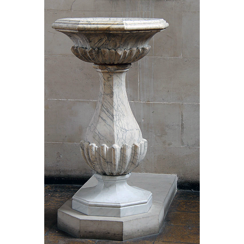
Image copyright © John Salmon, 2013
CC-BY-SA-2.0
Results: 5 records
view of font
Scene Description: the modern (18thC?) font in use
Copyright Statement: Image copyright © John Salmon, 2013
Image Source: digital photograph taken 8 April 2013 by John Salmon [www.geograph.org.uk/photo/3405509] [accessed 25 June 2019]
Copyright Instructions: CC-BY-SA-2.0
view of church exterior - southwest view
![EXT SW digital photograph taken 8 April 2013 by John Salmon [www.geograph.org.uk/photo/3405559] [accessed 25 June 2019]
INT E digital photograph taken 8 April 2013 by John Salmon [www.geograph.org.uk/photo/3405515] [accessed 25 June 2019]
INT W digital photograph taken 8 April 2013 by John Salmon [www.geograph.org.uk/photo/3405512] [accessed 25 June 2019]
MOD FONT CNTXT digital photograph taken 8 April 2013 by John Salmon [www.geograph.org.uk/photo/3405501] [accessed 25 June 2019]
MOD FONT digital photograph taken 8 April 2013 by John Salmon [www.geograph.org.uk/photo/3405509] [accessed 25 June 2019]](/static-50478a99ec6f36a15d6234548c59f63da52304e5/compressed/1190625010_compressed.png)
Scene Description: EXT SW digital photograph taken 8 April 2013 by John Salmon [www.geograph.org.uk/photo/3405559] [accessed 25 June 2019]
INT E digital photograph taken 8 April 2013 by John Salmon [www.geograph.org.uk/photo/3405515] [accessed 25 June 2019]
INT W digital photograph taken 8 April 2013 by John Salmon [www.geograph.org.uk/photo/3405512] [accessed 25 June 2019]
MOD FONT CNTXT digital photograph taken 8 April 2013 by John Salmon [www.geograph.org.uk/photo/3405501] [accessed 25 June 2019]
MOD FONT digital photograph taken 8 April 2013 by John Salmon [www.geograph.org.uk/photo/3405509] [accessed 25 June 2019]
Copyright Statement: Image copyright © John Salmon, 2013
Image Source: digital photograph taken 8 April 2013 by John Salmon [www.geograph.org.uk/photo/3405559] [accessed 25 June 2019]
Copyright Instructions: CC-BY-SA-2.0
view of font in context
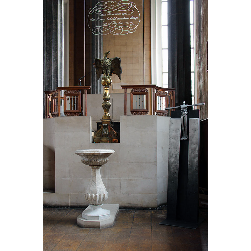
Scene Description: the modern (18thC?) font is located at the east of the nave, south side, at the foot of the modern pulpit
Copyright Statement: Image copyright © John Salmon, 2013
Image Source: digital photograph taken 8 April 2013 by John Salmon [www.geograph.org.uk/photo/3405501] [accessed 25 June 2019]
Copyright Instructions: CC-BY-SA-2.0
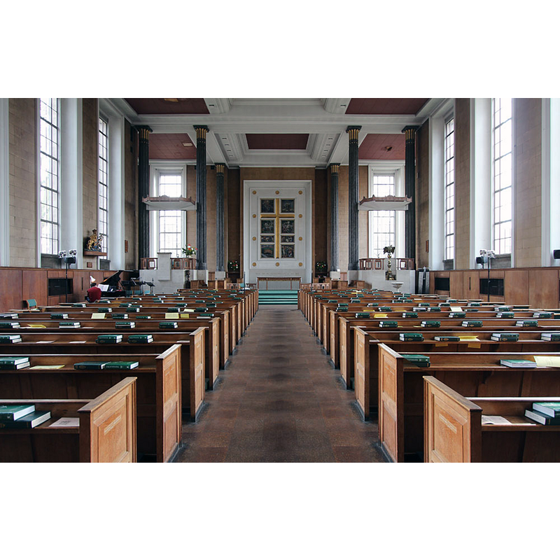
view of church interior - looking west
Copyright Statement: Image copyright © John Salmon, 2013
Image Source: digital photograph taken 8 April 2013 by John Salmon [www.geograph.org.uk/photo/3405512] [accessed 25 June 2019]
Copyright Instructions: CC-BY-SA-2.0
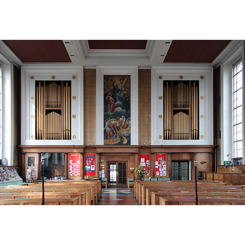
view of church interior - looking east
Copyright Statement: Image copyright © John Salmon, 2013
Image Source: digital photograph taken 8 April 2013 by John Salmon [www.geograph.org.uk/photo/3405515] [accessed 25 June 2019]
Copyright Instructions: CC-BY-SA-2.0
INFORMATION
Font ID: 22204ISL
Object Type: Baptismal Font1?
Font Century and Period/Style: 12th century (mid-to-late?), Late Norman
Church / Chapel Name: Parish Church of St. Mary the Virgin
Font Location in Church: [disappeared]
Church Patron Saint(s): St. Mary the Virgin
Church Address: Upper St, The Angel, Islington, London N1P 2TX, UK
Site Location: Greater London, South East, England, United Kingdom
Directions to Site: Located off (E) the A1 [aka Upper St], just W of the A104 [aka Essex Rd], S of Highbury Fields
Ecclesiastic Region: Diocese of London
Historical Region: Hundred of Ossulstone -- formerly Middlesex
Additional Comments: disappeared font? (the one from the mid-to-late 12thC church here)
Font Notes:
Click to view
There are four entries for this Islington [variant spellings] in the Domesday survey [https://opendomesday.org/place/TQ3184/islington/] [accessed 25 June 2019] none of which mentions cleric or church in it. The entry for this parish in the Victoria County History (Middlesex, vol. 8, 1985) notes: "Islington church served the whole parish until 1814. It was recorded in the settlement, enrolled between 1163 and 1180, of a dispute about the rectory and advowson [...] The church of ST. MARY, so called by 1392, (fn. 29) has been rebuilt at least three times on the same site. A stone from a building of the earlier 12th century was found in the walls of the crypt in 1938, [...] but the church demolished in 1751 was apparently of the mid 15th century [...] The font, two brasses of the Fowler family, the lectern eagle, and the coat of arms of George II are from the previous church and the organ is from the demolished church of St. Mary, Bourdon Street, Berkeley Square. [...] The church was bombed in 1940. Everything except the tower was rebuilt in 1954-6 on the 18thcentury plan"; all other churches here noted in the VCH entry [cf. supra] are modern. The entry for this church in Historic England [Listing NGR: TQ3174483875] notes: "The original church of 1751-54 by Launcelot Dowbiggin; portico added 1903; all but the tower and portico rebuilt after bomb damage, 1955-6" but mentions no font in it. The present font in use in this church is probably 18th-century and it survived the WWII bombing of the church; it is an unremarkable sample of the baluster-type design.
COORDINATES
UTM: 30U 700966 5713681
Latitude & Longitude (Decimal): 51.538406, -0.102058
Latitude & Longitude (DMS): 51° 32′ 18.26″ N, 0° 6′ 7.41″ W
REFERENCES
- Victoria County History [online], University of London, 1993-. URL: https://www.british-history.ac.uk.