Edgware
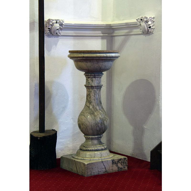
Image copyright © John Salmon, 2015
CC-BY-SA-2.0
Results: 4 records
view of font and cover
Scene Description: the 18thC font in use in this church
Copyright Statement: Image copyright © John Salmon, 2015
Image Source: digital photograph taken 16 March 2015 by John Salmon [www.geograph.org.uk/photo/4398772] [accessed 12 June 2019]
Copyright Instructions: CC-BY-SA-2.0
view of church exterior - southwest view
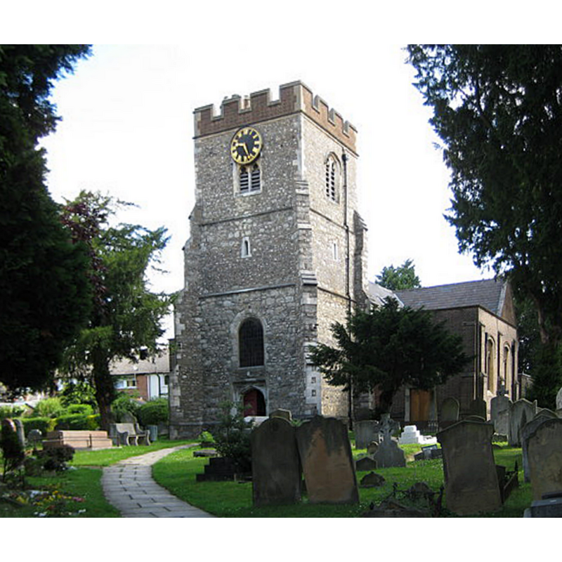
Copyright Statement: Image copyright © Nigel Cox, 2009
Image Source: edited detail of a digital photograph taken 25 July 2009 by Nigel Cox [www.geograph.org.uk/photo/1418923] [accessed 12 June 2019]
Copyright Instructions: CC-BY-SA-2.0
view of church exterior - southeast view
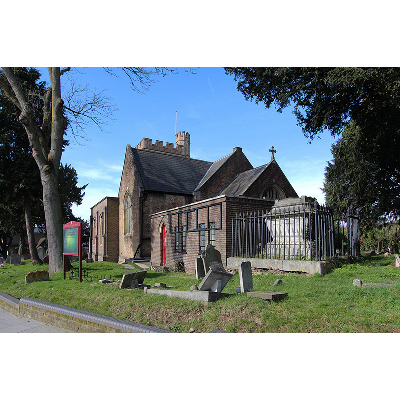
Copyright Statement: Image copyright © John Salmon, 2015
Image Source: digital photograph taken 5 March 2015 by John Salmon [www.geograph.org.uk/photo/4398755] [accessed 12 June 2019]
Copyright Instructions: CC-BY-SA-2.0
view of church interior - looking east
![the 18thC font is visible at the far [east] end, on the right [south] side, next to the pulpit](/static-50478a99ec6f36a15d6234548c59f63da52304e5/compressed/1190613006_compressed.png)
Scene Description: the 18thC font is visible at the far [east] end, on the right [south] side, next to the pulpit
Copyright Statement: Image copyright © John Salmon, 2015
Image Source: digital photograph taken 16 March 2015 by John Salmon [www.geograph.org.uk/photo/4398762] [accessed 12 June 2019]
Copyright Instructions: CC-BY-SA-2.0
INFORMATION
Font ID: 22189EDG
Object Type: Baptismal Font1?
Font Century and Period/Style: 13th century (mid?), Early English
Church / Chapel Name: Parish Church of St. Margaret of Antioch
Font Location in Church: [disappeared]
Church Patron Saint(s): St. Margaret of Antioch [aka Margaret the Virgin, Marina]
Church Address: 1 Station Rd, Edgware HA8 7JE, UK
Site Location: Greater London, South East, England, United Kingdom
Directions to Site: Located off (NE) the A5-B461 crossroads, the corner of Watling St and Station R), 200-300 yards SW of the Edgware Underground station
Ecclesiastic Region: Diocese of Loncon
Historical Region: Hundred of Gore -- formerly Middlesex
Additional Comments: disappeared font? (the one from the mid-13thC church here)
Font Notes:
Click to view
No individual entry for Edgware found in the Domesday survey. The entry for this parish in the Victoria Country History (Middlesex, vol. 4, 1971) notes: "In the 12th and 13th centuries there was a small church or chapel belonging to the Hospital of St. Bartholomew in the north-west corner of the parish near the village of Elstree, [...] but the church of Edgware proper is first mentioned in the mid 13th century, when with Kingsbury it was stated to be appropriated to the use of the Knights Hospitallers [...] The church of ST. MARGARET stands on the north-west side of Station Road near its junction with High Street. [...] The tower [...] probably dates from the 15th century, although 14th-century bricks were found when repairs were made to the newel turret in 1960 [...] The small 18th-century marble font was removed from the aisle to a pew at the entrance of the church". The entry for this church in Historic England [Listing NGR: TQ1928291694] notes: "C15 tower, much renewed in C19. The body of the Church was rebuilt in circa 1764/5 and then largely again in circa 1845", but mentions no font in it.
COORDINATES
UTM: 30U 688414 5721333
Latitude & Longitude (Decimal): 51.61146, -0.27873
Latitude & Longitude (DMS): 51° 36′ 41.26″ N, 0° 16′ 43.43″ W
REFERENCES
- Victoria County History [online], University of London, 1993-. URL: https://www.british-history.ac.uk.