Cranford / Cranforde [Domesday] (Gt. London) [disappeared font?]
![Main image for Cranford / Cranforde [Domesday] (Gt. London) [disappeared font?]](/static-50478a99ec6f36a15d6234548c59f63da52304e5/compressed/1190607011_compressed.png)
Image copyright © John Salmon, 2010
CC-BY-SA-2.0
Results: 4 records
view of font and cover
Scene Description: the modern font
Copyright Statement: Image copyright © John Salmon, 2010
Image Source: digital photograph taken 27 September 2003 by John Salmon [www.geograph.org.uk/photo/1684690] [accessed 6 June 2019]
Copyright Instructions: CC-BY-SA-2.0
view of church exterior - southeast view
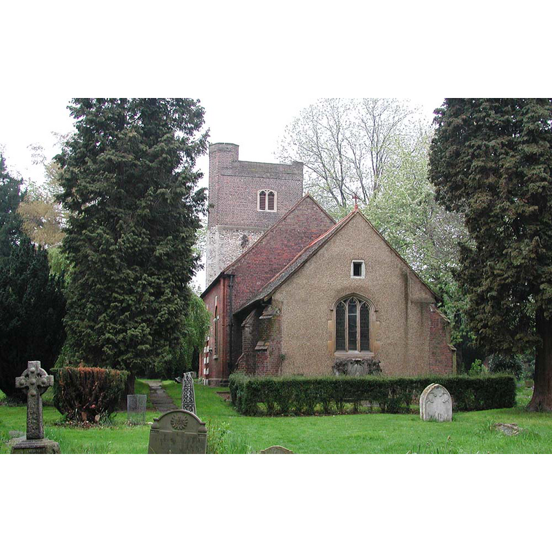
Copyright Statement: Image copyright © John Salmon, 2010
Image Source: digital photograph taken 27 September 2003 by John Salmon [www.geograph.org.uk/photo/1689498] [accessed 6 June 2019
Copyright Instructions: CC-BY-SA-2.0
view of church exterior - southwest view
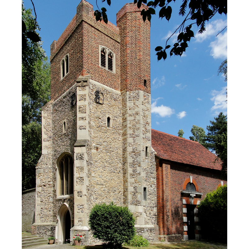
Copyright Statement: Image copyright © Maxwell Hamilton, 2010
Image Source: digital photograph taken 11 July 2010 by Maxwell Hamilton [https://commons.wikimedia.org/wiki/File:St_Dunstan's_Church_in_Cranford_Park_-_panoramio.jpg] [accessed 6 June 2019]
Copyright Instructions: CC-BY-SA-3.0
view of church interior - nave - looking east
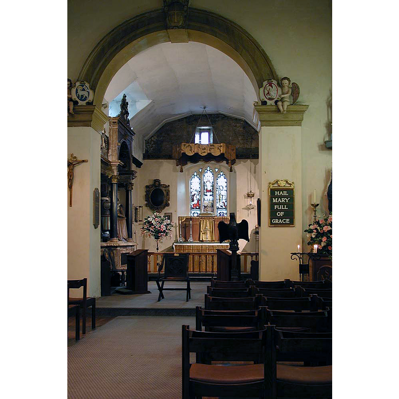
Copyright Statement: Image copyright © John Salmon, 2010
Image Source: digital photograph taken 27 September 2003 by John Salmon [www.geograph.org.uk/photo/1684674] [accessed 6 June 2019]
Copyright Instructions: CC-BY-SA-2.0
INFORMATION
Font ID: 22186CRA
Object Type: Baptismal Font1?
Font Century and Period/Style: 11th century, Pre-Conquest? / Norman
Church / Chapel Name: Parish Church of St. Dunstan
Font Location in Church: [disappeared]
Church Patron Saint(s): St. Dunstan
Church Address: Cranford, Harlington, Hounslow TW5 9RZ, UK -- Tel.: +44 20 8897 8836
Site Location: Greater London, South East, England, United Kingdom
Directions to Site: Located off (SW) the Bath Rd crossroads with the Parkway, just E of Heathrow airport, 20 km W of Charing Cross, in the London Borough of Hounslow,
Ecclesiastic Region: Diocese of London
Historical Region: Hundred of Elthorne
Additional Comments: disappeared font? (the one from the Domesday-time church here)
Font Notes:
Click to view
There is an entry for this Cranford [variant spelling] in the Domesday survey [https://opendomesday.org/place/TQ1077/cranford/] [accessed 6 June 2019]; it reports a priest and "0,25 church lands" but not a church in it, though there must have been one there. The entry for this parish in the Victoria County History (Middlesex, vol. 3, 1962) notes: "There was a priest at Cranford in 1086, when he held 1 virgate of land, [...] and presumably there was a church there also. The benefice is a rectory, and though the advowson was held by two religious orders, the Knights Templars and the Hospitallers, it was never appropriated. [...] When the lands of the Templars were confiscated in 1308 the advowson passed to the king, as he presented a parson in 1311. [...] it remained their property until the Dissolution, except when their Cranford manor was leased for a life. [...] The theory that the church was a chapel of the Templars dedicated to St. John the Baptist and only became a parish church in 1310 [...] with a presentation by the king does not appear to have any factual foundation. [...] The parish church of ST. DUNSTAN is very small and consists of a chancel, nave, vestry, and west tower. (fn. 48) The present chancel and tower, built of flint and rubble, date from the 15th century. [...] The marble font was given to the church in 1716, also by Lady Berkeley".
COORDINATES
UTM: 30U 679497 5707737
Latitude & Longitude (Decimal): 51.49224, -0.4143
Latitude & Longitude (DMS): 51° 29′ 32.06″ N, 0° 24′ 51.48″ W
REFERENCES
- Victoria County History [online], University of London, 1993-. URL: https://www.british-history.ac.uk.