Shepperton / Lower Shepperton / Scepertone / Shepperton Green / Upper Sheperton
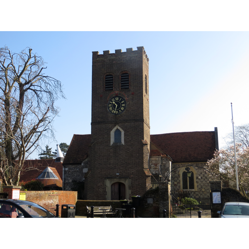
Image copyright © Peter Wood, 2014
CC-BY-SA-2.0
Results: 3 records
view of church exterior - west view
Copyright Statement: Image copyright © Peter Wood, 2014
Image Source: digital photograph taken 9 March 2014 by Peter Wood [www.geograph.org.uk/photo/3891987] [accessed 30 May 2019]
Copyright Instructions: CC-BY-SA-2.0
view of font and cover in context
![Source caption: "The North Transept of St Nicholas which contains the baptismal font." [i.e., the modern font in use]](/static-50478a99ec6f36a15d6234548c59f63da52304e5/compressed/1190601020_compressed.png)
Scene Description: Source caption: "The North Transept of St Nicholas which contains the baptismal font." [i.e., the modern font in use]
Copyright Statement: Image copyright © Len Williams, 2014
Image Source: digital photograph taken 27 September 2014 by Len Williams [www.geograph.org.uk/photo/4204375] [accessed 30 May 2019]
Copyright Instructions: CC-BY-SA-2.0
view of church interior - looking east
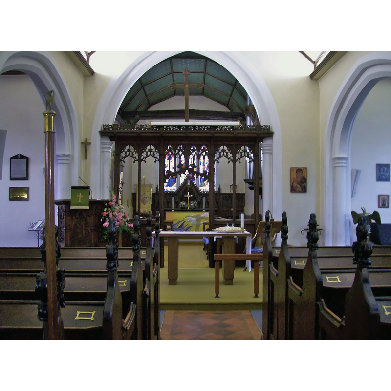
Copyright Statement: Image copyright © Len Williams, 2014
Image Source: digital photograph taken 27 September 2014 by Len Williams [www.geograph.org.uk/photo/4204363] [accessed 30 May 2019]
Copyright Instructions: CC-BY-SA-2.0
INFORMATION
Font ID: 22182SHE
Object Type: Baptismal Font1?
Font Century and Period/Style: 11th century, Pre-Conquest? / Norman
Church / Chapel Name: Parish Church of St. Nicholas
Font Location in Church: [disappeared]
Church Patron Saint(s): St. Nicholas of Myra
Church Address: Church Square, TW17 9JY, UK -- Tel.: (01932) 220511
Site Location: Surrey, South East, England, United Kingdom
Directions to Site: Located between the B375 (N) and the Thames (S), S of the M3, approximately halfway between Woking (SW) and Twickenham (NE)
Ecclesiastic Region: Diocese of London
Historical Region: Hundred of Spelthorne -- formerly Middlesex
Additional Comments: disappeared font? (the one from the Domesday-time or earlier church here)
Font Notes:
Click to view
There ia an entry for Shepperton [variant spelling] in the Domesday survey [https://opendomesday.org/place/TQ0867/shepperton/] [accessed 30 May 2019]; it reporta a priest and "0.12 church lands" in it, but not a church though there must have been one there. The entry for this parish in the Victoria County History (Middlesex, vol. 3, 1962) notes that evidence of a Saxon cemetery of the 5th-6th cemetery has been found near the site of the present church, "north of Chertsey Road and near Walton Bridge", and that, at some point towards the end of the 16th century the old church had been partially (?) damaged and washed away by flodding of the Thames. The VCH (ibid.) further notes: "There was a priest at Shepperton in 1086 [...] and a church is referred to in 1157 [...] The church continued to serve the whole parish until 1949 when the northern part was transferred to Littleton ecclesiastical parish. [...] and the church was closed about 1953. [...] The present church of ST. NICHOLAS is generally said to have been built in 1614 from the ruins of a former building which had been washed away by the River Thames" [cf. supra] "The west door and tower arch both survive from the building of c. 1600, but the rest of the tower was rebuilt in 1710 [...] An ancient octagonal font is said to have been removed from the church in 1710. [...] The present one is modern." [NB: was the octagonal font removed in 1710 the one from the Domesday-time church, or, more likely, from a later iteration of the parish church here?]
The modern font in use is located in the north transept.
The modern font in use is located in the north transept.
COORDINATES
UTM: 30U 677220 5696102
Latitude & Longitude (Decimal): 51.38845, -0.4529
Latitude & Longitude (DMS): 51° 23′ 18.42″ N, 0° 27′ 10.44″ W
REFERENCES
- Victoria County History [online], University of London, 1993-. URL: https://www.british-history.ac.uk.