Firsby
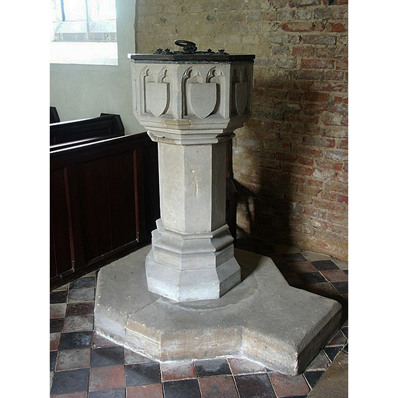
Image copyright © Dave Hitchborne, 2004
CC-BY-SA-2.0
Results: 5 records
view of font and cover
Scene Description: modern font from the 1856 replacement church by G. E. Street.
Copyright Statement: Image copyright © Dave Hitchborne, 2004
Image Source: digital photograph taken 8 May 2004 by Dave Hitchborne [www.geograph.org.uk/photo/432722] [accessed 20 May 2019]
Copyright Instructions: CC-BY-SA-2.0
view of church exterior - east view
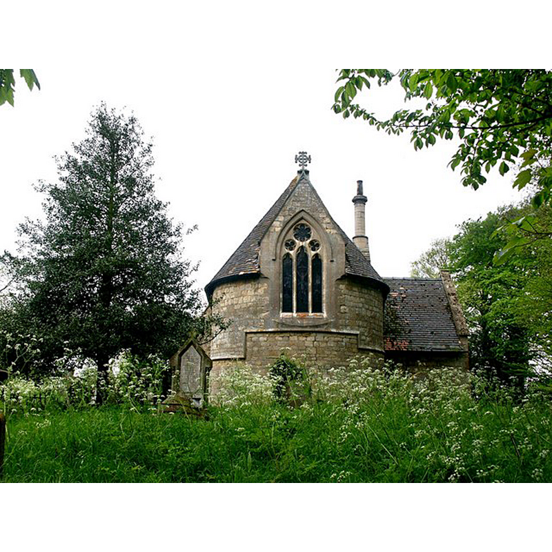
Scene Description: the 1856 replacement church by G. E. Street in the southwest corner
Copyright Statement: Image copyright © Dave Hitchborne, 2004
Image Source: digital photograph taken 8 May 2004 by Dave Hitchborne [www.geograph.org.uk/photo/432718] [accessed 20 May 2019]
Copyright Instructions: CC-BY-SA-2.0
view of church exterior - southeast view
![Source caption: "St.Andrew's church [...] by G.E.Street in 1856 on the site of an earlier church".](/static-50478a99ec6f36a15d6234548c59f63da52304e5/compressed/1190520020_compressed.png)
Scene Description: Source caption: "St.Andrew's church [...] by G.E.Street in 1856 on the site of an earlier church".
Copyright Statement: Image copyright © Richard Croft, 2015
Image Source: 15 April 2015 by Richard Croft [www.geograph.org.uk/photo/4432690] [accessed 20 May 2019]
Copyright Instructions: CC-BY-SA-2.0
view of church interior - nave - looking west
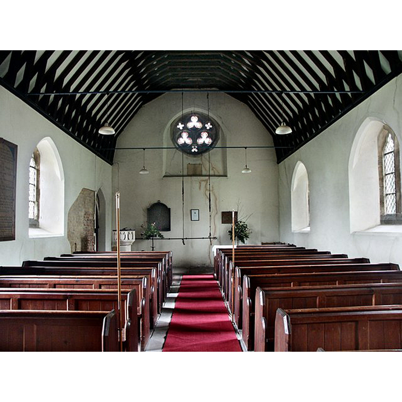
Scene Description: with the modern font from the 1856 replacement church by G. E. Street in the southwest corner
Copyright Statement: Image copyright © Dave Hitchborne, 2004
Image Source: digital photograph taken 8 May 2004 by Dave Hitchborne [www.geograph.org.uk/photo/432736] [accessed 20 May 2019]
Copyright Instructions: CC-BY-SA-2.0
view of church interior - nave - looking east
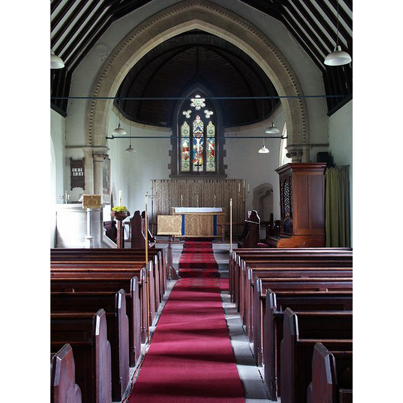
Scene Description: in the 1856 replacement church by G. E. Street.
Copyright Statement: Image copyright © Dave Hitchborne, 2004
Image Source: digital photograph taken 8 May 2004 by Dave Hitchborne [www.geograph.org.uk/photo/432723] [accessed 20 May 2019]
Copyright Instructions: CC-BY-SA-2.0
INFORMATION
Font ID: 22166FIR
Object Type: Baptismal Font1?
Church / Chapel Name: Parish Church of St. Andrew
Font Location in Church: [disappeared]
Church Patron Saint(s): St. Andrew
Church Address: Fendyke Rd, Firsby, Spilsby PE23 5QG, UK
Site Location: Lincolnshire, East Midlands, England, United Kingdom
Directions to Site: Located off (S) the B1195, 6-7 km SE of Spilsby, 11-12 W of Skegness
Ecclesiastic Region: Diocese of Lincoln
Historical Region: Wapentake of Candleshoe
Additional Comments: disappeared font? (the one from the original church here, an ancient church reported much decayed ca, 1834 and demolished soon thereafter)
Font Notes:
Click to view
No individual entry found for Firsby in the Domesday survey. Allen's History of the County of Lincoln (1834) writes: "The church belonging to the village is an ancient edifice, at present in a state of great decay. The walls are of sandstone and are very low. The body of the church consists only of a single aisle. The chancel is thatched. In the church yard, at a short distance from the porch is a pillar of stone, which it is probable at one time had a sun dial on its top. The church is dedicated to St Andrew." The old [Norman?] church must have been demolished soon after Allen's time as a new one was built in the mid-19th century to replace it. The entry for this church in Historic England [Listing NGR: TF4551262636] describes the present Victorian church but mentions nothing of the building it replaced: "Parish church. 1856 by G. E. Street. [...] C19 communion rail, choir stalls, pews and octagonal font."
COORDINATES
UTM: 31U 310979 5891677
Latitude & Longitude (Decimal): 53.14091, 0.1739
Latitude & Longitude (DMS): 53° 8′ 27.28″ N, 0° 10′ 26.04″ E
REFERENCES
- Allen, Thomas, The History of the County of Lincoln, from the earliest period to the present time [...], London & Lincoln: John Saunders, Junior, 1833-, vol. 2: 147