Barton-on-Humber No. 2 / Barton-upon-Humber / Bertone
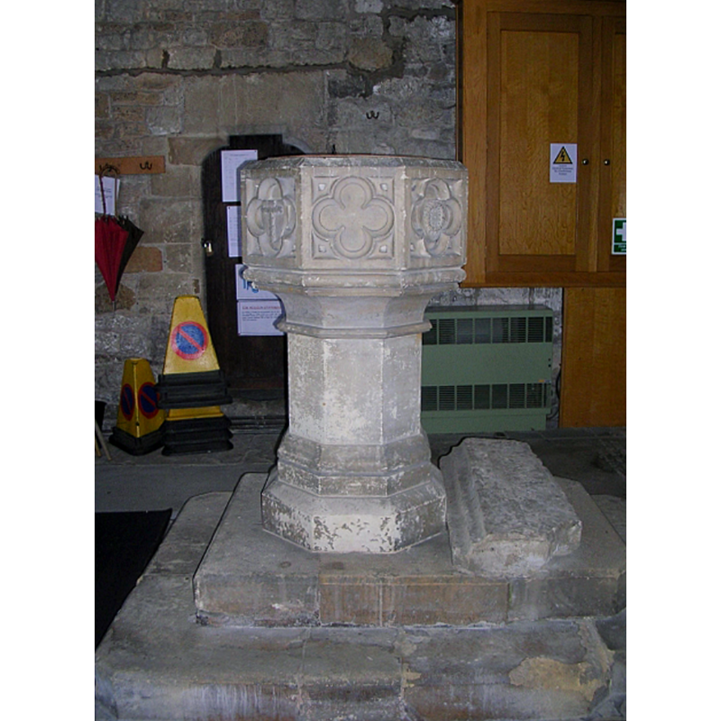
Image copyright © Betty Longbottom, 2009
CC-BY-SA-2.0
Results: 5 records
view of font in context
Scene Description: this font, now disused, is Victorian, of a traditional Perpendicular design
Copyright Statement: Image copyright © Betty Longbottom, 2009
Image Source: digital photograph taken 10 September 2009 by Betty Longbottom [www.geograph.org.uk/photo/1491205] [accessed 18 May 2019]
Copyright Instructions: CC-BY-SA-2.0
view of font
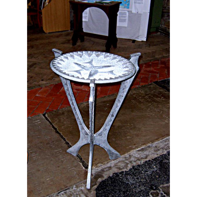
Scene Description: the modern font in use in this church
Copyright Statement: Image copyright © St Mary's Barton, 2007
Image Source: digital photograph taken 9 April 2007, in the parish web site [www.stmarysbarton.org.uk/StMarysBarton/Tour2.html] [accessed 18 May 2019]
Copyright Instructions: No known copyright restriction / Fair Dealing
view of church exterior in context - southeast view
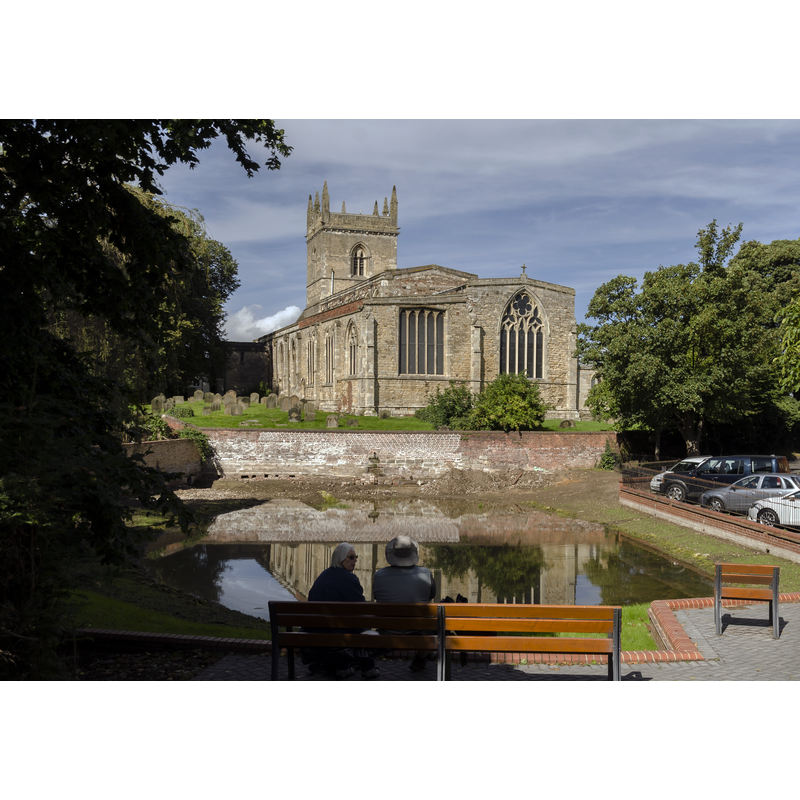
Scene Description: Source caption: "Barton on Humber has two churches located close to each other, the older being Saint Peter's which dates from the late 10th century, and is mentioned in the Domesday Book of 1086. It is unsure why a second church was built, although Saint Peter's was much smaller at the time, and the town was prosperous. St Mary's dates from the 12th century onwards, and has a nave with north and south aisles, a western tower, a chancel with south Chapel, and a south porch with parvis. The north arcade dates from the mid to late 12th century, and is of five bays plus a taller, later eastern arch. The piers are circular and the round arches have zigzag decoration. The south arcade is of four bays and dates from circa 1300. It has octagonal columns similar to those in Lincoln Cathedral, topped with water leaf capitals. Both the aisles were later enlarged. The tower dates from the 13th century, and has decorated parapets with eight pinnacles from a later date. There was initially a spire on top. The tower arch has stiff leaf capitals and keeled shafts. The south porch has a reset early 13th century archway, and an upper chamber with a door high in the nave, once reached by a stairway. In the 14th century the south chapel was built with a three bay arcade towards the chancel. The capitals contain a number of green men, many of its windows are reused In the 15th century a clerestory was added to the nave. The east window of the chancel was reduced in height when the gabled roof was lowered."
Copyright Statement: Image copyright © Jules & Jenny, 2017
Image Source: digital photograph taken 11 September 2017 by Jules & Jenny [www.flickr.com/photos/jpguffogg/26965046349/] [accessed 18 May 2019]
Copyright Instructions: CC-BY-2.0
view of church interior - looking west
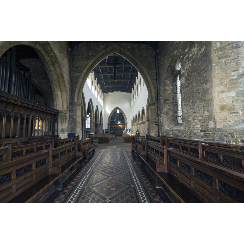
Copyright Statement: Image copyright © Jules & Jenny, 2017
Image Source: digital photograph taken 11 September 2017 by Jules & Jenny [www.flickr.com/photos/jpguffogg/38825983581/] [accessed 18 May 2019]
Copyright Instructions: CC-BY-2.0
view of church interior - looking east
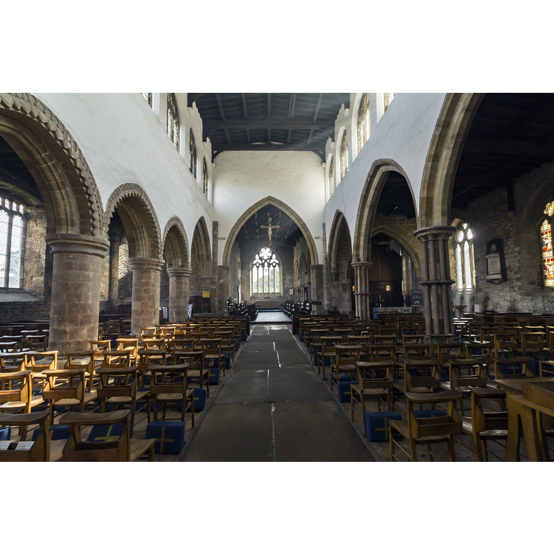
Copyright Statement: Image copyright © Jules & Jenny, 2017
Image Source: digital photograph taken 11 September 2017 by Jules & Jenny [www.flickr.com/photos/jpguffogg/27049984759/] [accessed 18 May 2019]
Copyright Instructions: CC-BY-2.0
INFORMATION
Font ID: 22165BAR
Object Type: Baptismal Font1?
Font Century and Period/Style: 12th century, Late Norman
Church / Chapel Name: Parish Church of St. Mary
Font Location in Church: [disappeared]
Church Patron Saint(s): St. Mary the Virgin
Church Address: Burgate, Barton-upon-Humber DN18 5EZ, UK -- Tel.: +44 1652 632202
Site Location: Lincolnshire, East Midlands, England, United Kingdom
Directions to Site: Located off (N) the A1077, on the S bank of the Humber river, 10-12 km WSW of Hull, 50 km NNE of Lincoln. St Mary's is just NW of St Peter's, on the other side (W) of Beck Hill
Ecclesiastic Region: Diocese of Lincoln
Historical Region: Hundred of Yarborough
Additional Comments: disappeared font? (the one from the Norman church here)
Font Notes:
Click to view
There are two entries for Barton [-upon-Humber] [variant spelling] in the Domesday survey [https://opendomesday.org/place/TA0322/barton-upon-humber/] [accessed 18 May 2019], on of which reports a priest and a church in it. NB: the church reported in Domesday must be St Peter's]. The entry for this church in Historic England [Listing NGR: TA0334522020] notes: "Norman and Early English with nave and aisles, chancel, west tower, south porch. Lower part of tower and north aisle arcade Norman, otherwise Early English with C14 and C15 windows, C14 pinnacles and parapet to tower, C15 roof to south chapel. Mediaeval window glass assembled in C17. Sedile and piscinae. Chancel monuments of 1626 and 1729. Porch restored 1938"; no font mentioned. The parish web site [www.stmarysbarton.org.uk/StMarysBarton/Tour2.html] [accessed 18 May 2019] notes: "Immediately on the left of the church door is the old font, a victorian product of mass production on a high pedestal which makes it difficult to use. The present font, shown in the picture, was made in 1995. It is kept in the vestry when not in use." [cf. entry for Barton-on-Humber No. 1 for information on St Peter's, originally Anglo-Saxon, now redundant].
COORDINATES
UTM: 30U 669273 5951461
Latitude & Longitude (Decimal): 53.6844, -0.43673
Latitude & Longitude (DMS): 53° 41′ 3.84″ N, 0° 26′ 12.23″ W