London No. 100
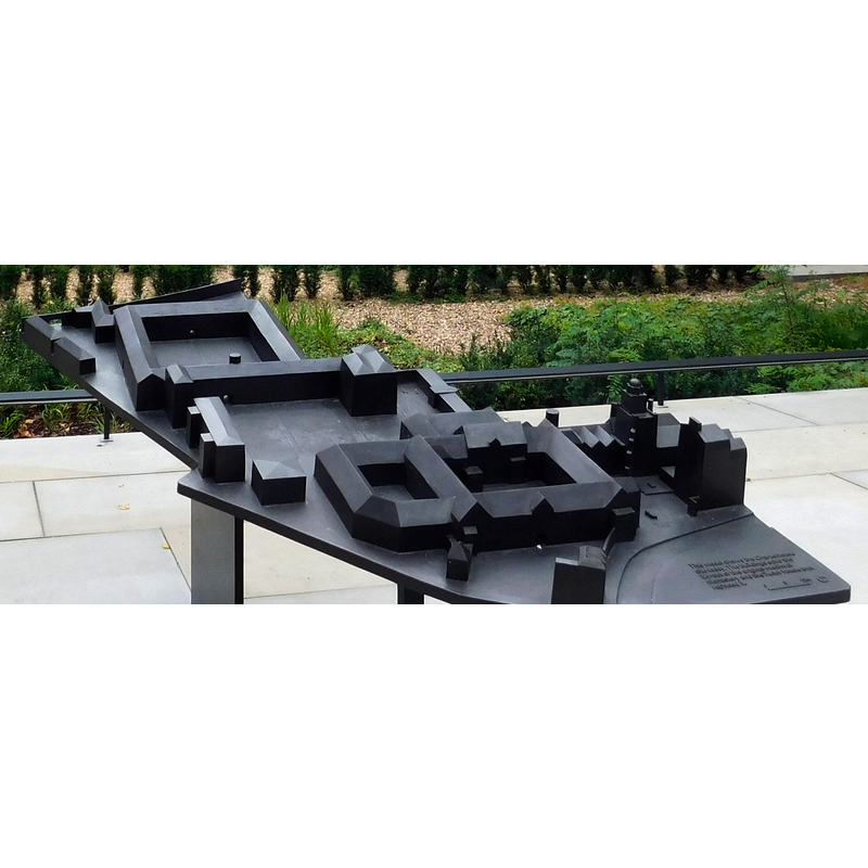
Image copyright © Paul the Archivist, 2017
CC-BY-SA-3.0
Results: 2 records
view of church exterior in context
Scene Description: maquette of the London Chapterhouse; the church is probably the small building at the upper left end next to the large square cloister, and not prominent at all, for, according to the entry in the VCH [https://www.british-history.ac.uk/vch/middx/vol1/pp159-169] [accessed 17 May 2019], "The Carthusians, differing from every other order of monks and canons in this, gave no architectural prominence to their churches. The only one to remain in a fair state of preservation, that of Mount Grace (Yorks. N.R.), is even smaller and meaner in exterior appearance than that of the London Charterhouse must have been. The original building was a simple rectangle of 94 by 38 feet, divided internally into presbytery, choir, and a small (25 by 35 ft.) 'body of the church' at the western end, divided from the choir by a wooden screen with two altars against its western face."
Copyright Statement: Image copyright © Paul the Archivist, 2017
Image Source: edited detail of a digital photograph taken 10 July 2017 by Paul the Archivist [https://commons.wikimedia.org/wiki/File:The_Charterhouse,_Charterhouse_Square,_London_05.jpg] [accessed 16 May 2019]
Copyright Instructions: CC-BY-SA-3.0
view of context
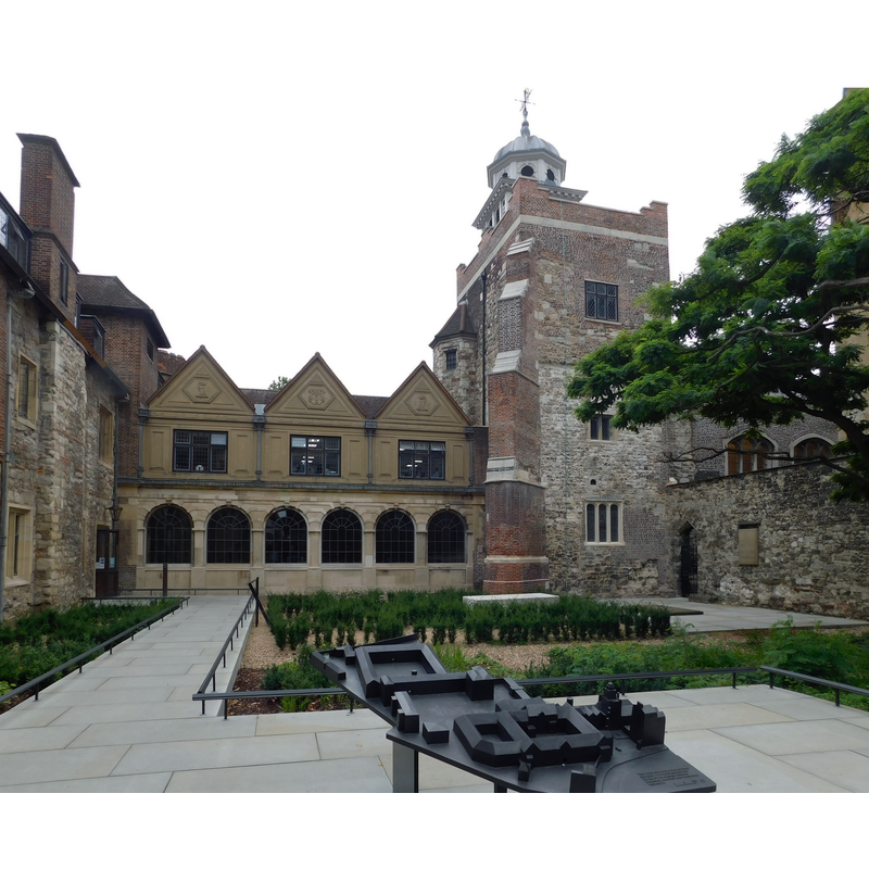
Scene Description: A view of the London Chapterhouse present buildings; the church of the old Carthusian priory was demolished in 1545.
Copyright Statement: Image copyright © Paul the Archivist, 2017
Image Source: edited detail of a digital photograph taken 10 July 2017 by Paul the Archivist [https://commons.wikimedia.org/wiki/File:The_Charterhouse,_Charterhouse_Square,_London_05.jpg] [accessed 16 May 2019]
Copyright Instructions: CC-BY-SA-3.0
INFORMATION
Font ID: 22163LON
Object Type: Baptismal Font1?
Font Century and Period/Style: 14th century, Decorated
Church / Chapel Name: Carthusian Priory Chapterhouse Church [disappeared; demolished 1545]
Font Location in Church: [disappeared]
Church Patron Saint(s): St. Thomas?
Church Address: Charterhouse Square, Barbican, London EC1M 6AN, UK
Site Location: Greater London, South East, England, United Kingdom
Directions to Site: The site of the former priory is NW of the Barbican, just W of the A1 [aka Goeswell Rd]
Ecclesiastic Region: [Diocese of London]
Additional Comments: disappeared font? (the one from the 14thC(?) priory church here)
Font Notes:
Click to view
[NB: we have no information on the font of the priory church here demolished in 1545, following the suppression of the priory].
COORDINATES
UTM: 30U 701203 5711796
Latitude & Longitude (Decimal): 51.521389, -0.099722
Latitude & Longitude (DMS): 51° 31′ 17″ N, 0° 5′ 59″ W