Bonby / Bundebi / Bundeei
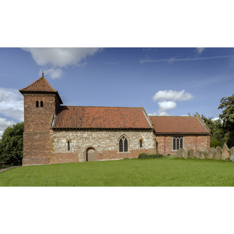
Image copyright © Julian P Guffogg, 2016
CC-BY-SA-2.0
Results: 2 records
view of church exterior in context - south view
Copyright Statement: Image copyright © Julian P Guffogg, 2016
Image Source: digital photograph taken 11 September 2016 by Julian P. Guffogg [www.geograph.org.uk/photo/5118863] [accessed 15 May 2019]
Copyright Instructions: CC-BY-SA-2.0
view of church interior - looking east
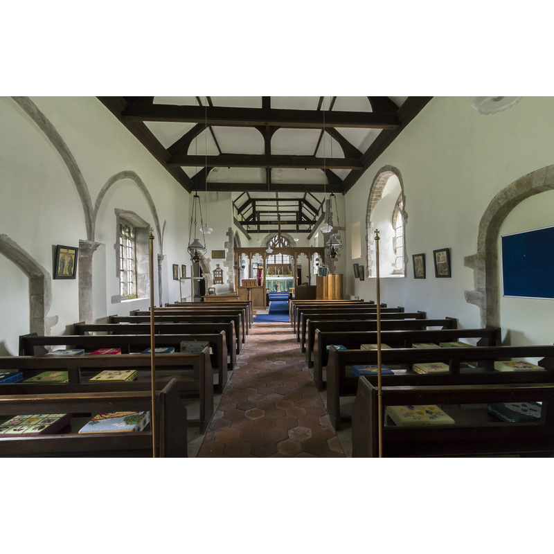
Scene Description: Source caption: "Interior, St Andrew's church, Bonby. The blocked arcade can be seen on the left hand side."
Copyright Statement: Image copyright © Julian P Guffogg, 2016
Image Source: digital photograph taken 11 September 2016 by Julian P. Guffogg [www.geograph.org.uk/photo/5118876] [accessed 15 May 2019]
Copyright Instructions: CC-BY-SA-2.0
INFORMATION
Font ID: 22160BON
Object Type: Baptismal Font1
Font Century and Period/Style: 12th - 13th century [basin only], Medieval / composite
Church / Chapel Name: Parish Church of St. Andrew
Font Location in Church: Inside the church
Church Patron Saint(s): St. Andrew
Church Address: Church Ln, Bonby, North Lincolnshire DN20 0PU, UK -- Tel.: 01652 653989
Site Location: Lincolnshire, East Midlands, England, United Kingdom
Directions to Site: Located off (E) the B1204, W of the A16, 8 km S of Barton-upon-Humber and the Humber river
Ecclesiastic Region: Diocese of Lincoln
Historical Region: Hundred of Yarborough
Additional Comments: altered font (medieval basin on a later-date base)
Font Notes:
Click to view
There are two entries for Bonby [variant spelling] in the Domesday survey [https://opendomesday.org/place/TA0015/bonby/] [accessed 15 May 2019] neither of which mentions cleric nor church in it. The entry for the priory of Bonby in the Victoria County History (Lincoln, vol. 2, 1910) notes: "The churches which formed the endowment of Bonby Priory were granted during the reign of John [i.e., 1199-1216] to the Benedictine priory of St. Fromund, Normandy; they had previously belonged to the prior and convent of Merton". The entry for this church in Historic England [Listing NGR: TA0037215523] notes: "Parish church. C12 nave with C13 and C15 windows, C13 blocked north arcade and chancel arch, tower of 1710, C18 chancel. South door blocked, porch demolished and west door inserted first half C19. Restorations of 1894 [...] Font with C12-C13 chamfered square bowl on later base."
COORDINATES
UTM: 30U 666399 5944917
Latitude & Longitude (Decimal): 53.62656, -0.4837
Latitude & Longitude (DMS): 53° 37′ 35.62″ N, 0° 29′ 1.32″ W
MEDIUM AND MEASUREMENTS
Material: stone
Font Shape: square, mounted
Basin Exterior Shape: square