Burwell nr. Lincoln No. 2 / Buruelle
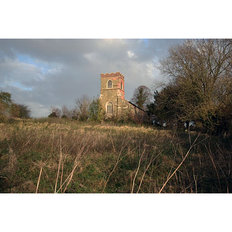
Image copyright © Richard Croft, 2007
CC-BY-SA-2.0
Results: 1 records
view of context
Scene Description: Source caption: The field in the foreground is approximately the position for the earthworks mentioned in the Pastscape listing [cf. FontNotes] as the probable site of the Priory. The Parish Church of St Michael, Burwell, in the background.
Copyright Statement: Image copyright © Richard Croft, 2007
Image Source: digital photograph taken 23 November 2007 by Richard Croft [www.geograph.org.uk/photo/621157] [accessed 14 May 2019]
Copyright Instructions: CC-BY-SA-2.0
INFORMATION
Font ID: 22154BUR
Object Type: Baptismal Font1?
Font Century and Period/Style: 12th century (early?), Norman
Church / Chapel Name: Alien Priory Church of Burwell [disppeared]
Font Location in Church: [disappeared]
Church Address: [NB: address and coordinates are for the site of the disappeared priory: Burwell, Louth, UK]
Site Location: Lincolnshire, East Midlands, England, United Kingdom
Directions to Site: The site of the disappeared priory is just E of the A16, 4-5 km SSE of Louth
Ecclesiastic Region: [Diocese of Lincoln]
Historical Region: Hundred of Louthesk
Additional Comments: disappeared font? (the one from the 12thC priory church here)
Font Notes:
Click to view
There is an entry for this Burwell [variant spelling] in the Domesday survey [https://opendomesday.org/place/TF3579/burwell/] [accessed 14 May 2019] and it mentions a church in it. The Victoria County History (Lincoln, vol. 2, 1906) notes : "The Alien priory of Burwell, for Benedictine monks, was probably built quite early in the twelfth century, during the first years of King Henry I. [...] In 1427, on the death of the prior, it was found that the site of the priory with dilapidated houses was worth nothing beyond reprises: 140 acres of arable land were worth 2d. an acre, the rectory 14s., the oblation at the cross of Burwell from 40s. to 2 marks, there were 76s. of annual rent, pensions from the churches of Authorpe and Walmsgate, and some meadow land, tithes of Burwell Wood, &c. (fn. 12) It was granted finally to the college of Tattershall." The entry for this priory in PastScape [www.pastscape.org.uk/hob.aspx?hob_id=354216] [accessed 14 May 2019] notes: "There are earthworks at Burwell which may be associated with the priory, but nothing definite can be ascertained."
COORDINATES
UTM: 31U 302263 5909382
Latitude & Longitude (Decimal): 53.29669, 0.0328
Latitude & Longitude (DMS): 53° 17′ 48.08″ N, 0° 1′ 58.08″ E