Barlings / Berlinge
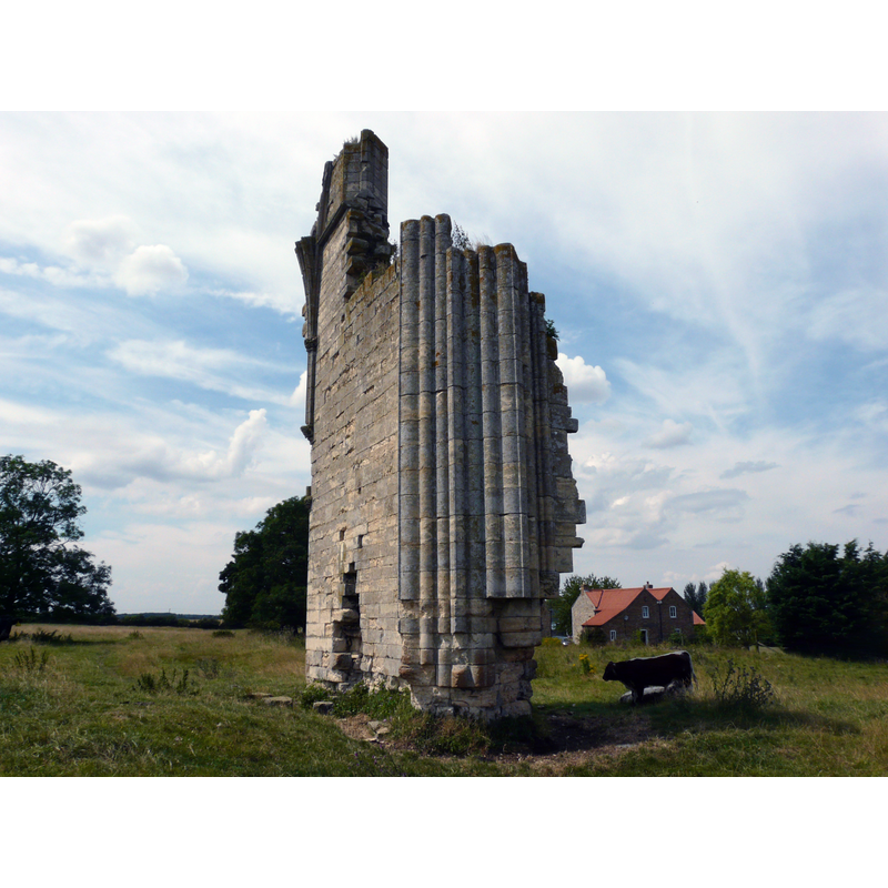
Image copyright © Peter Wood, 2012
CC-BY-SA-2.0
Results: 3 records
view of church exterior - detail
Scene Description: the last stading remains of the medieval abbey church
Copyright Statement: Image copyright © Peter Wood, 2012
Image Source: digital photograph taken 25 July 2012 by Peter Wood [www.geograph.org.uk/photo/3057861] [accessed 9 May 2019]
Copyright Instructions: CC-BY-SA-2.0
view of church exterior - detail
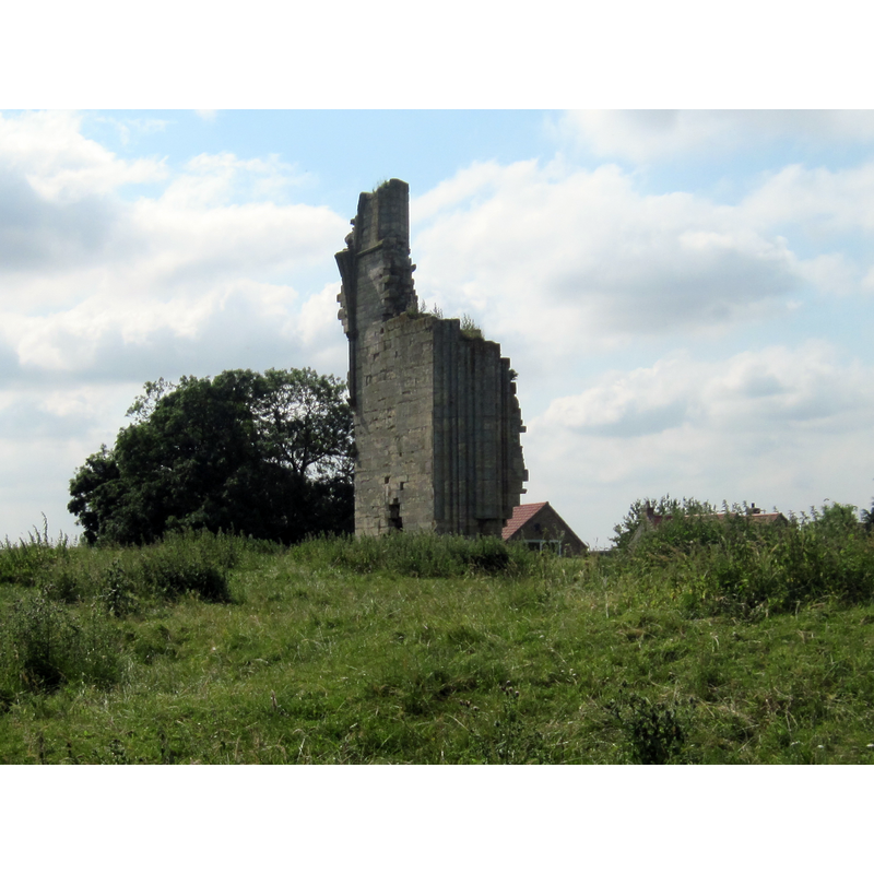
Scene Description: the last stading remains of the medieval abbey church
Copyright Statement: Image copyright © Admiralgary, 2007
Image Source: digital photograph taken 10 January 2007 by Admiralgary [https://commons.wikimedia.org/wiki/File:Barlings_Abbey.jpg] [accessed 9 May 2019]
Copyright Instructions: CC-BY-SA-3.0
view of church exterior - northwest view
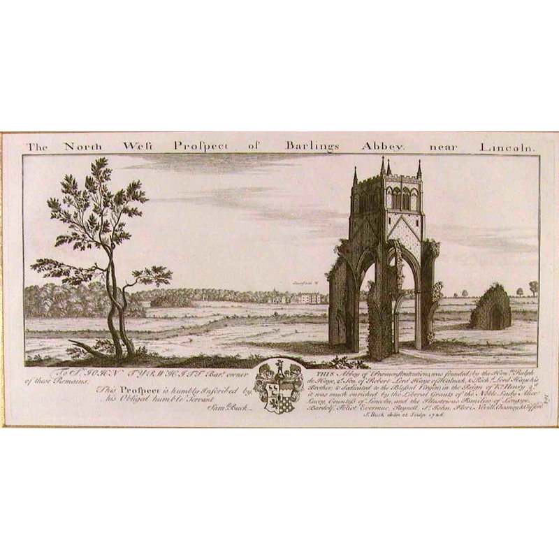
Scene Description: the west tower of the abbey church was still standing in 1726, when the engraving was done; it would collapse in 1757
Copyright Statement: Image copyright © [in the public domain]
Image Source: digital image of a 1726 engraving by Samuel Buck [https://commons.wikimedia.org/wiki/File:Barlings_Abbey_1726.jpg] [accessed 9 May 2019]
Copyright Instructions: CC-PD-Mark
INFORMATION
Font ID: 22143BAR
Object Type: Baptismal Font1?
Font Century and Period/Style: 12th century (mid?), Late Norman
Church / Chapel Name: Abbey Church [in ruins]
Font Location in Church: [disappeared]
Church Patron Saint(s): The Assumption of St. Mary
Church Address: Barlings, Lincoln LN3 5DG, UK
Site Location: Lincolnshire, East Midlands, England, United Kingdom
Directions to Site: The few remaining ruins of this abbey are located on the west banks of Barlings Eau, about a mile N of Short Ferry Rd, 15-16 km E of Lincoln
Ecclesiastic Region: [Diocese of Lincoln]
Historical Region: Hundred of Lawress
Additional Comments: disappeared font? (the one from the mid 12thC abbey church here)
Font Notes:
Click to view
There are three entries for Barlings [variant spelling] in the Domesday survey [https://opendomesday.org/place/TF0774/barlings/] [accessed 9 May 2019] one of which reports a church in it. The entry for this Premonstratensian abbey in the Victoria County History (Lincoln, vol. 2, 1906) notes: "The abbey of Barlings was founded in 1154 by Ralf de Haya, [...] son of the constable of Lincoln Castle, and lord of Burwell and Carlton. It was at first placed at a site called Barling Grange, but afterwards removed to Oxney, within the same vill of Barlings. [...] The house was dedicated in honour of the Assumption of Blessed Mary.[...] During the reign of Edward III two abbots were under the special favour of the king and of Queen Philippa, and in aid of the re-building of the conventual church at this time they were exempted for several years from payment of tenths"; it was disestablished in 1537. The defacing of the church, the removing and melting of its lead is said to have been done under the closed direction of Cromwell himself. The abbey church tower survived standing, as shown in a 1726 engraving by Samuel Buck, until its collapse in 1757; at present only some earthworks and partial wall of the nave remain from the old abbey.
COORDINATES
UTM: 30U 675570 5903079
Latitude & Longitude (Decimal): 53.2479, -0.3685
Latitude & Longitude (DMS): 53° 14′ 52.44″ N, 0° 22′ 6.6″ W
REFERENCES
- Victoria County History [online], University of London, 1993-. URL: https://www.british-history.ac.uk.