Alvingham No. 3 / Aluingeham / Aluingham / Alvingeham / North Cockerington

Image copyright © Dave Hitchborne, 2013
CC-BY-SA-2.0
Results: 6 records
view of font and cover
Scene Description: The CRSBI (2019) notes: "The base of the font has also been attributed to the Romanesque period. [...] According to the church guide, the font base is a 12thc column base from the Gilbertine Priory that once stood nearby. The diameter of the base is quite large at 2.54 m and, if it did once form part of the old Priory, it was surely a plinth to a column system rather than the base. However, there are no indentifying characteristics to substantiate this speculation."
Copyright Statement: Image copyright © Dave Hitchborne, 2013
Image Source: digital photograph taken 28 April 2013 by Dave Hitchborne [www.geograph.org.uk/photo/3649178] [accessed 6 May 2019]
Copyright Instructions: CC-BY-SA-2.0
view of font and cover
![The CRSBI (2019) notes: "The base of the font has also been attributed to the Romanesque period. [...] According to the church guide, the font base is a 12thc column base from the Gilbertine Priory that once stood nearby. The diameter of the base is quite large at 2.54 m and, if it did once form part of the old Priory, it was surely a plinth to a column system rather than the base. However, there are no indentifying characteristics to substantiate this speculation."](/static-50478a99ec6f36a15d6234548c59f63da52304e5/compressed/1190506006_compressed.png)
Scene Description: The CRSBI (2019) notes: "The base of the font has also been attributed to the Romanesque period. [...] According to the church guide, the font base is a 12thc column base from the Gilbertine Priory that once stood nearby. The diameter of the base is quite large at 2.54 m and, if it did once form part of the old Priory, it was surely a plinth to a column system rather than the base. However, there are no indentifying characteristics to substantiate this speculation."
Copyright Statement: Image copyright © Dave Hitchborne, 2013
Image Source: digital photograph taken 28 April 2013 by Dave Hitchborne [www.geograph.org.uk/photo/3649182] [accessed 6 May 2019]
Copyright Instructions: CC-BY-SA-2.0
view of church exterior - northeast view
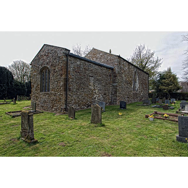
Scene Description: the fragment of an earlier window is discernible in the centre of the chancel wall, in the eastern half of the body of the church
Copyright Statement: Image copyright © Dave Hitchborne, 2013
Image Source: digital photograph taken 28 April 2013 by Dave Hitchborne [www.geograph.org.uk/photo/3649212] [accessed 6 May 2019]
Copyright Instructions: CC-BY-SA-2.0
view of church exterior - north view - window - fragment
![Source capion: "Saxon window. Fragmentary remains of an 11th century window in the north chancel wall of St.Mary's church" [NB: the entry for this church in the CRSBI [www.crsbi.ac.uk/site/5311/] [accessed 6 May 2019] notes: "A small window fragment in the chancel may be late 11thc [...] The window fragment in the chancel is similar to the tower window at the church of St John the Baptist, Great Hale, in terms of its small scale and monolithic manufacturing process. Everson and Stocker (1999), 311, date the Great Hale window to the late 11thc, the period of transitional overlap between the Anglo-Saxon and Romanesque periods. The stone block above the North Cockerington window fragment is badly weathered, but, based on its undulating surface, it too may have carried carved ornamentation in the form of a row of semi-circular cusps."]](/static-50478a99ec6f36a15d6234548c59f63da52304e5/compressed/1190506004_compressed.png)
Scene Description: Source capion: "Saxon window. Fragmentary remains of an 11th century window in the north chancel wall of St.Mary's church" [NB: the entry for this church in the CRSBI [www.crsbi.ac.uk/site/5311/] [accessed 6 May 2019] notes: "A small window fragment in the chancel may be late 11thc [...] The window fragment in the chancel is similar to the tower window at the church of St John the Baptist, Great Hale, in terms of its small scale and monolithic manufacturing process. Everson and Stocker (1999), 311, date the Great Hale window to the late 11thc, the period of transitional overlap between the Anglo-Saxon and Romanesque periods. The stone block above the North Cockerington window fragment is badly weathered, but, based on its undulating surface, it too may have carried carved ornamentation in the form of a row of semi-circular cusps."]
Copyright Statement: Image copyright © Richard Croft, 2013
Image Source: digital photograph taken 28 April 2013 by Richard Croft [www.geograph.org.uk/photo/3434689] [accessed 6 May 2019]
Copyright Instructions: CC-BY-SA-2.0
view of church exterior - southeast view
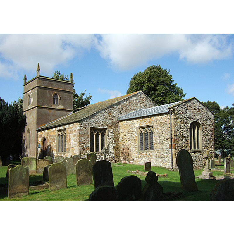
Scene Description: Source caption: "St Mary, North Cockerington at Alvingham. The church was formerly the chapel of a small Gilbertine Priory which adjoined the parish church of St Adelwold at Alvingham. The Priory was founded as a 'double house' for both monks and nuns in about 1150 and by the Dissolution of the Monasteries when the house was surrendered to the Crown on 29 September 1538 it had a prior and seven canons and a prioress and eleven nuns. It was subsequently given to the village of North Cockerington when their church became derelict. The simple two cell monastic chapel was extended over time and the current tower dates from a C19th restoration. The church is now redundant and looked after by the Historic Churches Trust."
Copyright Statement: Image copyright © Simon Huguet, 2008
Image Source: digital photograph taken 3 September 2008 by Simon Huguet [www.geograph.org.uk/photo/953107] [accessed 6 May 2019]
Copyright Instructions: CC-BY-SA-2.0
view of church interior - looking east
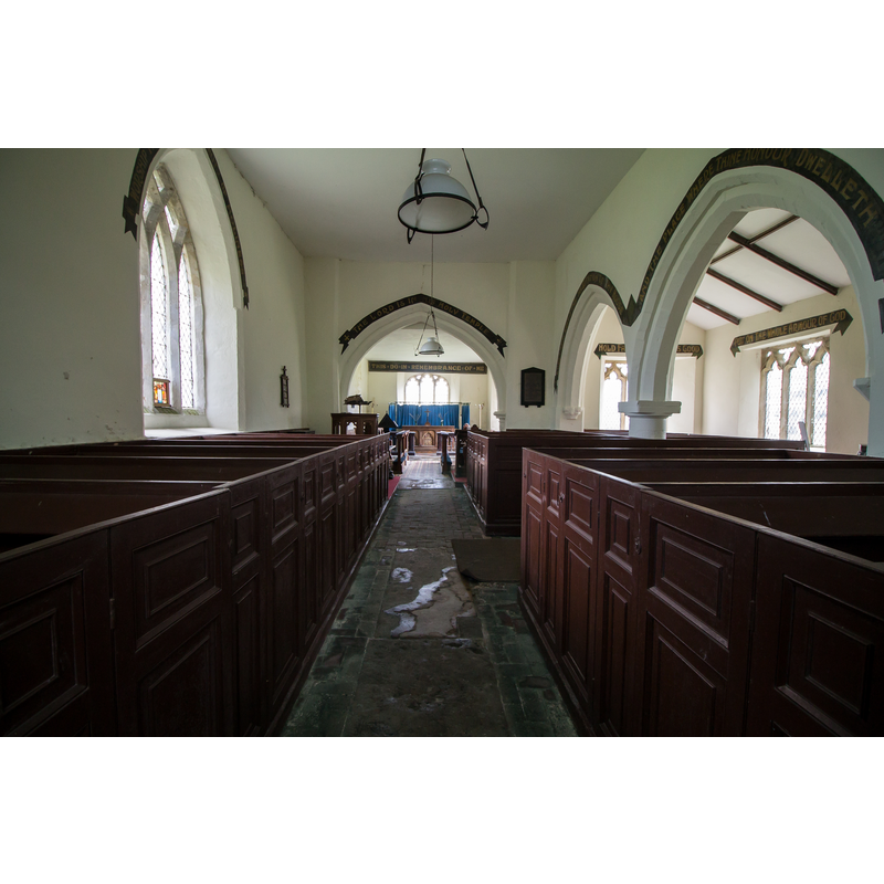
Copyright Statement: Image copyright © J. Hannan-Briggs, 2015
Image Source: digital photograph taken 4 May 2015 ny J. Hannan-Briggs [www.geograph.org.uk/photo/4461335] [accessed 6 May 2019]
Copyright Instructions: CC-BY-SA-2.0
INFORMATION
Font ID: 22135ALV
Object Type: Baptismal Font1?
Font Century and Period/Style: 13th century [composite font?], Medieval [composite]
Church / Chapel Name: Parish Church of St. Mary [redundant]
Font Location in Church: Inside the now redundant church, by the S arcade
Church Patron Saint(s): St. Mary the Virgin
Church Notes: St Mary's may have been in the possession of Alvinham Priory at some point, even though it may have been older than the priory itself; at the Dissolution this church was given to North Cockerington to replace its own deteriorated church [redundant since 1981 and in the care of the Churches Conservation Trust]
Church Address: Abbey Ln, Alvingham, Louth LN11 0QD, UK
Site Location: Lincolnshire, East Midlands, England, United Kingdom
Directions to Site: Located just W of the Louth Canal, 6-8 km NE of Louth and the A16 -- it shares cemetery with St. Adelwad's
Ecclesiastic Region: Diocese of Lincoln
Historical Region: Hundred of Louthesk
Additional Comments: composite font? (the present font, re-using a stone from the disappeared priory nearby as lower base or plinth) -- disappeared font? (the one from the late-11thC(?) church here)
Font Notes:
Click to view
The entry for this church in the CRSBI (2019) notes: "The font is located near the W respond of the S aisle arcade. The base consists of two chamfered, round steps. The lower section of the W side of the base has been reconstructed with brick and cement. [...] The base of the font has also been attributed to the Romanesque period. [...] According to the church guide, the font base is a 12thc column base from the Gilbertine Priory that once stood nearby. The diameter of the base is quite large at 2.54 m and, if it did once form part of the old Priory, it was surely a plinth to a column system rather than the base. However, there are no indentifying characteristics to substantiate this speculation." The entry for this church in Historic England [Listing NGR: TF3676191332] notes: "Chapel to Gilbertine Priory, now parish church to village of North Cockerington. Cll, late C12, c.1300, C14, C19. [...] Plain C13 octagonal font on tall octagonal base."
COORDINATES
UTM: 31U 304261 5920930
Latitude & Longitude (Decimal): 53.4011, 0.0556
Latitude & Longitude (DMS): 53° 24′ 3.96″ N, 0° 3′ 20.16″ E
MEDIUM AND MEASUREMENTS
Material: stone
Number of Pieces: three
Font Shape: octagonal, mounted
Basin Interior Shape: round
Basin Exterior Shape: octagonal
Drainage Notes: lead-lined
LID INFORMATION
Date: modern
Material: wood, oak?
Apparatus: no
Notes: octagonal and flat, with metal decoration and ring handle
REFERENCES
- Corpus of Romanesque Sculpture in Britain and Ireland, The Corpus of Romanesque Sculpture in Britain and Ireland, The Corpus of Romanesque Sculpture in Britain and Ireland. URL: http://www.crsbi.ac.uk.