Haverholme
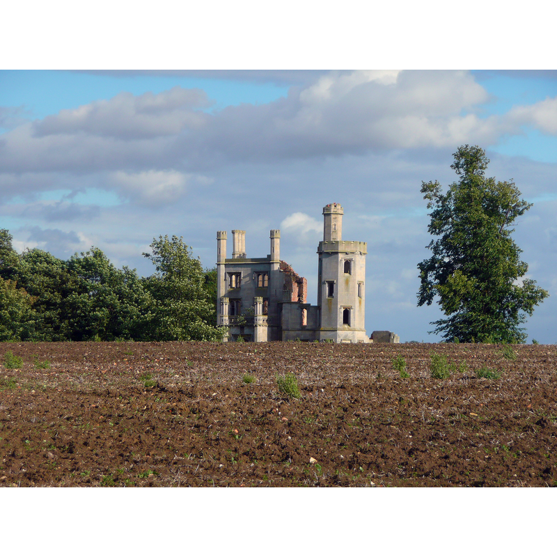
Image copyright © Steve Tapster, 2010
CC-BY-SA-2.0
Results: 1 records
view of context
Scene Description: site of the disappeared priory; the ruin here is that of the 19thC re-building of an 18thC mansion; there are no remains of the medieval priory left above ground
Copyright Statement: Image copyright © Steve Tapster, 2010
Image Source: digital photograph taken 24 August 2010 by Steve Tapster [www.geograph.org.uk/photo/2181031] [accessed 6 May 2019]
Copyright Instructions: CC-BY-SA-2.0
INFORMATION
Font ID: 22132HAV
Object Type: Baptismal Font1?
Font Century and Period/Style: 12th century (mid?), Late Romanesque
Church / Chapel Name: Priory Church of St. Mary [disappeared]
Font Location in Church: [disappeared]
Church Patron Saint(s): St. Mary the Virgin
Church Notes: First Cistercian (1137), then Gilbertine priory of St. Mary founded 1139; dissolved in 1539; mansion built 1780; re-built 1835; only underground ruins remain from the priory; some above-ground remains are from the 19thC mansion
Church Address: Address and coordinates are those of the site of the disappeared priory church: Haverholme, Ewerby and Evedon, Sleaford, UK
Site Location: Lincolnshire, East Midlands, England, United Kingdom
Directions to Site: The site of the disappeared priory is located off (W) Park Ln, S of the Slea river and the A153, 2 km SW of Anwick, 6 km NE of Sleaford
Ecclesiastic Region: [Diocese of Lincoln]
Additional Comments: disappeared font? (the one from the mid-12thC priory church here)
Font Notes:
Click to view
No individual entry for Haverholme found in the Domesday survey. The entry for this priory in the Victoria County History (Lincoln, vol. 2, 1906) notes: "The Gilbertine priory of St. Mary, Haverholme, was founded as a double house in 1139 by Alexander, bishop of Lincoln. [...] In 1137 he had offered the site, a marshy island in the river near Sleaford, to the abbot of Fountains for a Cistercian abbey. [...] Abbot Gervase accepted it; two years were spent in erecting those monastic buildings which were absolutely needful, and on Candlemas Day, 1139, a band of monks was sent from Fountains to take possession. [...] The place displeased them, and the bishop gave them instead the site on which the house of Louth Park was built. Alexander then offered Haverholme to his former confessor, Gilbert of Sempringham [...] The later history of the priory is quite obscure. Shortly before the dissolution there were many manuscripts but few printed books. [...] The house was surrendered on 24 September, 1538, by the prior and six canons."
COORDINATES
UTM: 53.0308, -0.349301
Latitude & Longitude (Decimal): 53.0308, -0.349301
Latitude & Longitude (DMS): 53° 1′ 50.88″ N, 0° 20′ 57.49″ W
REFERENCES
- Victoria County History [online], University of London, 1993-. URL: https://www.british-history.ac.uk.