Nocton No. 2 / Nochetune
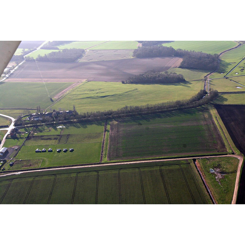
Image copyright © Simon Tompson, 2019
CC-BY-SA-2.0
Results: 1 records
view of context
Scene Description: Source caption: "Nocton Park Augustinian Priory site [...] Nocton Priory was a small house of Augustinian Canons founded in the mid twelfth century by Robert D’Arcy, son of the major landowner in Nocton, in honour of St Mary Magdalene, in or near a pre-existing deerpark. Carr Dyke runs across the shot through the line of trees."
Copyright Statement: Image copyright © Simon Tompson, 2019
Image Source: digital photograph taken 16 February 2019 by Simon Tompson [www.geograph.org.uk/photo/6061740] [accessed 1 May 2019]
Copyright Instructions: CC-BY-SA-2.0
INFORMATION
Font ID: 22127NOC
Object Type: Baptismal Font1?
Church / Chapel Name: Priory Church
Font Location in Church: [disappeared]
Church Patron Saint(s): St. Mary Magdalene
Church Address: Abbey Hill, Nocton, Lincoln, UK
Site Location: Lincolnshire, East Midlands, England, United Kingdom
Directions to Site: Located off the B1202, 11 km SE of Lincoln; the priory site is about 1-2 km fENE of the village centre
Ecclesiastic Region: [Diocese of Lincoln]
Historical Region: Hundred of Langoe
Font Notes:
Click to view
There are two entries for Nocton [variant spelling] in the Domesday survey [https://opendomesday.org/place/TF0664/nocton/] [accessed 1 May 2019] one of which reports a priest and a church in it. The entry for this Augustinian priory in the Victoria County History (Lincoln, vol. 2, 1906) notes: "The priory of Nocton Park was founded by Robert Darcy in honour of St. Mary Magdalene, probably during the reign of Stephen [r. 1135-1154] [...] The last prior, Thomas Hornell, [..] had to give up his house before Michaelmas, 1536".
COORDINATES
UTM: 30U 674435 5894431
Latitude & Longitude (Decimal): 53.17061, -0.39022
Latitude & Longitude (DMS): 53° 10′ 14.2″ N, 0° 23′ 24.79″ W
REFERENCES
- Victoria County History [online], University of London, 1993-. URL: https://www.british-history.ac.uk.