Thornholme / Thornholm Priory
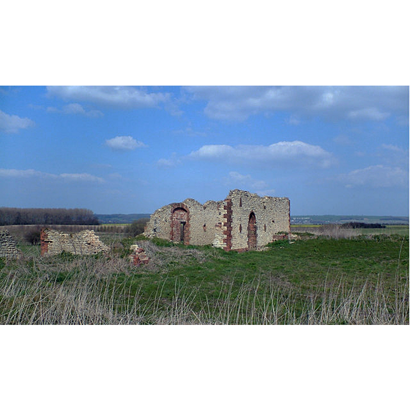
Image copyright © David Wright, 2007
CC-BY-SA-2.0
Results: 1 records
view of context
Scene Description: Source caption: "Site of Thornholme Priory This old ruined barn, of no great antiquity, marks the site of Thornholme Priory. The Priory was a house of Augustinian Canons founded mid C12. Visible nearby are the remains of the Priory fishponds."
Copyright Statement: Image copyright © David Wright, 2007
Image Source: digital photograph taken 7 April 2007 by David Wright [https://commons.wikimedia.org/wiki/File:Site_of_Thornholme_Priory_-_geograph.org.uk_-_391963.jpg] [accessed 1 May 2019]
Copyright Instructions: CC-BY-SA-2.0
INFORMATION
Font ID: 22126THO
Object Type: Baptismal Font1?
Font Century and Period/Style: 12th century (mid?), Late Norman
Church / Chapel Name: Church of the Augustinian Priory of the Blessed Virgin Mary
Font Location in Church: [disappeared]
Church Patron Saint(s): St. Mary the Virgin
Church Address: Thornholme Priory, Appleby, Scunthorpe, UK
Site Location: Lincolnshire, East Midlands, England, United Kingdom
Directions to Site: Locatd just E of the West Drain and the B1207, W of the Ancholme river, 3 km SSE of Appleby
Ecclesiastic Region: [Diocese of Lincoln]
Additional Comments: disappeared font? (the one from the mid-12thC(?) priory church here)
Font Notes:
Click to view
No individual entry found for this Thornholme in the Domesday survey. The priory is noted in the Victroria County History (Lincoln, vol. 2, 1906). The entry for this priory in Historic England [List Entry Number: 1017821] notes: "The Priory of the Blessed Virgin Mary at Thornholme was founded by King Stephen between 1148 and 1154. [...] Thornholme Priory [...] is a good example of a medium sized Augustinian foundation. It is well preserved with very little post-Dissolution disturbance, with the core of the priory surviving with substantial upstanding earthworks. Excavation has shown that much of the site, including those areas ploughed, retain undisturbed deposits extending over 1m below the modern ground surface. These deposits also included organic remains. The monument includes the buried and earthwork remains of Thornholme Priory, including the church, cloister and other inner court buildings as well as the service buildings of the outer court. [...] the priory was suppressed in 1536 [...] diarists of the late 17th century mentioned that substantial standing remains of the priory still survived over a century later. By the late 17th century a small farm was established on the site, centred to the north west of the church. This farm was ruinous by 1954. [...] The priory church is cruciform in plan".
COORDINATES
UTM: 30U 662611 5941888
Latitude & Longitude (Decimal): 53.600556, -0.5425
Latitude & Longitude (DMS): 53° 36′ 2″ N, 0° 32′ 33″ W
REFERENCES
- Victoria County History [online], University of London, 1993-. URL: https://www.british-history.ac.uk.