Stainfield / Stainfelde
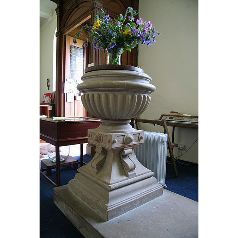
Image copyright © Richard Croft, 2008
CC-BY-SA-2.0
Results: 5 records
view of font and cover
Scene Description: the modern font in the modern church
Copyright Statement: Image copyright © Richard Croft, 2008
Image Source: digital photograph taken 10 May 2008 by Richard Croft [www.geograph.org.uk/photo/805758] [accessed 25 August 2019]
Copyright Instructions: CC-BY-SA-2.0
view of church exterior
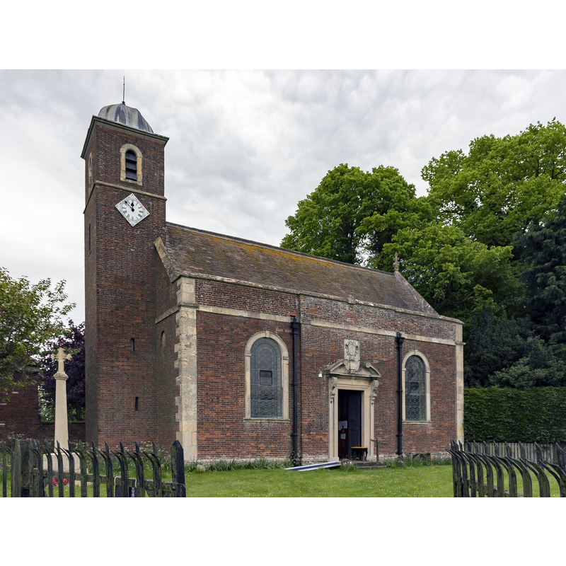
Scene Description: Source caption: "St Andrew's church, Stainfield. Viewed from the north west, showing the "liturgical south" side of the church."
Copyright Statement: Image copyright © Julian P Guffogg, 2018
Image Source: digital photograph taken 13 May 2018 by Julian P Guffogg [www.geograph.org.uk/photo/5773587] [accessed 25 August 2019]
Copyright Instructions: CC-BY-SA-2.0
view of context
![Source caption: "Stainfield Hall. This solitary gatepier is all that remains of the grand 16th century house built by Sir Robert Tyrwhit, the current house was built in 1856." [NB: Trywhit had received the grounds of the old priory at the Dissolution from Henry VIII, where he built Stainfield Hall]](/static-50478a99ec6f36a15d6234548c59f63da52304e5/compressed/1190418014_compressed.png)
Scene Description: Source caption: "Stainfield Hall. This solitary gatepier is all that remains of the grand 16th century house built by Sir Robert Tyrwhit, the current house was built in 1856." [NB: Trywhit had received the grounds of the old priory at the Dissolution from Henry VIII, where he built Stainfield Hall]
Copyright Statement: Image copyright © Richard Croft, 2006
Image Source: digital photograph taken 17 September 2006 by Richard Croft [www.geograph.org.uk/photo/242581] [accessed 17 April 2019]
Copyright Instructions: CC-BY-SA-2.0
view of church interior - looking east
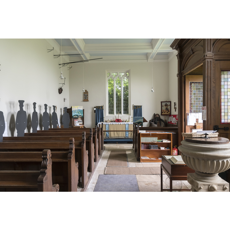
Scene Description: the modern church showing the modern font by the entranceway
Copyright Statement: Image copyright © Julian P Guffogg, 2018
Image Source: digital photograph taken 13 May 2018 by Julian P Guffogg [www.geograph.org.uk/photo/5773591] [accessed 25 August 2019]
Copyright Instructions: CC-BY-SA-2.0
view of context
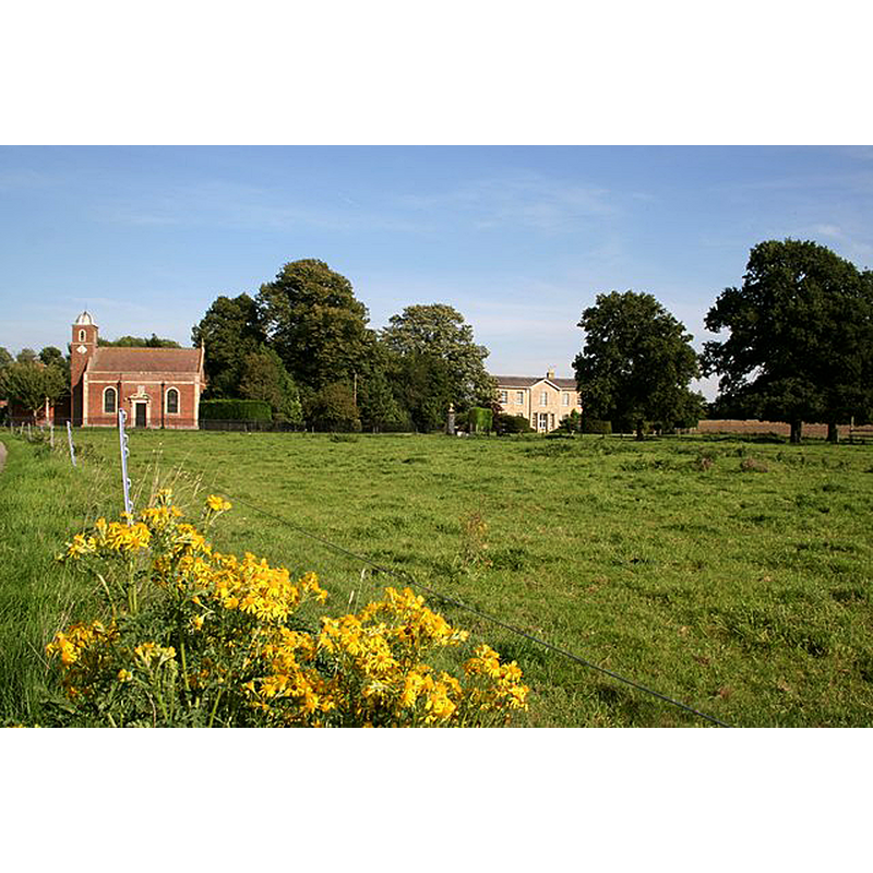
Scene Description: Source caption: "St Andrew's church and Stainfield Hall seen from the parkland. Undulations in the ground mark the site of Stainfield Priory, a house for Benedictine nuns founded c1154 by Henry de Percy and dissolved in 1536."
Copyright Statement: Image copyright © Richard Croft, 2006
Image Source: digital photograph taken 17 September 2006 by Richard Croft [www.geograph.org.uk/photo/242587] [accessed 25 August 2019]
Copyright Instructions: CC-BY-SA-2.0
INFORMATION
Font ID: 22097STA
Object Type: Baptismal Font1?
Font Century and Period/Style: 12th century, Late Norman
Church / Chapel Name: Benedictine Priory Church [disappeared]
Font Location in Church: [disappeared]
Church Address: [cf. Directions Geo]
Site Location: Lincolnshire, East Midlands, England, United Kingdom
Directions to Site: The site of the Hall and the old priory is W of the B1202, S of the A158, 16 km E of Lincoln town centre
Ecclesiastic Region: [Diocese of Lincoln]
Historical Region: Hundred of Wraggoe
Additional Comments: disappeared font? (the one from the 12thC(?) priory church here
Font Notes:
Click to view
There are two entries for this Stainfield [variant spelling] in the Domesday survey [https://opendomesday.org/place/TF1073/stainfield/] [accessed 17 April 2019] neither of which mentions cleric or church in it. The entry for this House of Benedictine nuns in the Victoria County History (Lincoln, vol. 2, 1906) notes: "The priory of Stainfield was founded by William or Henry de Percy, in or before the reign of Henry II.[i.e., 1154-1189] It was the only Benedictine nunnery in Lincolnshire [...] In 1392 Bishop Bokyngham forbade merchants to sell their wares in the conventual church". It was dissolved in 1536 and nothing remains of the priory church itself, the site having been re-built as Stainfield Hall by Sir Robert Tyrwhitt accorcing to Historic England [www.pastscape.org.uk/hob.aspx?hob_id=1058727] [accessed 17 April 2019]. The present-day Parish Church of St Andrew is a 19th-century re-building of a 18th-century church on a different site; it has a modern font.
COORDINATES
UTM: 30U 677756 5902693
Latitude & Longitude (Decimal): 53.2437, -0.336
Latitude & Longitude (DMS): 53° 14′ 37″ N, 0° 20′ 10″ W
REFERENCES
- Victoria County History [online], University of London, 1993-. URL: https://www.british-history.ac.uk.