Colton nr. Ulverston / Coleton / Coulton
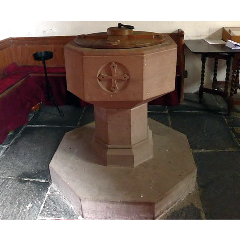
Image copyright © Basher Eyre, 2015
CC-BY-SA-2.0
Results: 5 records
view of font and cover
Scene Description: "The old font, which is octagonal in plan and of red sandstone, apparently of early 16th-century date, was rechiselled and is now restored to use." [cf. VCH entry in FontNotes]
Copyright Statement: Image copyright © Basher Eyre, 2015
Image Source: digital photograph taken 19 February 2015 by Basher Eyre [www.geograph.org.uk/photo/4478534] [accessed 12 April 2019]
Copyright Instructions: CC-BY-SA-2.0
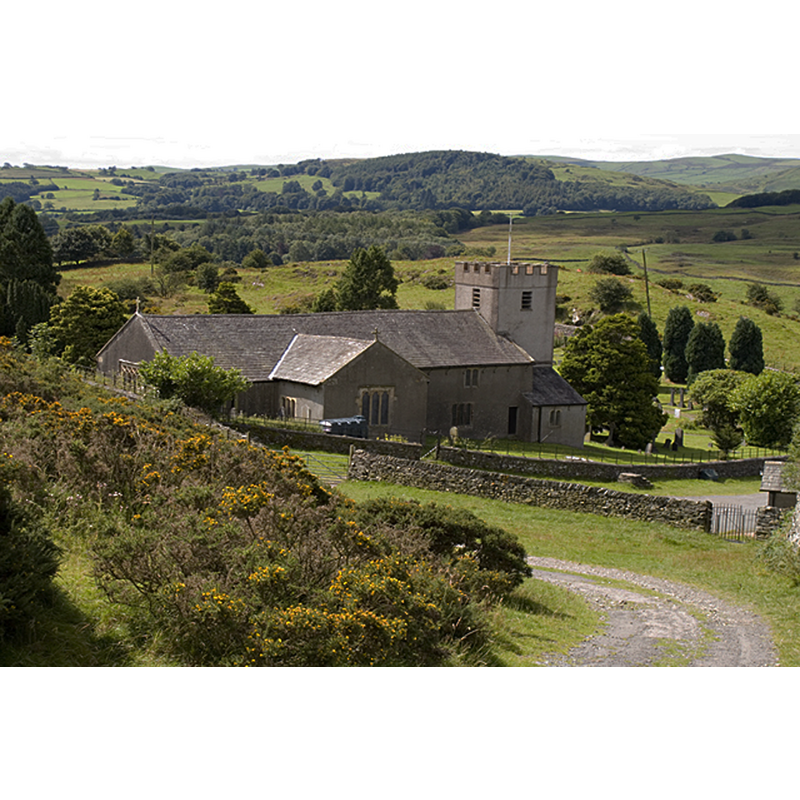
view of church exterior in context - northeast view
Copyright Statement: Image copyright © Tim Richardson, 2011
Image Source: digital photograph taken 9 August 2011 by Tim Richardson [www.geograph.org.uk/photo/2546477] [accessed 12 April 2019]
Copyright Instructions: CC-BY-SA-2.0
view of church exterior - south view
![MOD FONT IN CNXT digital photograph taken 19 February 2015 by Basher Eyre [www.geograph.org.uk/photo/4478507] [accessed 12 April 2019] IS THE FONT MODERN OR DOES IT APPEAR THAT WAY? SEE FONTNOTES
MOD FONT digital photograph taken 19 February 2015 by Basher Eyre [www.geograph.org.uk/photo/4478534] [accessed 12 April 2019]](/static-50478a99ec6f36a15d6234548c59f63da52304e5/compressed/1190414010_compressed.png)
Scene Description: MOD FONT IN CNXT digital photograph taken 19 February 2015 by Basher Eyre [www.geograph.org.uk/photo/4478507] [accessed 12 April 2019] IS THE FONT MODERN OR DOES IT APPEAR THAT WAY? SEE FONTNOTES
MOD FONT digital photograph taken 19 February 2015 by Basher Eyre [www.geograph.org.uk/photo/4478534] [accessed 12 April 2019]
Copyright Statement: Image copyright © Yohan euan o4, 2009
Image Source: digital photograph taken 13 August 2009 by Yohan euan o4 [https://commons.wikimedia.org/wiki/File:Colton_Church.JPG] [accessed 12 April 2019]
Copyright Instructions: CC-BY-SA-3.0
view of font and cover in context
Copyright Statement: Image copyright © Basher Eyre, 2015
Image Source: digital photograph taken 19 February 2015 by Basher Eyre [www.geograph.org.uk/photo/4478507] [accessed 12 April 2019]
Copyright Instructions: CC-BY-SA-2.0
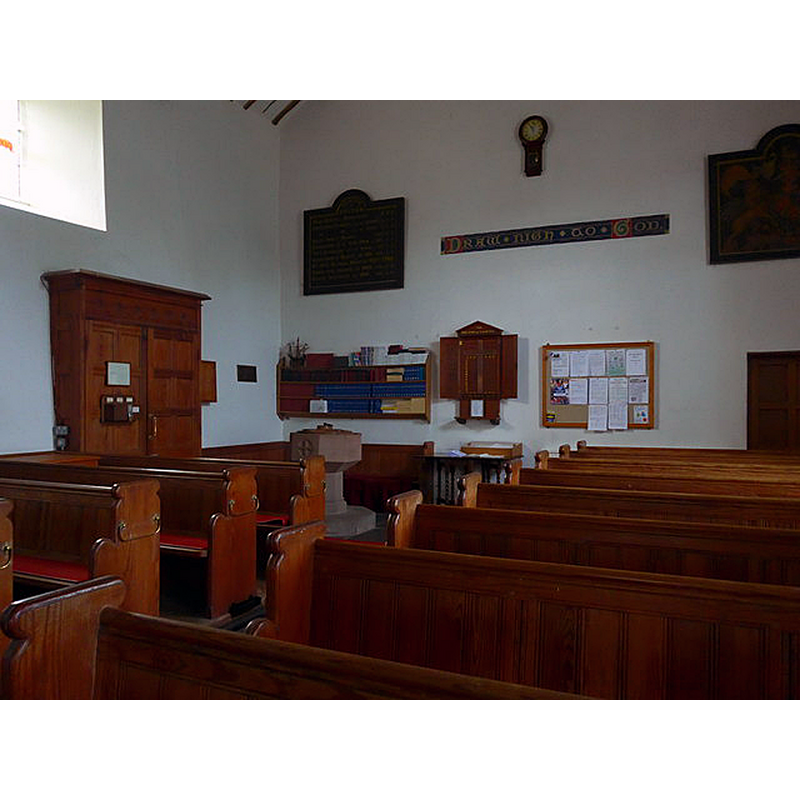
view of church interior - nave - looking west
![the baptismal font is partially visible at the far [west] end, left [south] side](/static-50478a99ec6f36a15d6234548c59f63da52304e5/compressed/1190414012_compressed.png)
Scene Description: the baptismal font is partially visible at the far [west] end, left [south] side
Copyright Statement: Image copyright © Basher Eyre, 2015
Image Source: digital photograph taken 19 February 2015 by Basher Eyre [www.geograph.org.uk/photo/4478507] [accessed 12 April 2019]
Copyright Instructions: CC-BY-SA-2.0
INFORMATION
Font ID: 22090COL
Object Type: Baptismal Font1
Font Date: ca. 1530?
Font Century and Period/Style: 16th century(early?), Late Perpendicular
Church / Chapel Name: Parish Church of the Holy Trinity
Font Location in Church: Inside the church [cf. FontNotes]
Church Patron Saint(s): The Holy Trinity
Church Address: Colton, Ulverston LA12 8HF, UK
Site Location: Cumbria, North West, England, United Kingdom
Directions to Site: Located off (N) the A590 between Newby Bridge and Ulverston, between the southern ends of Windermere and Coniston Water
Ecclesiastic Region: Diocese of Carlisle
Historical Region: Hundred of Lonsdale -- Hundred of Amounderness -- formerly Lancashire?
Additional Comments: disused font (old basin used as base of later font; then, re-carved and reinstated as main vessel)
Font Notes:
Click to view
No individual entry for this Colton found in the Domesday survey. Whitaker (1823) writes: "In the Liger Regis, the church of Coltin is stated to be dedicated to the Holy Trinity, and have belonged to Furness Abbey", suggesting that it may have been a chapel of ease to one of the its churches. The entry for this parish in the Victoria County History (Lancaster, vol. 8, 1914) notes: "Nothing is known of the origin of the chapel at Colton. It is mentioned in a complaint against the Abbot of Furness in 1530 [...] The building may have been erected about 1530 on the site of an older building, (fn. 31) while the tower may have been added at the beginning of the 17th century, [...] but is of the same plain character as the rest of the building, having nothing in its appearance suggesting a later date. [...] In dismantling the church in 1889 the bowl of the ancient font was discovered upside down, used as the base of an 18th-century font then in use bearing the initials of the four churchwardens of 1717–18. [...] The old font, which is octagonal in plan and of red sandstone, apparently of early 16th-century date, was rechiselled and is now restored to use." The present font in this church appears modern, but it must be the re-chislled one mentioned in the VCH entry above.
COORDINATES
UTM: 30U 496874 6013063
Latitude & Longitude (Decimal): 54.2655, -3.048
Latitude & Longitude (DMS): 54° 15′ 55.8″ N, 3° 2′ 52.8″ W
MEDIUM AND MEASUREMENTS
Material: stone, sandstone (red)
Font Shape: octagonal, mounted
Basin Interior Shape: round
Basin Exterior Shape: octagonal
LID INFORMATION
Date: modern
Material: wood, oak?
Apparatus: no
Notes: round with flat cross atop and metal handle; modern
REFERENCES
- Victoria County History [online], University of London, 1993-. URL: https://www.british-history.ac.uk.
- Whitaker, Thomas Dunham, An history of Richmondshire, in the North Riding of the County of York [...], with illustrations by J.M.W. Turner, London: [s.n.], 1823, vol. 2: 410