Satterthwaite
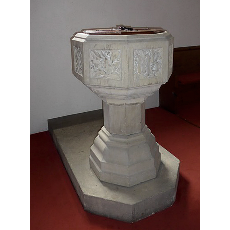
Image copyright © Basher Eyre, 2015
CC-BY-SA-2.0
Results: 4 records
view of font and cover
Scene Description: the modern font and cover
Copyright Statement: Image copyright © Basher Eyre, 2015
Image Source: digital photograph taken 19 February 2015 by Basher Eyre [www.geograph.org.uk/photo/4447898] [accessed 12 April 2019]
Copyright Instructions: CC-BY-SA-2.0
view of church exterior - southwest view
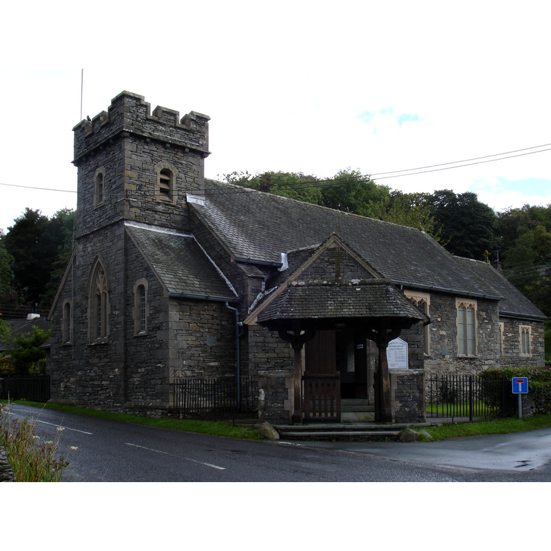
Copyright Statement: Image copyright © [in the public domain]
Image Source: digital photograph taken 17 August 2007 by JohnArmagh [https://commons.wikimedia.org/wiki/File:DSC02194_AllSaintsChurch_Satterthwaite.JPG] [accessed 12 April 2019]
Copyright Instructions: PD-self
view of church interior - looking west
![with the modern font at the far [west] end](/static-50478a99ec6f36a15d6234548c59f63da52304e5/compressed/1190414003_compressed.png)
Scene Description: with the modern font at the far [west] end
Copyright Statement: Image copyright © Alexander P Kapp, 2011
Image Source: digital photograph taken 5 April 2011 by Alexander P Kapp [www.geograph.org.uk/photo/2343236] [accessed 12 April 2019]
Copyright Instructions: CC-BY-SA-3.0
view of church interior - nave - looking east
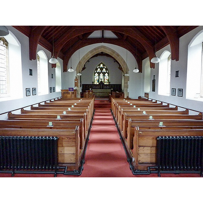
Copyright Statement: Image copyright © Alexander P Kapp, 2011
Image Source: digital photograph taken 5 April 2011 by Alexander P Kapp [www.geograph.org.uk/photo/2343223] [accessed 12 April 2019]
Copyright Instructions: CC-BY-SA-3.0
INFORMATION
Font ID: 22089SAT
Object Type: Baptismal Font1?
Font Century and Period/Style: 16th - 17th century
Church / Chapel Name: Parish Church of All Saints
Font Location in Church: [disappeared]
Church Address: 1 Church Cl, Satterthwaite, Ulverston LA12 8LP, UK
Site Location: Cumbria, North West, England, United Kingdom
Directions to Site: Located in Grizedale, 6-7 km S of Hawkshead, between Coniston Water (W) and Windermere (E), 20 kim W of Kendall
Ecclesiastic Region: Diocese of Carlisle
Historical Region: Hundred of Lonsdale -- Hundred of Amounderness -- formerly Lancashire?
Additional Comments: disappeared font? (the one from the original chapel/church here)
Font Notes:
Click to view
No individual entry found for Satterthwaite in the Domesday survey. The entry for this township in the Victoria County History (Lancaster, vol. 8, 1914) notes: "Of the ancient chapel at Satterthwaite little can be said. [...] [it] was used in 1650, when Robert Johnson was the minister. [...] In 1733 it was supposed to be still unconsecrated [...] In 1767 they stated that there was a communion table but no font; the curate administered the Lord's Supper thrice a year, at Easter, Trinity and Christmas, but there was no paten, chalice or flagon belonging to the chapel." [NB: we have no information on the original font of this church].
COORDINATES
UTM: 30U 498764 6019393
Latitude & Longitude (Decimal): 54.3224, -3.019
Latitude & Longitude (DMS): 54° 19′ 20.64″ N, 3° 1′ 8.4″ W
REFERENCES
- Victoria County History [online], University of London, 1993-. URL: https://www.british-history.ac.uk.