Blawith
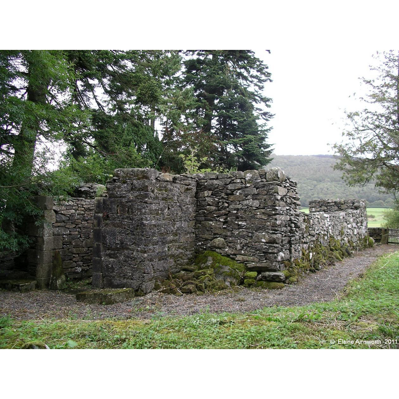
Image copyright © Elaine Ainsworth, 2011
No known copyright restriction / Fair Dealing
Results: 2 records
view of church exterior in context
Scene Description: Source caption: "The ruins of the older church can still be seen nearby. Parts of the walls remain standing and there are a number of graves in the churchyard. It has been described as being little more than a small barn with no tower or steeple. The ruins are Grade II listed."
Copyright Statement: Image copyright © Elaine Ainsworth, 2011
Image Source: digital photograph taken in 2011 by Elaine Ainsworth, in the Lancashire OnLine Parish Clerks site [www.lan-opc.org.uk/Ulverston/stjohn/index.html] [accessed 9 April 2019]
Copyright Instructions: No known copyright restriction / Fair Dealing
view of church exterior - southeast view
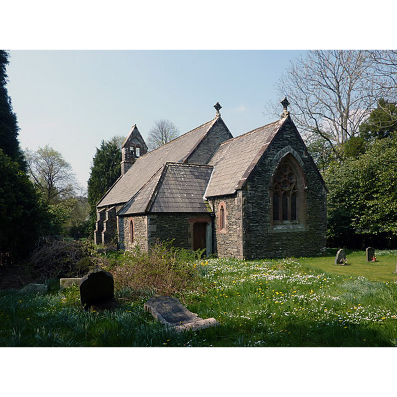
Scene Description: modern church of the mid-19thC
Copyright Statement: Image copyright © Alexander P Kapp, 2011
Image Source: digital photograph taken 19 April 2011 by Alexander P Kapp [www.geograph.org.uk/photo/2383281] [accessed 9 April 2019]
Copyright Instructions: CC-BY-SA-3.0
INFORMATION
Font ID: 22086BLA
Object Type: Baptismal Font1?
Font Century and Period/Style: 16th century
Church / Chapel Name: Parish Church of St. John the Baptist [new church] [redundant since 1988]
Font Location in Church: [cf. FontNotes]
Church Patron Saint(s): St. John the Baptist
Church Notes: present church mid-19thC built near the site of the old church, on the other side of the A5084
Church Address: A5084, Blawith, Ulverston LA12 8EQ, UK
Site Location: Cumbria, North West, England, United Kingdom
Directions to Site: Located off (E) the A5084, N of the A5092, ENE of Broughton-in-Furness
Ecclesiastic Region: Diocese of Carlisle
Historical Region: Hundred of Lonsdale -- Hundred of Amounderness [in Domesday] -- formerly Lancashire
Additional Comments: disappeared font? (the one from the original 16thC chapel here)
Font Notes:
Click to view
No individual entry found for Blawith in the Domesday survey. The entry for this township in the Victoria County History (Lancaster, vol. 8, 1914) notes: "The chapel of Blawith is of unknown origin, but it is marked on the 1577 map of the county. The present church of St. John the Baptist was built in 1863, near the old site. [...] The chapel was reported to be in good repair in 1692; the Lord's Supper was then administered at Ulverston, but in 1711 there was 'a decent communion table' in the chapel. A font was inserted between 1737 and 1754. The chapel was rebuilt in 1749. These details are from the chapelwarden's replies to visitation inquiries." There is an entry for the old church in Historic England [Listing NGR: SD2881688227]: "Remains of church. C16, rebuilt 1749. Stone rubble. Walls remain to height of 3 to 6m. Rectangular plan with small structure to west end. Lower part of window openings, one to east end, 4 to north side, entrance to south side. West end has blocked opening, short projecting wall with return with jamb stones; footings of building to north of this."
COORDINATES
UTM: 30U 493881 6015314
Latitude & Longitude (Decimal): 54.2857, -3.094
Latitude & Longitude (DMS): 54° 17′ 8.52″ N, 3° 5′ 38.4″ W
REFERENCES
- Victoria County History [online], University of London, 1993-. URL: https://www.british-history.ac.uk.