Cartmel Fell / Cartmell Fell
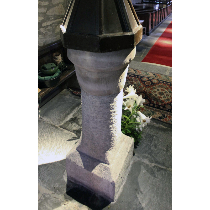
Image copyright © Cornish Churches, 2015
Standing permission
Results: 5 records
view of font - southwest side
Copyright Statement: Image copyright © Cornish Churches, 2015
Image Source: edited detail of a digital photograph 9 September 2015 by Ian, at Cornish Churches [www.cornishchurches.com/Cartmel Fell Church Cumbria - St. Anthony/index.htm] [accessed 8 April 2019]
Copyright Instructions: Standing permission
view of church exterior - southwest view
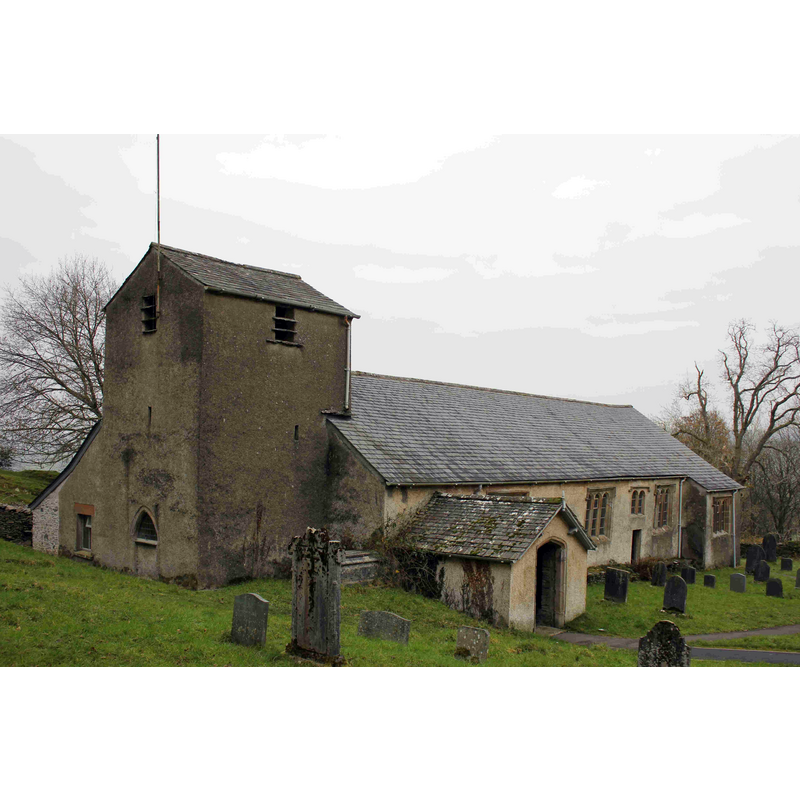
Copyright Statement: Image copyright © Cornish Churches, 2015
Image Source: digital photograph 9 September 2015 by Ian, at Cornish Churches [www.cornishchurches.com/Cartmel Fell Church Cumbria - St. Anthony/index.htm] [accessed 8 April 2019]
Copyright Instructions: Standing permission
view of font and cover in context - east side
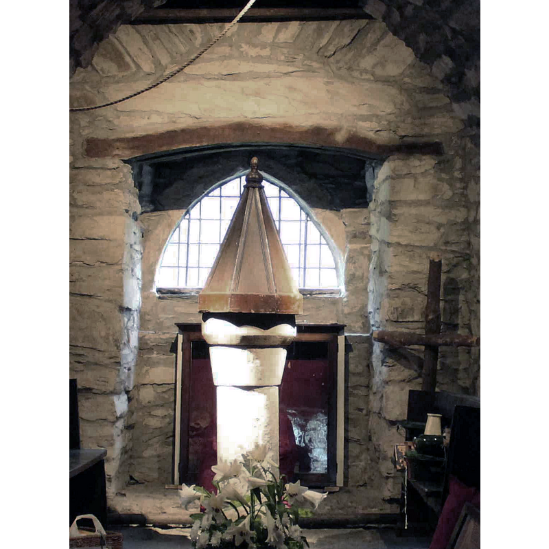
Scene Description: in the tower space
Copyright Statement: Image copyright © Cornish Churches, 2015
Image Source: digital photograph 9 September 2015 by Ian, at Cornish Churches [www.cornishchurches.com/Cartmel Fell Church Cumbria - St. Anthony/index.htm] [accessed 8 April 2019]
Copyright Instructions: Standing permission
view of church interior - looking west
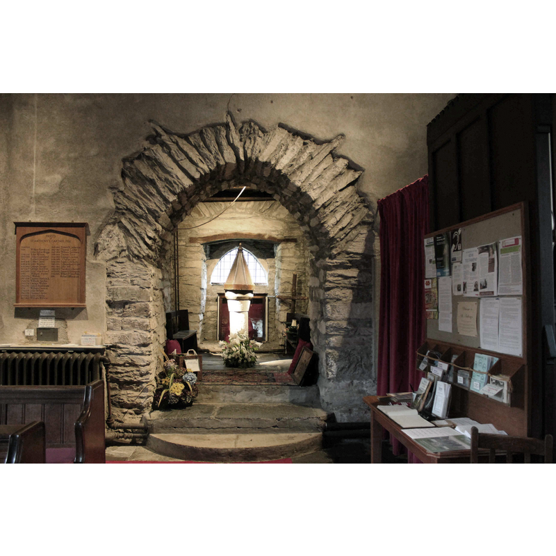
Copyright Statement: Image copyright © Cornish Churches, 2015
Image Source: digital photograph 9 September 2015 by Ian, at Cornish Churches [www.cornishchurches.com/Cartmel Fell Church Cumbria - St. Anthony/index.htm] [accessed 8 April 2019]
Copyright Instructions: Standing permission
view of church interior - looking east
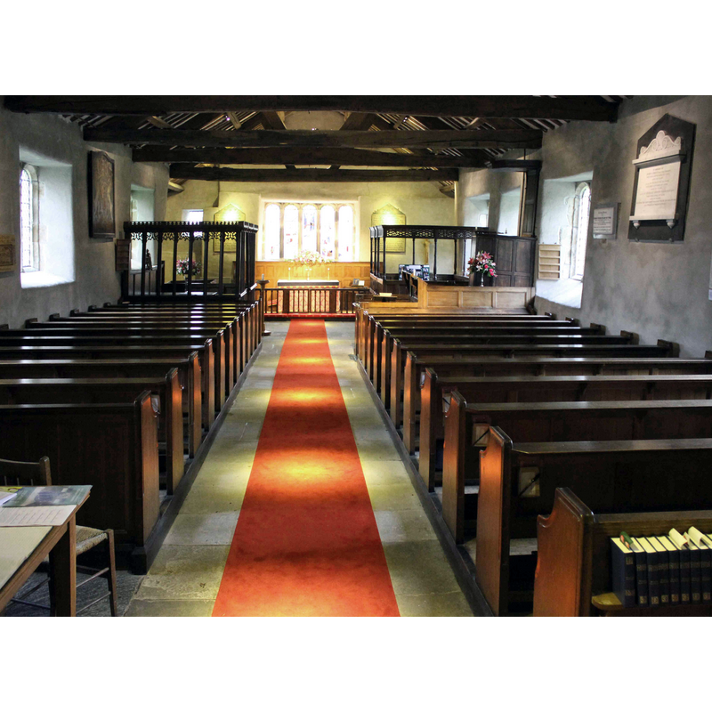
Copyright Statement: Image copyright © Cornish Churches, 2015
Image Source: digital photograph 9 September 2015 by Ian, at Cornish Churches [www.cornishchurches.com/Cartmel Fell Church Cumbria - St. Anthony/index.htm] [accessed 8 April 2019]
Copyright Instructions: Standing permission
INFORMATION
Font ID: 22083CAR
Object Type: Baptismal Font1?
Font Date: ca. 1504?
Font Century and Period/Style: 16th century(early?)
Church / Chapel Name: Parish Church of St. Anthony
Font Location in Church: Inside the church
Church Patron Saint(s): St. Anthony the Great [aka Antony the Great, Anthony the Abbot, Anthony of the Desert, Anthony the Anchorite, Anthony of Thebes]
Church Notes: originally a chapel of ease to Cartmel Priory ca. 1504
Church Address: [Cartmel Fell] Grange-over-Sands LA11 6NH, UK
Site Location: Cumbria, North West, England, United Kingdom
Directions to Site: Located off (NE) the A590, 11-12 km N of Cartmel Priory
Ecclesiastic Region: Diocese of Carlisle
Historical Region: Hundred of Lonsdale -- Hundred of Amounderness [in Domesday] [formerly Lancashire]
Additional Comments: disappeared font? (the one from the original ca. 1504 church here was missing in 1702)
Font Notes:
Click to view
No individual entry for Cartmel Fell found in the Domesday survey. The entry for this township in the Victoria County History (Lancaster, vol. 8, 1914) reports documented evidence of this chapel/church in 1504-1505; it also mentions that a font was lacking in 1702 but present in 1712. The present font, said to be of the early-16th century, consists of a rather narrow moulded round basin on a plain circular pedestal base and a square lower base. It has a tallish octagonal pyramidal wooden cover that could be 17th-century. [NB: we have no information on the font of the original church here].
COORDINATES
UTM: 30U 506660 6015225
Latitude & Longitude (Decimal): 54.2849, -2.8977
Latitude & Longitude (DMS): 54° 17′ 5.64″ N, 2° 53′ 51.72″ W
MEDIUM AND MEASUREMENTS
Material: stone
Font Shape: round, mounted
Basin Interior Shape: round
Basin Exterior Shape: round
LID INFORMATION
Date: 17th century?
Material: wood, oak?
Apparatus: no
Notes: [cf. FontNotes]