Woodplumpton / Plumptom / Plunton / Pluntun / Wodeplumptom
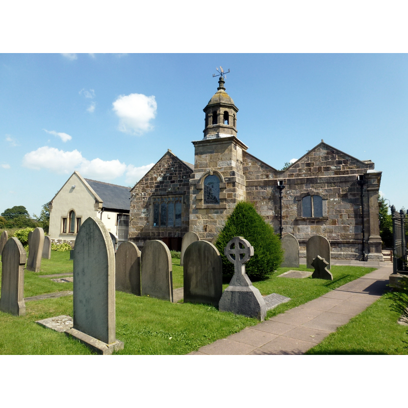
Image copyright © Rude Health, 2013
CC-BY-SA-2.0
Results: 1 records
view of church exterior in context
Scene Description: Source caption: "Historically, Woodplumpton was in the ancient parish of St Michael's on Wyre, served by the parish church of St Michael. There is architectural evidence of a chapel at Woodplumpton prior to 1200; documentary evidence of such a structure dates from 1552. The church was largely rebuilt in 1630. The south aisle was added in 1748. In 1899–1900 the Lancaster firm of architects Austin and Paley made additions and carried out a restoration of the church that included the installation of new windows, re-roofing the north aisle, repairing the arcades, and extending the vestry."
Copyright Statement: Image copyright © Rude Health, 2013
Image Source: digital photograph taken 26 August 2013 by Rude Health [www.geograph.org.uk/photo/3620795] [accessed 29 March 2019]
Copyright Instructions: CC-BY-SA-2.0
INFORMATION
Font ID: 22059WOO
Object Type: Baptismal Font1
Font Century and Period/Style: Medieval
Church / Chapel Name: Parish Church of St. Anne
Font Location in Church: Reported outside the church ca. 1912
Church Patron Saint(s): St. Anne
Church Address: Woodplumpton Rd, Woodplumpton, Preston PR4 0WE, UK
Site Location: Lancashire, North West, England, United Kingdom
Directions to Site: Located off (N) the M55, about 8 km NNW of Preston
Ecclesiastic Region: Diocese of Blackburn
Historical Region: Hundred of Amounderness
Additional Comments: disused font / damaged font (reported outside ca. 1912)
Font Notes:
Click to view
[Wood]Plumpton [variant spelling appears mentioned in the Domesday survey entry for Preston [http://domesdaymap.co.uk/place/XX0000/poulton-le-fylde-and-little-poulton/] [https://opendomesday.org/place/SD4934/woodplumpton/] [accessed 29 March 2019]; the entry reports three churches in it. The entry for this township in the Victoria County History (Lancaster, vol. 7, 1912) notes: "The piety of Richard son of Roger makes it probable that a chapel existed in his demesne before 1200. Though this is confirmed by remains in the building, there seems to be no direct documentary evidence [...] of the chapel till 1552, when its 'ornaments' were seized for the king. [...] About the same time it was locally styled a 'church.' [...] The oldest part of the building is the western half of the north aisle wall, in which there are a window of c. 1300 and a door of about 100 years later [...] now in use is a modern one (1901) of red sandstone. An old round font, found some years ago at the back of the church, fell into the hands of a local mason, by whom it was re-cut, re-chiselled and reduced to octagon form, all vestiges of its original character being destroyed. It now stands outside, to the north of the turret."
COORDINATES
UTM: 30U 515694 5961730
Latitude & Longitude (Decimal): 53.8039, -2.7617
Latitude & Longitude (DMS): 53° 48′ 14.04″ N, 2° 45′ 42.12″ W
REFERENCES
- Victoria County History [online], University of London, 1993-. URL: https://www.british-history.ac.uk.