Stalmine / Stalmin / Stalemynne
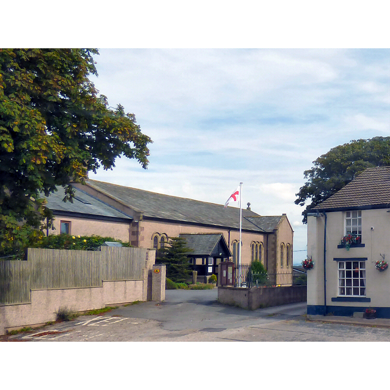
Image copyright © Gerald England, 2016
CC-BY-SA-2.0
Results: 1 records
view of church exterior in context
Scene Description: Source caption: "St James' Church, Stalmine was originally called St Oswald's and was first recorded in 1240. In 1710 the church was enlarged and in 1806 was completely rebuilt and renamed St James'. In 1880 the chancel, sanctuary, vestry and organ chamber were added. It was refurbished in 1991 and in 2000 became a united benefice with the parish of St John the Baptist at Pilling and St Mark at Eagland Hill. In 2007, the church building was extended".
Copyright Statement: Image copyright © Gerald England, 2016
Image Source: digital photograph taken 27 August 2016 by Gerald England [www.geograph.org.uk/photo/5102801] [accessed 22 March 2019]
Copyright Instructions: CC-BY-SA-2.0
INFORMATION
Font ID: 22045STA
Object Type: Baptismal Font1?
Font Date: ca. 1200-1240?
Font Century and Period/Style: 13th century (early?), Transitional / Early English
Church / Chapel Name: Parish Church of St. James [originally St Oswald's]
Font Location in Church: [disappeared]
Church Patron Saint(s): St. James [originally dedicated to St. Oswald?]
Church Notes: original chapel ca. 1200 dedicated to St. Oswald; re-built 1808 and dedicated to St. James; enlarged 2006
Church Address: Hallgate Ln, Stalmine, Poulton-le-Fylde FY6 0LD, UK -- Tel.: +44 1253 799895
Site Location: Lancashire, North West, England, United Kingdom
Directions to Site: Located off the A588, 2 km E of the Wyre river, 2-3 km S of the coastline, about 25 km NW of Preston
Ecclesiastic Region: Diocese of Blackburn
Historical Region: Hundred of Amounderness
Additional Comments: disappeared font? (the one from the medieval church here)
Font Notes:
Click to view
Stalmine appears mentioned in the Domesday survey entry for Preston [http://domesdaymap.co.uk/place/XX0000/poulton-le-fylde-and-little-poulton/] [https://opendomesday.org/place/SD3745/stalmine/] [accessed 22 March 2019]; the entry reports three churches in it. The entry for this composite township [with Staynall] in the Victoria County History (Lancaster, vol. 7, 1912) notes: "The chapel of Stalmine is first named about 1200, when it was a dependency of Lancaster [...] rebuilt in 1806 and called St. James'"; no font mentioned. The entry for this church in Historic England [Listing NGR: SD3746545520] mentions no font in it either.
COORDINATES
UTM: 30U 503075 5972600
Latitude & Longitude (Decimal): 53.90183, -2.9532
Latitude & Longitude (DMS): 53° 54′ 6.59″ N, 2° 57′ 11.52″ W
REFERENCES
- Victoria County History [online], University of London, 1993-. URL: https://www.british-history.ac.uk.