Lehe / Bremerhaven-Lehe / Lee / Le / Leh
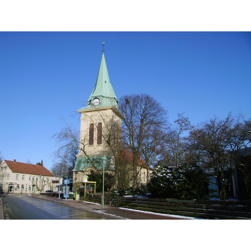
Image copyright © [in the public domain]
PD-self
Results: 2 records
view of church exterior in context - southwest view
Scene Description: Source caption: "Die Dionysiuskirche im Stadtteil Lehe von Bremerhaven. Blick von der Langen Straße."
Copyright Statement: Image copyright © [in the public domain]
Image Source: digital photograph taken 6 March 2010 by Garitzko [https://commons.wikimedia.org/wiki/File:Dionysiuskirche_Bremerhaven-Lehe.jpg] [accessed 18 March 2019]
Copyright Instructions: PD-self
view of church exterior
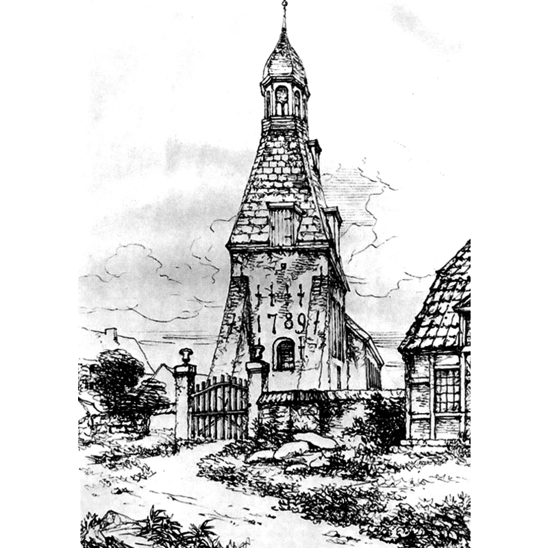
Scene Description: Source caption: "Federzeichnung der Kirche in Lehe (heute Bremerhaven) von George Ernest Papendiek (1788–1835) aus dem Jahr 1817."
Copyright Statement: Image copyright © [in the public domain]
Image Source: 1817 ink drawing by George Ernest Papendiek, in Herbert und Inge Schwarzwälder: Bremerhaven und seiner Vorgängergemeinden. Veröffentlichungen des Stadtarchivs Bremerhaven Bd. 2, Verlag Hauschild, Bremen 1977 [https://commons.wikimedia.org/wiki/File:Kirche_in_Lehe_-_George_Ernest_Papendiek_-_1817.jpg] [accessed 18 March 2019]
Copyright Instructions: CC-PD-Mark / PD-Art (PD-old default) / PD-Art (PD-old-70)
INFORMATION
Font ID: 22040LEH
Object Type: Baptismal Font1?
Font Date: ca. 1100-1300?
Font Century and Period/Style: 12th - 14th century, Medieval
Church / Chapel Name: Evangelisch-lutherische Dionysiuskirche in Lehe [aka Alte Kirche]
Font Location in Church: [disappeared]
Church Patron Saint(s): St. Denys [aka Denis, Dennis, Dionis, Dyonisius]
Church Notes: first church 1100-1300?; first documented 1310; originally dedicated to St James the Greater; an altar dedicated to St Dionysius [St Denys?] and the popularity of the latter saint transferred the dedication by the end of the 15thC; re-built 1802-1803; tower added 1868; renovated 1909, 1975 and 2005
Church Address: Klushof, 27580 Bremerhaven, Germany
Site Location: Bremen, Bremen, Germany, Europe
Directions to Site: Lehe is located N of Bremerhaven and road 212, W of highway 27 -- the church is located at the Lange Straße-Poststraße crossroads
Historical Region: Region Lehe-Mitte
Additional Comments: disappeared font? (the one from the medieval church here)
Font Notes:
Click to view
[NB: we have no information on the font of the medieval church here]
COORDINATES
UTM: 32U 473028 5935387
Latitude & Longitude (Decimal): 53.566658, 8.592742
Latitude & Longitude (DMS): 53° 33′ 59.97″ N, 8° 35′ 33.87″ E