Holtgaste
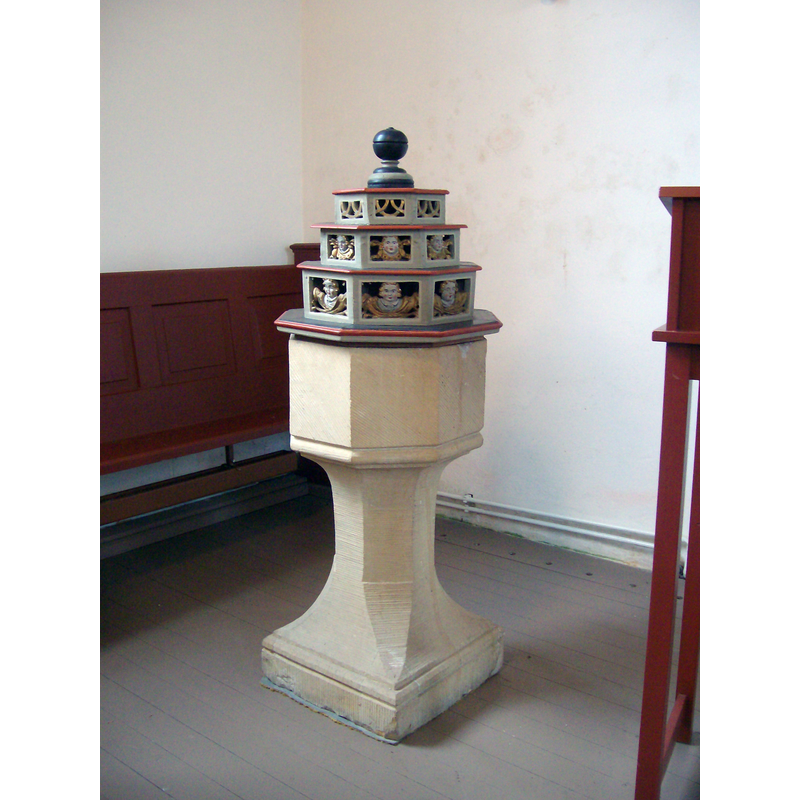
Image copyright © Wikiwal, 2010
CC-BY-SA-3.0
Results: 4 records
view of font and cover
Scene Description: said to be a former holy-water stoup adapted to the functions of a font after the Reformation
Copyright Statement: Image copyright © Wikiwal, 2010
Image Source: digital photograpg taken 3 April 2010 by Wikiwal [https://commons.wikimedia.org/wiki/File:Holtgaste_Taufe.jpg] [accessed 17 March 2019]
Copyright Instructions: CC-BY-SA-3.0
view of church exterior
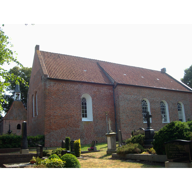
Scene Description: detached 18thC bell-cote on the left of the image, behind the main body of the church
Copyright Statement: Image copyright © Wikiwal, 2010
Image Source: digital photograpg taken 27 June 2010 by Wikiwal [https://commons.wikimedia.org/wiki/File:Kirche_Holtgaste.jpg] [accessed 17 March 2019]
Copyright Instructions: CC-BY-SA-3.0
view of church interior - nave - looking east
![the font cover is visible in the far left [northeast] corner of the nave](/static-50478a99ec6f36a15d6234548c59f63da52304e5/compressed/1190317005_compressed.png)
Scene Description: the font cover is visible in the far left [northeast] corner of the nave
Copyright Statement: Image copyright © Wikiwal, 2010
Image Source: digital photograpg taken 27 June 2010 by Wikiwal [https://commons.wikimedia.org/wiki/File:Kirche_Holtgaste_Innenraum.jpg] [accessed 17 March 2019]
Copyright Instructions: CC-BY-SA-3.0
view of font cover
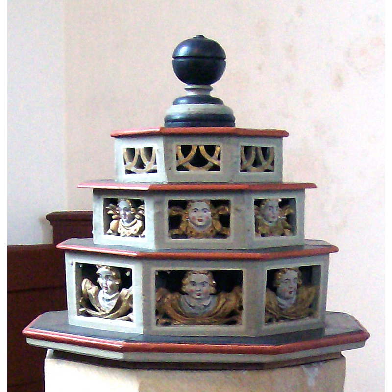
Copyright Statement: Image copyright © Wikiwal, 2010
Image Source: edited detail of a digital photograpg taken 3 April 2010 by Wikiwal [https://commons.wikimedia.org/wiki/File:Holtgaste_Taufe.jpg] [accessed 17 March 2019]
Copyright Instructions: CC-BY-SA-3.0
INFORMATION
Font ID: 22034HOL
Object Type: Stoup
Font Century and Period/Style: Late Gothic
Church / Chapel Name: Evangelisch-lutherische Liudgeri-Kirche
Font Location in Church: Inside the church, at the NE corner of the nave
Church Patron Saint(s): St. Ludger [aka Liudger / Ludgerus / Lüdiger]
Church Notes: earliest church here may have been a mid-9thC wooden building; re-built in stone; re-built again ca. 1290; destroyed and re-built 17thC; detached tower added early-18thC;
Church Address: Holtgaste, 26844 Ditzum-Jemgum, Germany
Site Location: Leer, Niedersachsen, Germany, Europe
Directions to Site: Located off (N) highway 31, just W of the Emse river, 8-10 km W of Leer
Historical Region: Ostfriesland
Additional Comments: re-cycled stoup (serving as font since the Reformation?) -- disappeared font? (the one from the medieval church here)
Font Notes:
Click to view
The present font in this church is said to be a former holy-water stoup adapted to the functions of a font after the Reformation; it consists of an octagonal basin with a single roll moulding around the lower end, an octagonal stem and an octagonal-to-square splaying lower base; one of the upper sides of the basin shows evidence of what may have been an anchoring place for an earlier(?) cover. The present cover is in the shape of a three-layer octagonal cake with a ball finial; the sides of the cover have carvings on them; the top layer has tracery motifs; the other two layers have cherub heads; all brightly painted. [NB: we have no information on the font of the medieval church here].
COORDINATES
UTM: 32U 390764 5899249
Latitude & Longitude (Decimal): 53.231282, 7.363473
Latitude & Longitude (DMS): 53° 13′ 52.61″ N, 7° 21′ 48.5″ E
MEDIUM AND MEASUREMENTS
Material: stone, limestone?
Font Shape: octagonal, mounted
Basin Exterior Shape: octagonal
LID INFORMATION
Material: wood
Apparatus: no
Notes: [cf. FontNotes]