Coppull / Cophull / Cophulle / Copthull
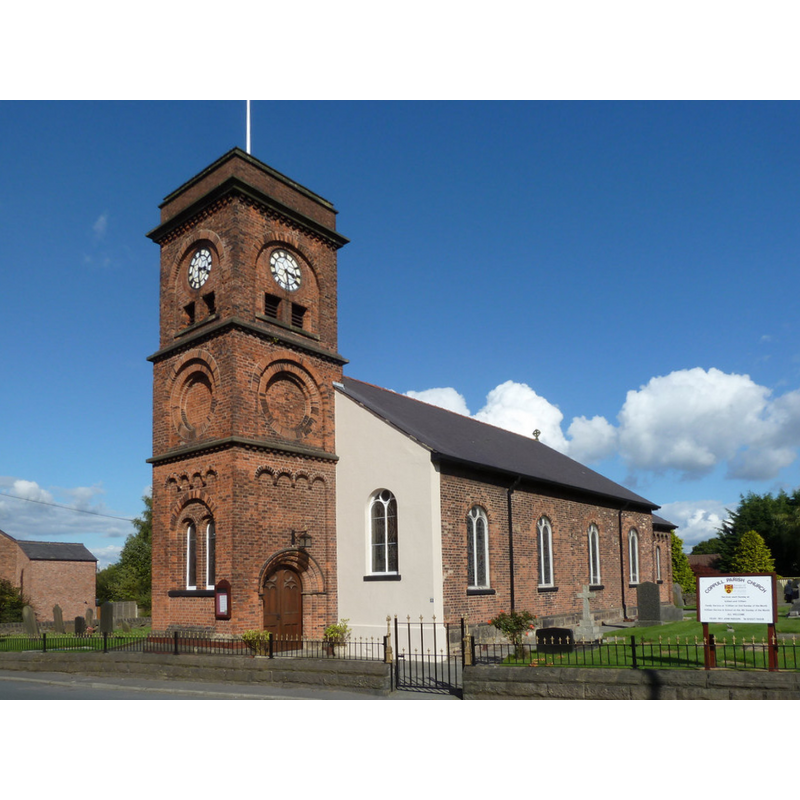
Image copyright © Gary Rogers, 2015
CC-BY-SA-2.0
Results: 1 records
view of church exterior - southwest view
Scene Description: latest (1861) re-building of a pre-Reformation chapel here
Copyright Statement: Image copyright © Gary Rogers, 2015
Image Source: digital photograph taken 18 September 2015 by Gary Rogers [www.geograph.org.uk/photo/4671459] [accessed 13 March 2019]
Copyright Instructions: CC-BY-SA-2.0
INFORMATION
Font ID: 22027COP
Object Type: Baptismal Font1
Font Date: ca. 1520?
Font Century and Period/Style: 16th century(early?), Pre-Reformation
Church / Chapel Name: Coppull C Of E Parish Church
Font Location in Church: [disappeared]
Church Notes: original pre-Reformation chapel documented 1520; re-built several times, lastly 1861 as parish church
Church Address: 209 Chapel Ln, Coppull, Chorley PR7 4NA, UK -- Tel.: +44 1257 791218
Site Location: Lancashire, North West, England, United Kingdom
Directions to Site: Located off (E) the A49, between Chorley (NE) and Standish (S)
Ecclesiastic Region: Diocese of Blacburn
Historical Region: Hundred of Leyland
Font Notes:
Click to view
No individual entry for Coppull found in the Domesday survey. The entry for this township in the Victoria County History (Lancaster, vol. 6, 1911) notes: "A chapel certainly existed at Coppull before the Reformation, [...] but it was afterwards allowed to fall into ruin. [...] In 1654 a new one was built [...] in 1660 the chapel appears to have been served from the parish church [...] closed in 1715 [...] rebuilt in 1758 and replaced by the present church in 1861. There is no dedication"; no font mentioned.
COORDINATES
UTM: 30U 522861 5940928
Latitude & Longitude (Decimal): 53.61666, -2.6544
Latitude & Longitude (DMS): 53° 36′ 59.98″ N, 2° 39′ 15.84″ W