Hannover No. 3 / Hanover / Embere
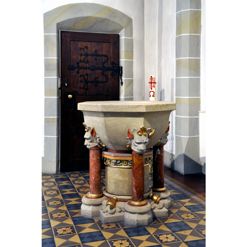
Image copyright © Andreas Praefcke, 2014
CC-BY-3.0
Results: 5 records
view of font
Scene Description: the 1890 font by Eduard Hillebrand in the modern Gartenkierche St Marien, successor of the Kapelle Unserer lieben Frauen demolished 1534
Copyright Statement: Image copyright © Andreas Praefcke, 2014
Image Source: digital photograph October 2014 by Andreas Praefcke [https://commons.wikimedia.org/wiki/File:Hannover_Gartenkirche_Taufstein_img01.jpg] [accessed 9 March 2019]
Copyright Instructions: CC-BY-3.0
view of church exterior - southeast view

Scene Description: Source caption: "Die Aegidienkirche ist eine im 14. Jahrhundert entstandene Kirche in Hannover. Die östlichste der drei Altstadtkirchen (die beiden anderen sind Marktkirche und Kreuzkirche) wurde benannt nach dem Heiligen Ägidius, einem der 14 Nothelfer. Sie befindet sich in der Altstadt nahe dem Aegidientorplatz an der Ecke Breite Straße und Osterstraße. 1943 wurde die Kirche bei den Luftangriffen auf Hannover durch Bomben zerstört."
Copyright Statement: Image copyright © H. Helmlechner, 2012
Image Source: digital photograph taken 25 May 2012 by H. Helmlechner [https://commons.wikimedia.org/wiki/File:Hannover_Aegidienkirche_01.jpg] [accessed 9 March 2019]
Copyright Instructions: CC-BY-SA-4.0
view of church exterior - southeast view
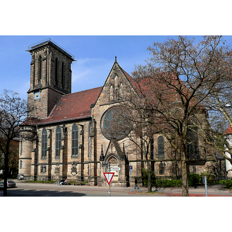
Scene Description: The Gartenkirche St Marien,successor of the Kapelle Unserer lieben Frauen demolished 1534
Copyright Statement: Image copyright © [in the public domain]
Image Source: digital photograph taken April 2010 by AxelHH [https://commons.wikimedia.org/wiki/File:Gartenkirche_St._Marien_Seite.jpg] [accessed 9 March 2019[
Copyright Instructions: PD-self
view of church interior - relief - fragment
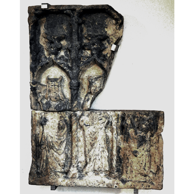
Scene Description: Source caption: "Hannover, Gartenkirche, Relief aus der alten Marienkapelle, nach 1490; links: hl. Chrysogonus, Mitte: hl. Katharina, rechts: hl. Konrad von Konstanz".
Copyright Statement: Image copyright © Andreas Praefcke, 2014
Image Source: digital photograph October 2014 by Andreas Praefcke [https://commons.wikimedia.org/wiki/File:Hannover_Gartenkirche_Relief_aus_der_Marienkapelle_c1490.jpg] [accessed 9 March 2019]
Copyright Instructions: CC-BY-3.0
view of church interior - chancel
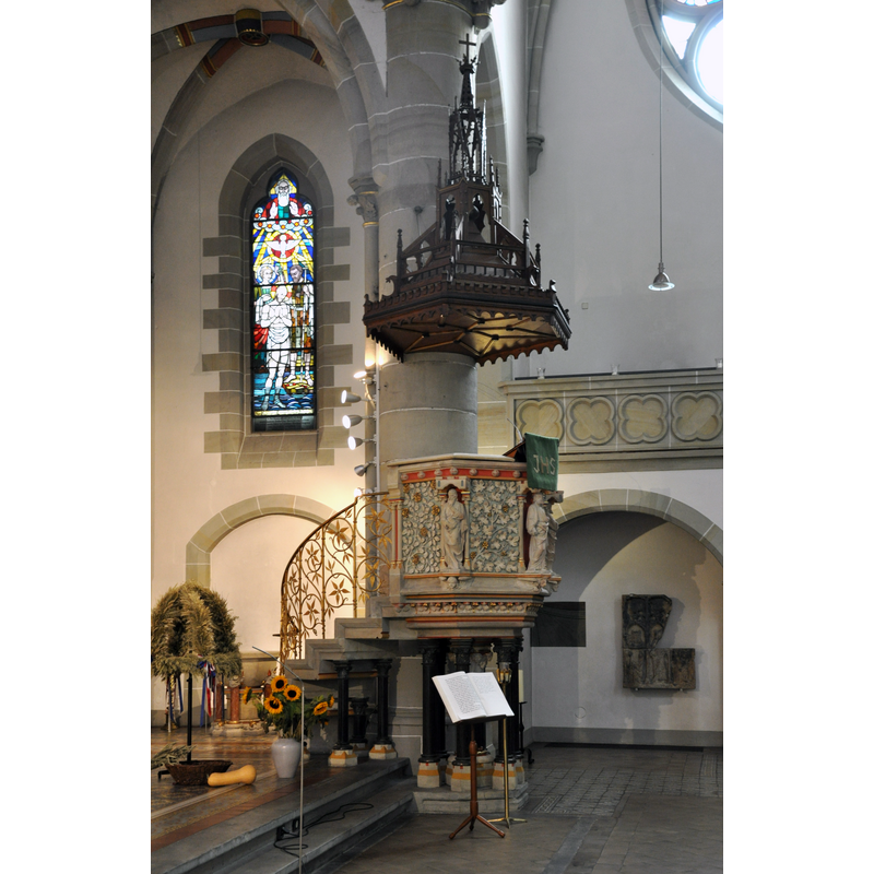
Scene Description: notice in the recessed arch, on the wall behind and to the right of the pulpit, the relief fragment from the earlier chapel
Copyright Statement: Image copyright © Andreas Praefcke, 2014
Image Source: digital photograph October 2014 by Andreas Praefcke [https://commons.wikimedia.org/wiki/File:Hannover_Gartenkirche_Kanzel_img03.jpg] [accessed 9 March 2019]
Copyright Instructions: CC-BY-3.0
INFORMATION
Font ID: 22018HAN
Object Type: Baptismal Font1
Font Date: 1349?
Font Century and Period/Style: 14th century (mid?), Gothic
Church / Chapel Name: Aegidienkirche / Kapelle Unserer lieben Frauen [aka Kapelle St. Marien vor dem Ägidientore / Capella Beate Marie Virginis extra Valvam S. Aegidii] [demolished 1534]
Font Location in Church: [cf. FontNotes]
Church Patron Saint(s): St. Mary the Virgin [original church dedicated to St Giles]
Church Notes: the original Romanesque church was probably built in the mid-12thC and dedicated to St Giles; replaced by a chapel in 1347-1349, the predecessor of the present Gartenkirche St. Marien built in the mid-18thC; demolished 1534; re-built in 1554 as the Liebfrauenkirchhof
Church Address: 30159 Hannover, Germany
Site Location: Hannover, Niedersachsen, Germany, Europe
Directions to Site: The disappeared chapel was located outside the city walls, in Embere, the area later known as the Aegidienneustadt. The site is occupied today by the Gartenkirche St. Marien. The ruins of the re-built church of St. Aegidius stand today.
Additional Comments: disappeared font? / destroyed font? [cf. FontNotes]
Font Notes:
Click to view
Lübke (1870) notes a metal font, "a decagon, also with sculpture, resting on small lions". [NB: the metal font from Aegidienkirche is reported as having been moved to Marktkirche Hannover after WWII.
COORDINATES
UTM: 32U 550598 5802244
Latitude & Longitude (Decimal): 52.368135, 9.743161
Latitude & Longitude (DMS): 52° 22′ 5.29″ N, 9° 44′ 35.38″ E
MEDIUM AND MEASUREMENTS
Material: metal
Font Shape: decagonal
Basin Exterior Shape: decagonal
REFERENCES
- Lübke, Wilhelm, Ecclesiastical in Gemany during the Middle Ages [tranl. by L. A. Wheatley], London: Cassell, Petter, & Galpin, 1870, p. 190