Flixton nr. Manchester / Fleece-town / Flixston / Flixtone / Fluxton / Flyxeton / Flyxton
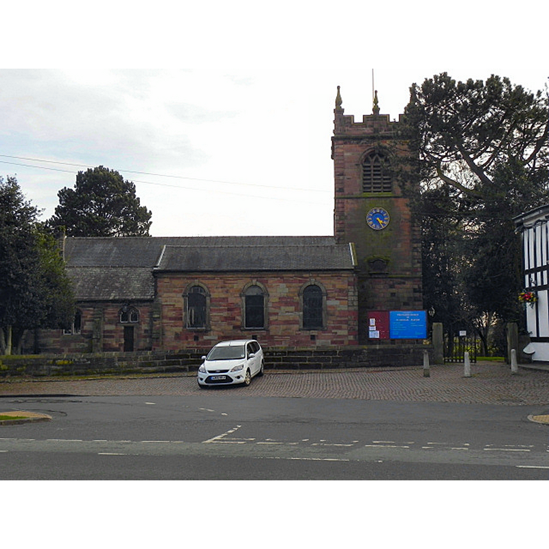
Image copyright © David Dixon, 2011
CC-BY-SA-2.0
Results: 2 records
view of church exterior - north view
Scene Description: Source caption: "The Parish Church of St Michael and All Angels is located on Church Road in Flixton [...] It is difficult to establish the origins of the church but records show that the Norman Lord of Manchester gave it away as a dowry for his daughter in 1150. The rough-hewn stone of the east wall dates back to the fifteenth century and the east window dates from 1853.The Ascension window in the south aisle is in the neo-classical style. The church underwent major internal restoration in 1877."
Copyright Statement: Image copyright © David Dixon, 2011
Image Source: digital photograph taken 14 March 2011 by David Dixon [www.geograph.org.uk/photo/2312955] [accessed 7 March 2019]
Copyright Instructions: CC-BY-SA-2.0
view of church interior - looking east
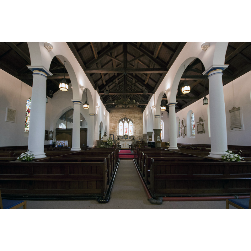
Copyright Statement: Image copyright © Parrot of Doom, 2011
Image Source: digital photograph taken 20 June 2011 by Parrot of Doom [https://commons.wikimedia.org/wiki/File:St_michaels_church_flixton_interior.jpg] [accessed 7 March 2019]
Copyright Instructions: CC-BY-SA-3.0
INFORMATION
Font ID: 22014FLI
Object Type: Baptismal Font1?
Font Century and Period/Style: 12th century, Late Norman
Church / Chapel Name: Parish Church of St. Michael
Font Location in Church: [disappeared]
Church Patron Saint(s): St. Michael
Church Notes: A church here is first recorded in the late 12thC but probably existed earlier.
Church Address: Church Rd, Flixton, Urmston, Manchester M41 6HR, UK
Site Location: Greater Manchester, North West, England, United Kingdom
Directions to Site: Located off the B5158-B5213 crossroads, just SW of Urmston, 10-12 km WSW of Manchester city centre
Ecclesiastic Region: Diocesed of Manchester
Additional Comments: disappeared font? (the one from the 12thC church here)
Font Notes:
Click to view
No individual entry found for this Flixton in the Domesday survey. The entry for this Church in Historic England [Listing NGR: SJ7472993965] notes: "Church. Part of chancel C15, nave and aisles 1756, chancel rebuilt 1815, tower rebuilt and restored in 1731, 1824 and 1888, vestry C19. [...] Carved stone font", but no date mentioned, therefore assumed modern.
COORDINATES
UTM: 30U 541055 5921597
Latitude & Longitude (Decimal): 53.4418, -2.38191
Latitude & Longitude (DMS): 53° 26′ 30.48″ N, 2° 22′ 54.88″ W