Netherton nr. Elmley Castle / Neotheretune
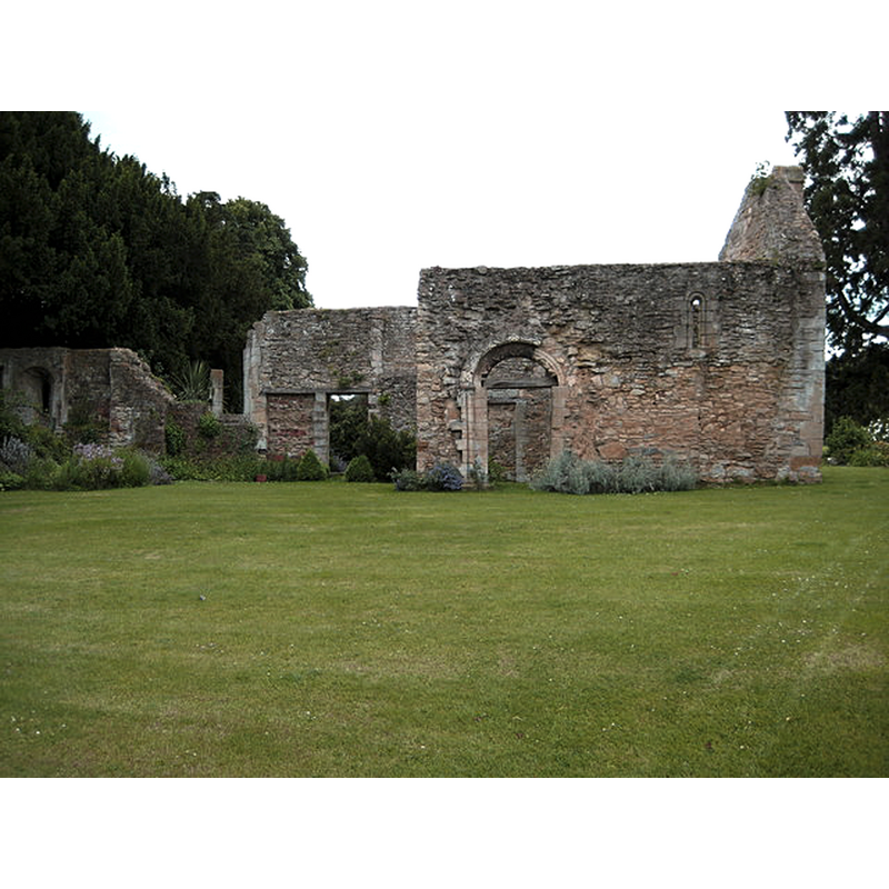
Image copyright © Philip Halling, 2008
CC-BY-SA-2.0
Results: 2 records
view of church exterior in context - north view
Scene Description: Source caption: "Chapel ruins, Netherton. The ruins of this chapel date from the 12th century and are in the private garden of a farmhouse. The chapel never had its own parish; it was a chapel of ease to nearby St Michael's church at Cropthorne."
Copyright Statement: Image copyright © Philip Halling, 2008
Image Source: digital photograph taken 15 June 2008 by Philip Halling [www.geograph.org.uk/photo/851392] [accessed 4 March 2019]
Copyright Instructions: CC-BY-SA-2.0
view of church exterior in context
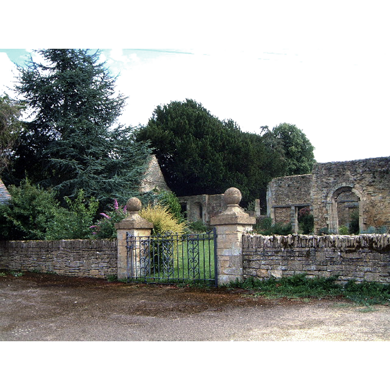
Scene Description: Source caption: "Old ruined chapel in Netherton."
Copyright Statement: Image copyright © Robin Phillips, 2005
Image Source: digital photograph taken 28 July 2005 by Robin Phillips [www.geograph.org.uk/photo/31153] [accessed 4 March 2019]
Copyright Instructions: CC-BY-SA-2.0
INFORMATION
Font ID: 22009NET
Object Type: Baptismal Font1?
Font Century and Period/Style: 11th - 12th century, Pre-Conquest? / Norman?
Church / Chapel Name: Netherton Chapel [in ruins]
Font Location in Church: [disappeared]
Church Address: Unnamed Rd, Netherton, Pershore WR10 3JG, UK
Site Location: Worcestershire, West Midlands, England, United Kingdom
Directions to Site: The ruins of the old chapel are located off an unnamed path, N of Netherton Lane, just E of Elmley Castle
Historical Region: Hunrded of Oswaldslow
Additional Comments: disappeared font? (the one from the Domesday-time chapel/church here)
Font Notes:
Click to view
There is an entry for this Netherton [variant spelling] in the Domesday survey [https://opendomesday.org/place/SO9941/netherton/] [accessed 4 March 2019]; it reports a priest but not a church in it, thought there must have been one there. The entry for this chapel in Historic England [List Entry Number: 1005302] notes: "This monument includes a small 12th century two celled chapel situated immediately east of Netherton Hall on the west side of a lane from Elmley Castle. The chapel is rectangular in plan, is on an east to west axis and consists of a nave and chancel. The west end is broadest with a stage in to a thinner chancel. The chapel walls survive mainly to eaves height and are composed largely of coursed yellow limestone rubble with some ashlar blocks, although the east end has blue lias courses. Surviving features of particular note include two blocked 17th century windows, the chancel arch and two doorways. The northern doorway has a round headed arch with zigzag moulding and the south doorway retains a chevroned tympanum of a carved winged dragon. The chapel was recorded as disused as early as the 14th century. In 1738 it was converted into a barn."
COORDINATES
UTM: 30U 567546 5769515
Latitude & Longitude (Decimal): 52.07209, -2.0145
Latitude & Longitude (DMS): 52° 4′ 19.52″ N, 2° 0′ 52.2″ W