Bad Bodenteich / Bodendike
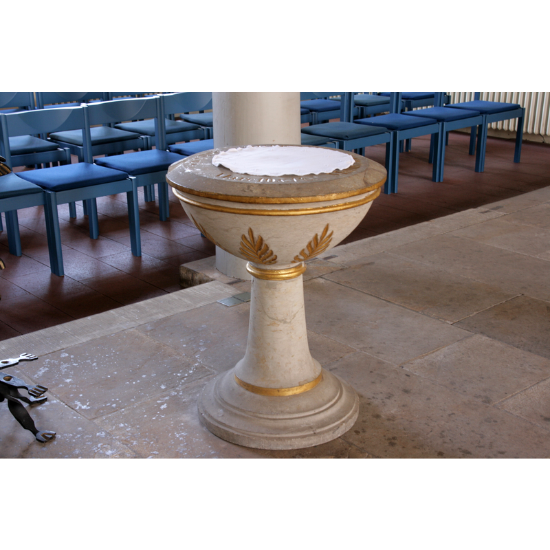
Image copyright © Frank Vincentz, 2010
GFDL / CC-BY-SA-3.0
Results: 4 records
view of font and cover
Scene Description: the modern font
Copyright Statement: Image copyright © Frank Vincentz, 2010
Image Source: digital photograph taken 7 April 2010 by Frank Vincentz [https://commons.wikimedia.org/wiki/File:Bad_Bodenteich_-_Hauptstraße_-_St_Petri_in_07_ies.jpg] [accessed 21 February 2019]
Copyright Instructions: GFDL / CC-BY-SA-3.0
view of church exterior - southeast view
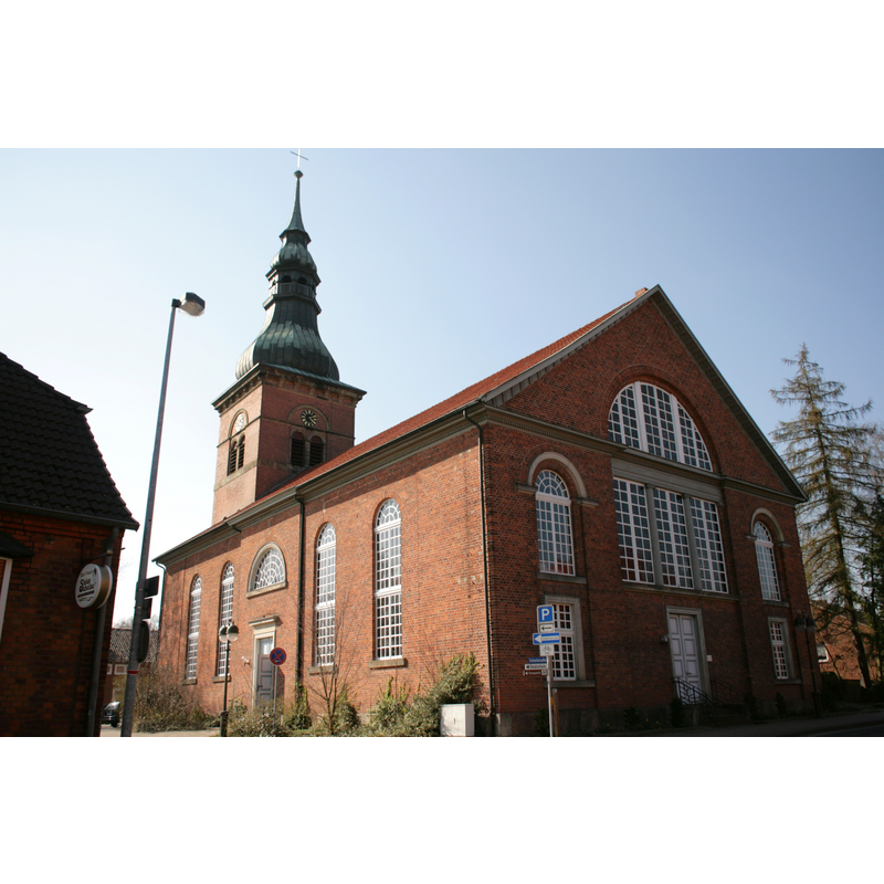
Copyright Statement: Image copyright © Frank Vincentz, 2010
Image Source: digital photograph taken 7 April 2010 by Frank Vincentz [https://commons.wikimedia.org/wiki/File:Bad_Bodenteich_-_Hauptstraße_-_St_Petri_ex_05_ies.jpg] [accessed 21 February 2019]
Copyright Instructions: GFDL / CC-BY-SA-3.0
view of church interior - nave - looking west
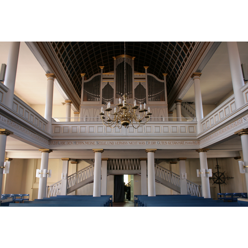
Copyright Statement: Image copyright © Frank Vincentz, 2010
Image Source: digital photograph taken 7 April 2010 by Frank Vincentz [https://commons.wikimedia.org/wiki/File:Bad_Bodenteich_-_Hauptstraße_-_St_Petri_in_05_ies.jpg] [accessed 21 February 2019]
Copyright Instructions: GFDL / CC-BY-SA-3.0
view of church interior - looking east
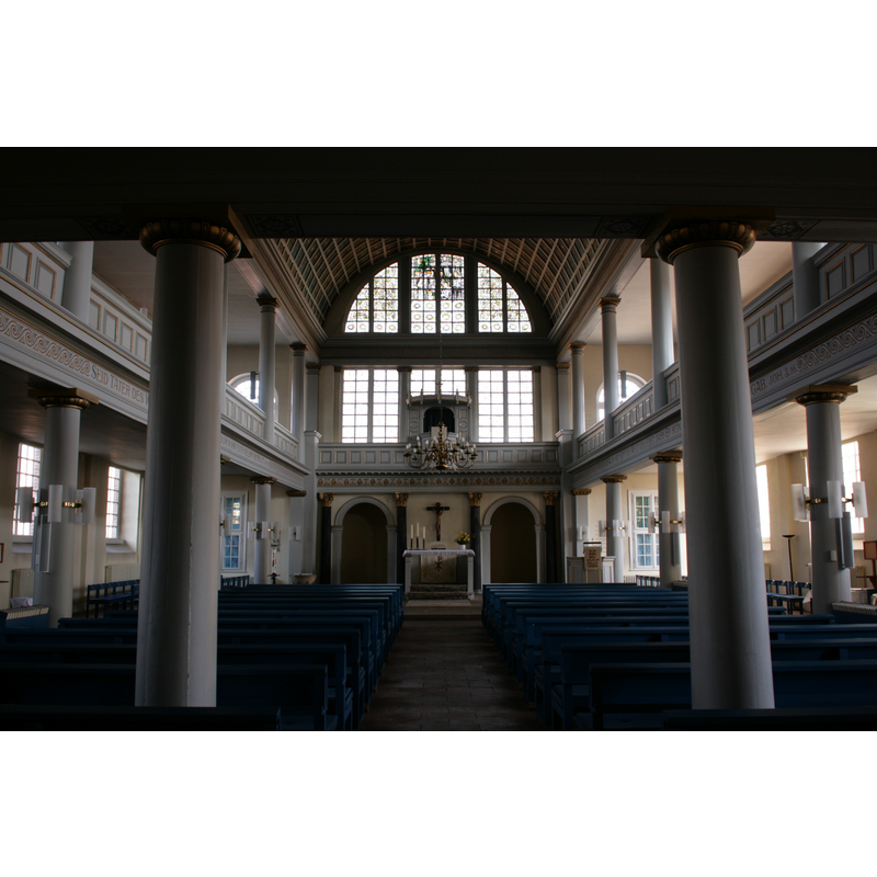
Copyright Statement: Image copyright © Frank Vincentz, 2010
Image Source: digital photograph taken 7 April 2010 by Frank Vincentz [https://commons.wikimedia.org/wiki/File:Bad_Bodenteich_-_Hauptstraße_-_St_Petri_in_01_ies.jpg] [accessed 21 February 2019]
Copyright Instructions: GFDL / CC-BY-SA-3.0
INFORMATION
Font ID: 21983BOD
Object Type: Baptismal Font1?
Font Date: ca. 1323?
Font Century and Period/Style: 14th century, Gothic
Church / Chapel Name: Evangelisch-lutherische St.-Petri-Kirche
Font Location in Church: [disappeared]
Church Patron Saint(s): St. Peter
Church Notes: original church may date back to Carolingian times; church documented 1323; much f=damaged in several wars; demolished 1833; new church built 1836
Church Address: 29389 Bad Bodenteich, Germany
Site Location: Uelzen, Niedersachsen, Germany, Europe
Directions to Site: Located off the L265-L270 crossroads, 10-12 km SE of Uelzen, NE of Hanover
Additional Comments: disappeared font? (the one from the ca. 1323 church; perhaps an earlier one from Carolingian times)
Font Notes:
Click to view
Present font is modern, from 1826.
COORDINATES
UTM: 32U 613248 5854962
Latitude & Longitude (Decimal): 52.8325, 10.681055
Latitude & Longitude (DMS): 52° 49′ 57″ N, 10° 40′ 51.8″ E