Wellingore / Welingoure / Wellingoure
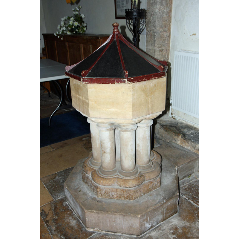
Image copyright © David, 2010
CC-BY-SA-2.0
Results: 4 records
view of font and cover
Scene Description: the font from 1881
Copyright Statement: Image copyright © David, 2010
Image Source: digital photograph taken 17 May 2010 by David [www.flickr.com/photos/brokentaco/4919308343/in/photostream/] [accessed 21 January 2019]
Copyright Instructions: CC-BY-SA-2.0
view of church exterior - north view
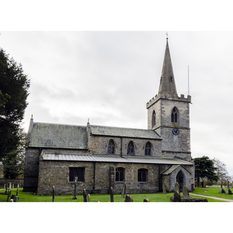
Copyright Statement: Image copyright © Jules & Jenny, 2015
Image Source: digital photograph taken 15 November 2015 by Jules & Jenny [www.flickr.com/photos/78914786@N06/24430379096] [accessed 21 January 2019]
Copyright Instructions: CC-BY-2.0
view of church interior - chancel - piscina and sedilia
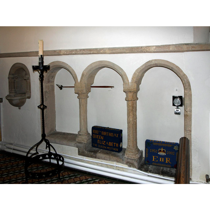
Scene Description: the triple sedilia is dated mid- to late-12thC
Copyright Statement: Image copyright © David, 2010
Image Source: digital photograph taken 17 May 2010 by David [www.flickr.com/photos/92024986@N00/4919308133] [accessed 21 January 2019]
Copyright Instructions: CC-BY-SA-2.0
view of church interior - looking east
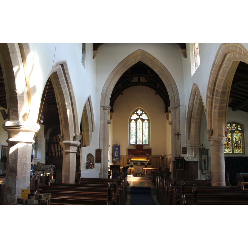
Copyright Statement: Image copyright © Jules & Jenny, 2015
Image Source: digital photograph taken 15 November 2015 by Jules & Jenny [www.flickr.com/photos/78914786@N06/24088795129] [accessed 21 January 2019]
Copyright Instructions: CC-BY-2.0
INFORMATION
Font ID: 21961WEL
Object Type: Baptismal Font1?
Font Century and Period/Style: 11th century, Pre-Conquest? / Norman
Church / Chapel Name: Parish Church of All Saints
Font Location in Church: [disappeared]
Church Patron Saint(s): All Saints
Church Address: Hall St at Cliff Rd, Wellingore, Lincoln LN5 0HX, UK -- Tel.: 01522 426723
Site Location: Lincolnshire, East Midlands, England, United Kingdom
Directions to Site: Located off (E) the A607, 16 km S of Lincoln
Ecclesiastic Region: Diocese of Lincoln
Historical Region: Hundred of Boothby
Additional Comments: disappeared font? (the one from the Domesday-time church here)
Font Notes:
Click to view
There are two entries for Wellingore [variant spellings] in the Domesday survey [https://opendomesday.org/place/SK9856/wellingore/] [accessed 21 January 2019] one of which reports a priest, a church and "2.25 church lands" in it. The entry for this church in Historic England
notes: "Parish church. Late C12, C13, C14, C15 restored 1881. [...] The roofs, pews, pulpit, font and altar-rail are 1881."
notes: "Parish church. Late C12, C13, C14, C15 restored 1881. [...] The roofs, pews, pulpit, font and altar-rail are 1881."
COORDINATES
UTM: 30U 665116 5885901
Latitude & Longitude (Decimal): 53.09698, -0.5339
Latitude & Longitude (DMS): 53° 5′ 49.13″ N, 0° 32′ 2.04″ W