Calceby / Calesbi
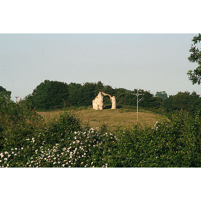
Image copyright © Chris, 2013
CC-BY-SA-2.0
Results: 3 records
view of church exterior in context
Scene Description: Source caption: "Norman Church of St. Andrew (remains of) at Calceby. View from the footpath SW of The Grange."
Copyright Statement: Image copyright © Chris, 2013
Image Source: digital photograph taken 7 July 2013 by Chris [www.geograph.org.uk/photo/3544814] [accessed 7 January 2019]
Copyright Instructions: CC-BY-SA-2.0
view of church interior - nave - looking west - tower arch - detail
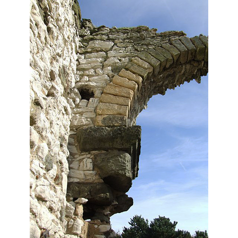
Scene Description: Source caption: "Interior of St Andrew, Calceby - remains of - Bracket and tower arch."
Copyright Statement: Image copyright © Dave Hitchborne, 2006
Image Source: digital photograph taken 12 October 2006 by Dave Hitchborne [www.geograph.org.uk/photo/428956] [accessed 7 January 2019]
Copyright Instructions: CC-BY-SA-2.0
view of church interior - nave - looking west - tower arch - ruins
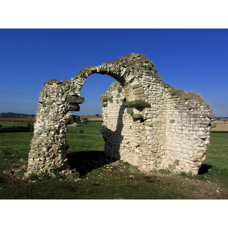
Copyright Statement: Image copyright © Colin Park, 2013
Image Source: digital photograph taken 23 September 2013 by Colin Park [www.geograph.org.uk/photo/3760998] [accessed 7 January 2019]
Copyright Instructions: CC-BY-SA-2.0
INFORMATION
Font ID: 21944CAL
Object Type: Baptismal Font1?
Font Century and Period/Style: 11th century, Norman
Church / Chapel Name: Parish Church of St. Andrew [in ruins]
Font Location in Church: [disappeared]
Church Patron Saint(s): St. Andrew
Church Notes: a portal from this church re-installed in South Ormsby's church? [cf. Index entry for South Ormsby]
Church Address: Calceby, South Thoresby, Lincoln LN13, UK
Site Location: Lincolnshire, East Midlands, England, United Kingdom
Directions to Site: Located off (S) the A16, 3-4 km W of South Ormsby, 5-6 km W of Alford
Ecclesiastic Region: [Diocese of Lincoln]
Historical Region: Hundred of Calcewath
Additional Comments: disappeared font? (the one from the Norman church now in ruins)
Font Notes:
Click to view
There are three entries for Calceby [variant spelling] in the Domesday survey [https://opendomesday.org/place/TF3975/calceby/] [accessed 7 January 2019] none of which mentions cleric or church in it. Only ruins remain of the former Norman church here. There is an entry in Historic England for the remaining ruins of the old church [Listing NGR: TF3897775698]: "Former parish church, now ruined. C11. Coursed chalk rubble with greenstone dressings and facing to chancel. Tower and nave walls survive in part up to about 20'0" and contain some herringbone masonry. Round headed tower arch with greenstone imposts, one chamfered and one simply hollow moulded."
COORDINATES
UTM: 31U 305377 5905234
Latitude & Longitude (Decimal): 53.2606, 0.082
Latitude & Longitude (DMS): 53° 15′ 38.16″ N, 0° 4′ 55.2″ E