Claxby St, Andrew / Clachesbi [Domesday] / Claxby by Alford / Claxby by Willoughby
![Main image for Claxby St, Andrew / Clachesbi [Domesday] / Claxby by Alford / Claxby by Willoughby](/static-50478a99ec6f36a15d6234548c59f63da52304e5/compressed/1181227015_compressed.png)
Image copyright © John Blakeston, 2011
CC-BY-SA-2.0
Results: 3 records
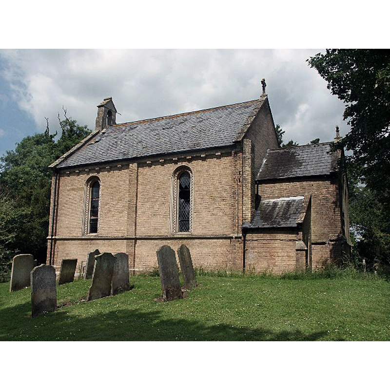
view of church exterior - southwest view
Scene Description: Source caption: "Claxby St Andrews Former Church. No Longer a church".
Copyright Statement: Image copyright © John Blakeston, 2011
Image Source: digital photograph taken 15 September 2011 by John Blakeston [www.geograph.org.uk/photo/2606411] [accessed 27 December 2018]
Copyright Instructions: CC-BY-SA-2.0
view of church exterior - west portal
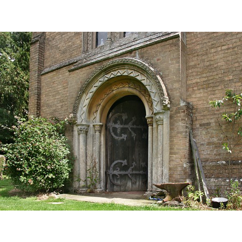
Scene Description: Source caption: "St Andrew's Church, Claxby (by Alford). The church of St Andrew is now a private dwelling."
Copyright Statement: Image copyright © Dave Hitchborne, 2007
Image Source: digital photograph taken 6 June 2004 by Dave Hitchborne [www.geograph.org.uk/photo/429082] [accessed 27 December 2018]
Copyright Instructions: CC-BY-SA-2.0
view of church exterior - south view
Scene Description: Source caption: "St Andrew's Church, Claxby (by Alford). The church of St Andrew is now a private dwelling."
Copyright Statement: Image copyright © Dave Hitchborne, 2007
Image Source: digital photograph taken 6 June 2004 by Dave Hitchborne [www.geograph.org.uk/photo/105503] [accessed 27 December 2018]
Copyright Instructions: CC-BY-SA-2.0
INFORMATION
Font ID: 21928CLA
Object Type: Baptismal Font1?
Font Century and Period/Style: 11th century, Pre-Conquest? / Norman
Church / Chapel Name: Parish Church of St. Andrew [declared redundant 1990 and sold for studio/workshop use]
Font Location in Church: [disappeared]
Church Patron Saint(s): St. Andrew
Church Notes: a church here reported in the Domesday survey; present 1846 building replaced an earlier thatched church; redundant 1990; sold for private use that October
Church Address: Willoughby Rd, Claxby, Alford LN13 0HJ, UK
Site Location: Lincolnshire, East Midlands, England, United Kingdom
Directions to Site: Located off (N) the B1196, E of the A1028, 2 km W of Willoughby, 5 km S of Alford [NB: not to be mistaken with Claxby by Normanby, also in Lincs]
Ecclesiastic Region: Diocese of Lincoln
Historical Region: Hundred of Calcewath
Additional Comments: disappeared font? (the one from the Domesday-time church here)
Font Notes:
Click to view
There are three entries for Claxby [-St-Andrew] [variant spelling] in the Domesday survey [https://opendomesday.org/place/TF4571/claxby-st-andrew/] [accessed 27 December 2018, one of which, in the chief tenancy of Hugh, son of Baldric, in 1086, reports a priest and a church in it. The entry for the present church in Historic England [Listing NGR: TF4529271479] notes: "Parish church, now disused. 1846. [...] Decorative C19 circular ashlar font. The floor of the chancel is tiled. East nave with brass plaque to Richard Johnson, 1607." [NB: we have no information on the whereabouts of the 19th-century font when the church became redundant and soldin 1990].
COORDINATES
UTM: 31U 311402 5900511
Latitude & Longitude (Decimal): 53.22037, 0.175
Latitude & Longitude (DMS): 53° 13′ 13.33″ N, 0° 10′ 30″ E