Bromesberrow / Bremes-byrig / Bremesberghe / Bromesburgh / Brommesberewe / Brommesberwe / Brunmeberge
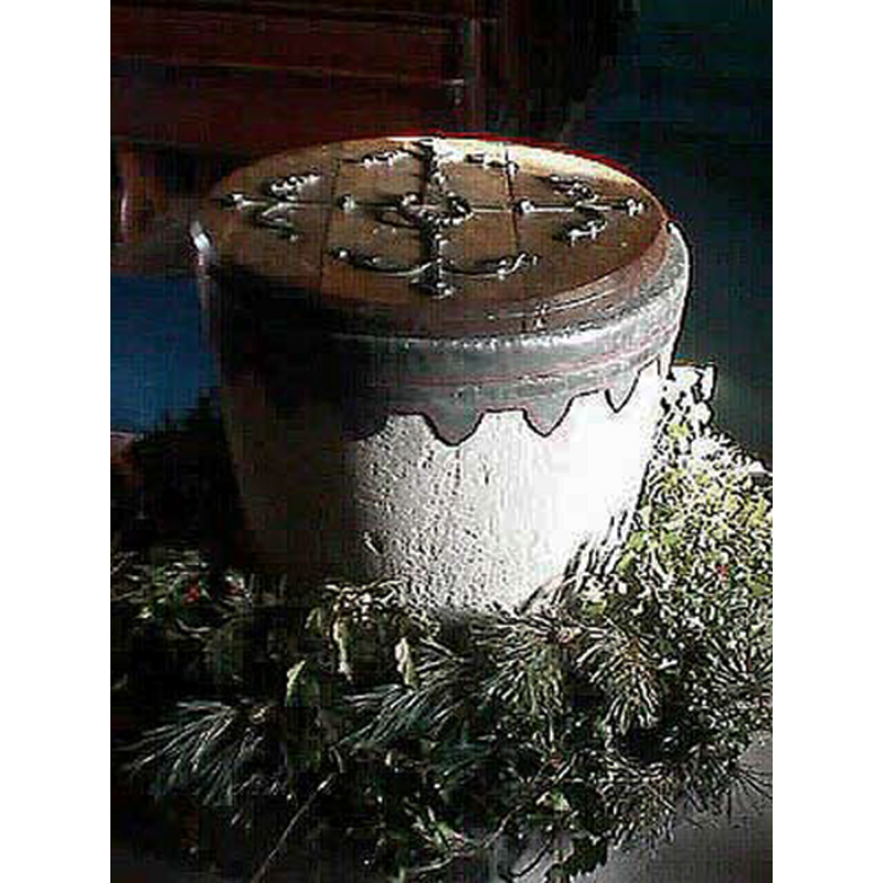
Image copyright © John Wilkes, 2009
Standing permission
Results: 5 records
view of font and cover
Copyright Statement: Image copyright © John Wilkes, 2009
Image Source: digital photograph 16 December 2008 taken by John Wilkes
Copyright Instructions: Standing permission
view of church exterior in context - southeast view
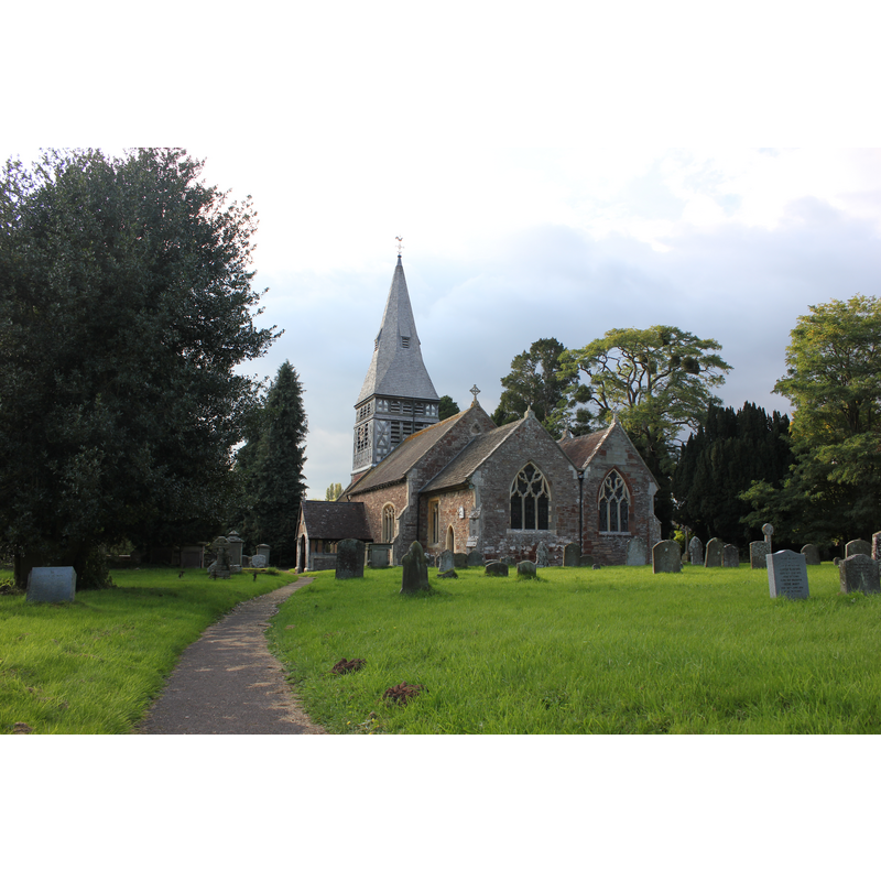
Copyright Statement: Image copyright © Tomortimer, 2017
Image Source: digital photograph taken 17 September 2017 by Tomortimer [https://commons.wikimedia.org/wiki/File:Church_Of_St_Mary,_Bromsberrow.jpg] [accessed 6 December 2018]
Copyright Instructions: CC-BY-SA-2.0
view of font and cover in context
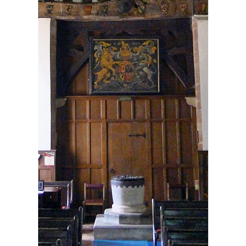
Copyright Statement: Image copyright © Philip Pankhurst, 2013
Image Source: edited detail of a digital photograph taken 19 July 2013 by Philip Pankhurst [www.geograph.org.uk/photo/3606253] [accessed 6 December 2018]
Copyright Instructions: CC-BY-SA-2.0
view of church interior - nave - looking west
Copyright Statement: Image copyright © Philip Pankhurst, 2013
Image Source: digital photograph taken 19 July 2013 by Philip Pankhurst [www.geograph.org.uk/photo/3606253] [accessed 6 December 2018]
Copyright Instructions: CC-BY-SA-2.0
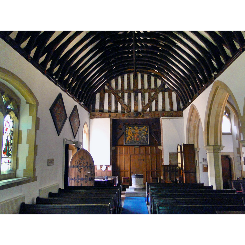
view of church interior - nave - looking east
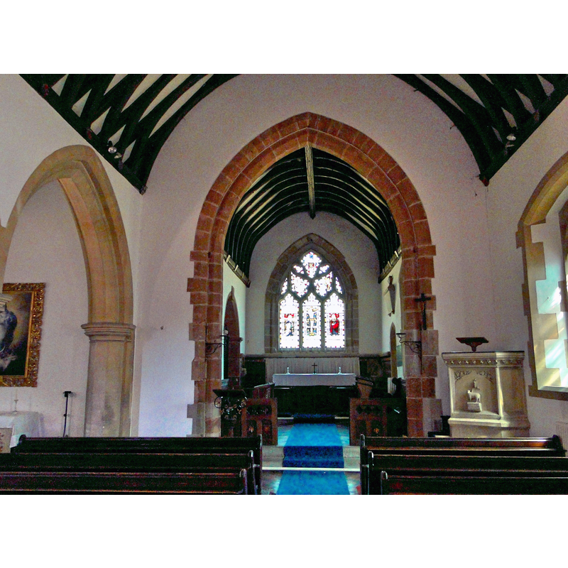
Copyright Statement: Image copyright © Philip Pankhurst, 2013
Image Source: digital photograph taken 19 July 2013 by Philip Pankhurst [www.geograph.org.uk/photo/3606308] [accessed 6 December 2018]
Copyright Instructions: CC-BY-SA-2.0
INFORMATION
Font ID: 21915BRO
Object Type: Baptismal Font1
Font Century and Period/Style: 12th century (late?), Late Norman
Cognate Fonts: lead-lined [modern]
Church / Chapel Name: Parish Church of St. Mary the Virgin
Font Location in Church: Inside the church, at the W end of the nave
Church Patron Saint(s): St. Mary the Virgin
Church Address: Allbright Lane, Bromsberrow HR8 1RU, UK -- Tel.: (01531) 650991
Site Location: Gloucestershire, South West, England, United Kingdom
Directions to Site: Located off (N) the A417, 5 km SE of Ledbury, 18 km NW of Gloucester
Ecclesiastic Region: Diocese of Gloucester
Additional Comments: composite font / altered font (the present font consists of a Norman basin on a Victiorian base [cf. FontNotes])
Font Notes:
Click to view
No individual entry found for Bromesberrow in the Domesday survey. The entry for this parish in the Victoria County History (Gloucester, vol. 12, 2010) notes: "In the late 11th century Ralph de Tony granted the greater part of his demesne tithes to the abbey founded at Conches (Eure) by his father Roger. [...] The medieval parish church comprised chancel and nave with a low belfry over the west end. [...] The earliest surviving fabric dates from the early 13th century [...] Bromesberrow church was extensively restored and enlarged in 1857 and 1858 [...] The font is a featureless limestone tub, which if in situ may indicate that there was already a church at Bromesberrow in the late 12th century. [...] In 1875 the tower was reconstructed with a timber spire in the French Gothic style [...] and the Norman font set within an ornate stone casing (removed in 1938) and mounted on an octagonal plinth." The entry for this church in Historic England [Listing NGR: SO7422433669] notes: "Parish church. C13, 14, 1502, 1725 chapel; nave rebuilt, north aisle added 1858, top of tower and spire 1875, vestry 1910. [...] Plain tub-shaped Norman font on 1875 stone base." Noted in Verey & Brooks (1999-2002): "Font. Norman tub-shaped bowl." [NB: the font is older than the fabric of the church]. Noted and illustrated in 'Bromesberrow Church' [http://www.englandspastforeveryone.org.uk/resources/assets/P/Picture_Gallery_Bromesberrow_Church_2209.pdf] [accessed 15 December 2008]: "The Norman font is a plain limestone tub and in 1875 was encased in an ornate octagonal stone cover, supported on pillars with bases and capitals. This was removed in 1938. An illustration of the Victorian font casing hangs at the west end of the north aisle."
Credit and Acknowledgements: We are grateful to John Wilkes, of www.allthecotswolds.com, for his photograph of this font
COORDINATES
UTM: 30U 542789 5761283
Latitude & Longitude (Decimal): 52.00055, -2.3767
Latitude & Longitude (DMS): 52° 0′ 1.98″ N, 2° 22′ 36.12″ W
MEDIUM AND MEASUREMENTS
Material: stone, limestone
Font Shape: tub-shaped, mounted
Basin Interior Shape: round
Basin Exterior Shape: round
Drainage System: centre hole in basin
Drainage Notes: lead-lining [modern]
LID INFORMATION
Date: modern?
Material: wood, oak
Apparatus: no
Notes: round and flat, with metal decoration and ring handle; Victorian or later?
REFERENCES
- Victoria County History [online], University of London, 1993-. URL: https://www.british-history.ac.uk.
- Verey, David, Gloucestershire, London: Penguin Books, 1999-2002, vol. 2, p. 298