Stainton nr. Tickhill and Doncaster / Stantone
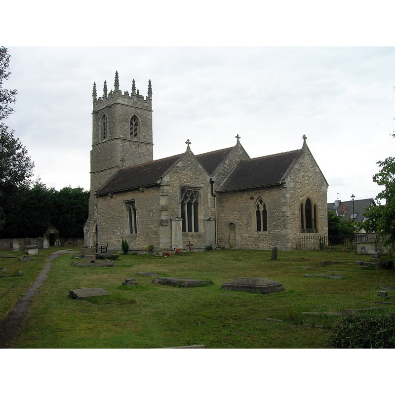
Image copyright © JThomas, 2011
CC-BY-SA-2.0
Results: 1 records
view of church exterior - southeast view
Scene Description: Source caption: "St.Winifred's church, Stainton. Norman and Early English origins with a Perpendicular tower. Surprising tranquility surrounded by pits and quarries."
Copyright Statement: Image copyright © JThomas, 2011
Image Source: digital photograph taken 14 August 2011 by JThomas [www.geograph.org.uk/photo/2553527] [accessed 26 November 2018]
Copyright Instructions: CC-BY-SA-2.0
INFORMATION
Font ID: 21898STA
Object Type: Baptismal Font1
Font Century and Period/Style: 17th century, Restoration
Church / Chapel Name: Parish Church of St. Winifred
Font Location in Church: Inside the church
Church Patron Saint(s): St. Winefride [aka Winifred, Wenefred, Wenefreda, Gwenfrewi]
Church Address: Stainton Ln, Stainton, Rotherham S66 7QX, UK
Site Location: South Yorkshire, Yorkshire and the Humber, England, United Kingdom
Directions to Site: Located off (N) the A631, 4 km WNW of Tickhill, 10 km SSW of Doncaster, 14-15 km E of Rotherham
Ecclesiastic Region: Diocese of Sheffield
Historical Region: Hundred of Strafforth, formerly WRYrks
Additional Comments: disappeared font? (the one from the 12thC(?) church here)
Font Notes:
Click to view
No individual entry found for this Stainton in the Domesday survey. The entry for this church in Historic England [Listing NGR: SK5552093633] notes: "Church. C12, C13, C14 and C15 with C19 restoration. [...] Font: octagonal, chalice-shaped with foiled side panels." The entry for this church in Explore Churches [ww.explorechurches.org/church/st-winifred-stainton] [accessed 26 November 2018] notes: "The lead-lined octagonal font dates from the 17th century."
COORDINATES
Latitude & Longitude (Decimal): 53.4366, -1.1657
Latitude & Longitude (DMS): 53° 26' 11" N, 1° 9' 56" W
MEDIUM AND MEASUREMENTS
Material: stone
Font Shape: octagonal, mounted
Basin Interior Shape: round
Basin Exterior Shape: octagonal
Drainage Notes: lead-lined