High Toynton / Tedlintune / Todintune
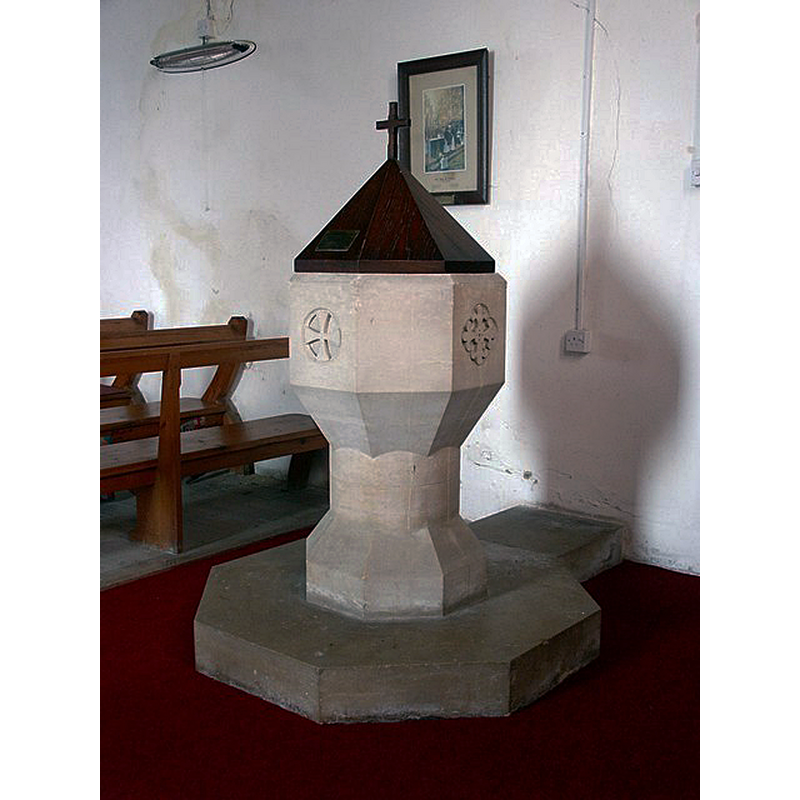
Image copyright © Dave Hitchborne, 2004
CC-BY-SA-2.0
Results: 4 records
view of font and cover
Scene Description: the 20thC font
Copyright Statement: Image copyright © Dave Hitchborne, 2004
Image Source: digital photograph taken 24 August 2004 by Dave Hitchborne [www.geograph.org.uk/photo/476823] [accessed 25 November 2018]
Copyright Instructions: CC-BY-SA-2.0
view of church exterior - south view
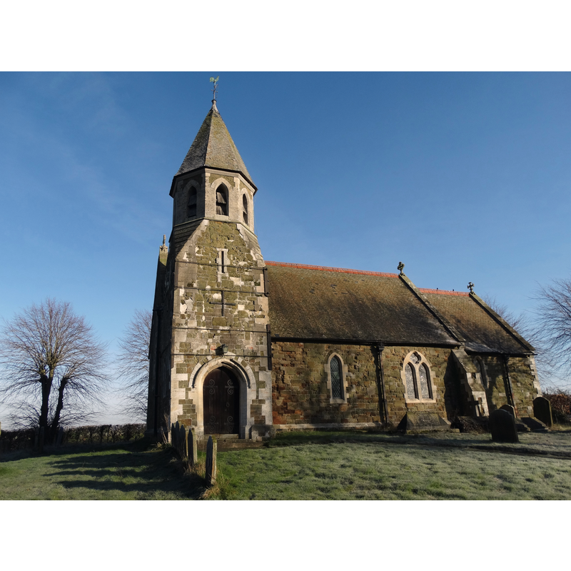
Copyright Statement: Image copyright © Neal Theasby, 2016
Image Source: digital photograph taken 16 February 20916 by Neil Theasby [www.geograph.org.uk/photo/4831384] [accessed 25 November 2018]
Copyright Instructions: CC-BY-SA-2.0
view of church interior - nave - looking west
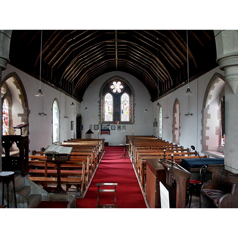
Copyright Statement: Image copyright © Dave Hitchborne, 2004
Image Source: digital photograph taken 24 August 2004 by Dave Hitchborne [www.geograph.org.uk/photo/476993] [accessed 25 November 2018]
Copyright Instructions: CC-BY-SA-2.0
view of church interior - nave - looking east
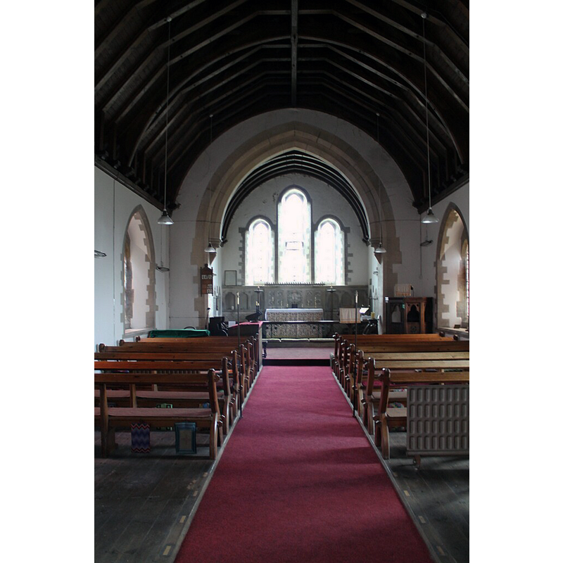
Copyright Statement: Image copyright © J. Hannan-Briggs, 2012
Image Source: digital photograph taken 15 April 2012 by J. Hannan-Briggs [www.geograph.org.uk/photo/2920053] [accessed 25 November 2018]
Copyright Instructions: CC-BY-SA-2.0
INFORMATION
Font ID: 21897TOY
Object Type: Baptismal Font1?
Font Century and Period/Style: 12th - 13th century, Medieval
Church / Chapel Name: Parish Church of St. John the Baptist
Font Location in Church: [cf. FontNotes]
Church Patron Saint(s): St. John the Baptist
Church Notes: present church of 1872 replaced a 1779 building, itself a replacement of the 12th / 13thC [documented 1231] medieval building
Church Address: Gravelpit Lane, High Toynton, Horncastle LN9 6NN, UK
Site Location: Lincolnshire, East Midlands, England, United Kingdom
Directions to Site: Located off (S) the A158, 2-3 km E of Horncastle
Ecclesiastic Region: Diocese of Lincoln
Historical Region: Hundred of Horncastle
Additional Comments: disappeared font? (the one from the 12th-13thC church here
Font Notes:
Click to view
There are two entries for [High and Low] Toynton [variant spelling] in the Domesday survey [https://opendomesday.org/place/XX0000/high-and-low-toynton/] [accessed 25 November 2018] neither of which mentions cleric or church in it. The entry for this church in Historic England [Listing NGR: TF2835769883] notes: "Parish church. 1872 by Ewan Christian, re-using some mid C12 fragments. [...] A segmental arch of C12 chevron re-set above. A similar smaller section of chevron set above outer doorway in porch interior. [...] C20 font".
COORDINATES
UTM: 30U 694985 5899634
Latitude & Longitude (Decimal): 53.2102, -0.08
Latitude & Longitude (DMS): 53° 12′ 36.72″ N, 0° 4′ 48″ W