Skelbrooke / Scalebre
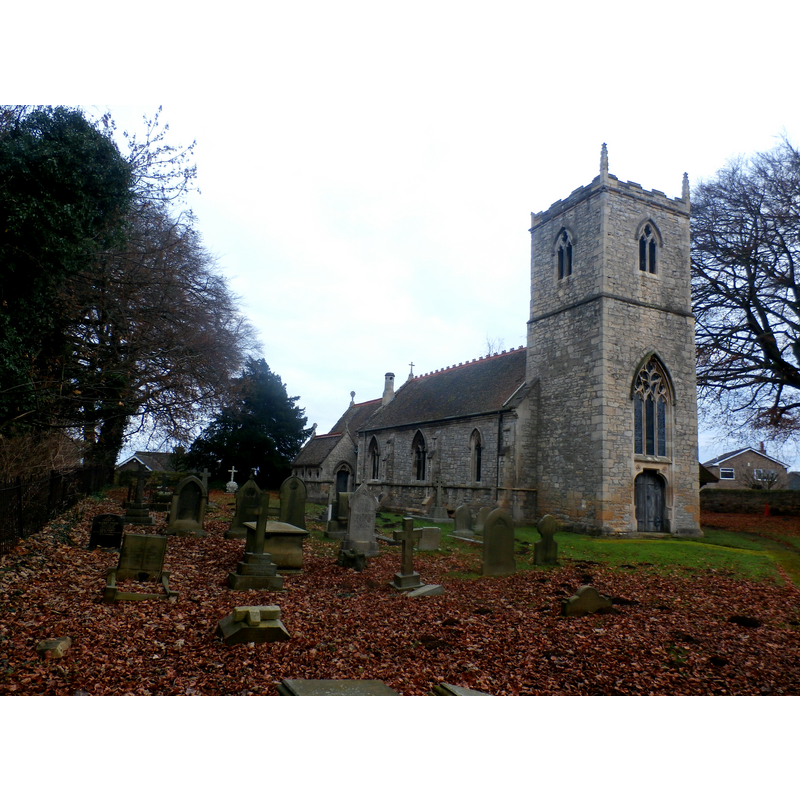
Image copyright © Jonathan Clitheroe, 2016
CC-BY-SA-2.0
Results: 1 records
view of church exterior in context - northwest view
Scene Description: Source caption: "St. Michael And All Angels Church in Skelbrooke". -- Late-19thC re-building of the original medieval church
Copyright Statement: Image copyright © Jonathan Clitheroe, 2016
Image Source: digital photograph taken 3 December 2016 by Jonathan Clitheroe [www.geograph.org.uk/photo/5216661] [accessed 21 November 2018]
Copyright Instructions: CC-BY-SA-2.0
INFORMATION
Font ID: 21893SKE
Object Type: Baptismal Font1?
Font Date: ca. 1230?
Font Century and Period/Style: 13th century, Medieval
Church / Chapel Name: Parish Church of St. Michael and All Angels
Font Location in Church: [disappeared]
Church Patron Saint(s): St. Michael & All Angels
Church Notes: church here documented 1230 and 1431, a chapel-of-ease of Douth Nirkby
Church Address: Straight Ln, Skelbrooke, Doncaster DN6 8LX, UK -- Tel.: 01302 815206
Site Location: South Yorkshire, Yorkshire and the Humber, England, United Kingdom
Directions to Site: Located off (E) the A638 [aka Doncaster Rd], W of the A1, 10-15 km NNW of Doncaster
Ecclesiastic Region: Diocese of Sheffield
Historical Region: Hundred of Osgodcross -- formerly WRYrks
Additional Comments: disappeared font? (the one in the medieval church here)
Font Notes:
Click to view
There is an entry for Skelbrooke [variant spelling] in the Domesday survey [http://opendomesday.org/place/SE5112/skelbrooke/] [accessed 21 November 2018] but it mentions neither cleric nor church in it. The entry for this church in Historic England [Listing NGR: SE5111812088] notes: "Church. Medieval but extensively rebuilt by Joseph Goddard following a major fire in 1872", but mentions no font in it.
COORDINATES
UTM: 30U 617186 5940755
Latitude & Longitude (Decimal): 53.6025, -1.229
Latitude & Longitude (DMS): 53° 36′ 9″ N, 1° 13′ 44.4″ W