Monk Bretton No. 1 / Bretton / Brettone / Lundwood / Munkebretton
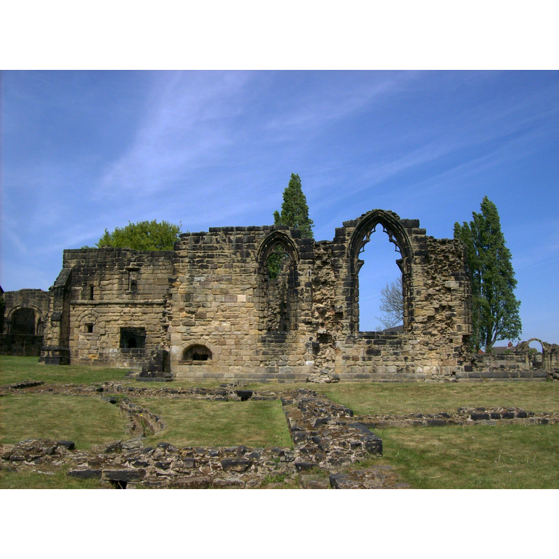
Image copyright © [in the public domain]
CC-Zero
Results: 2 records
view of church exterior - south view
Scene Description: the ruins of the former priory
Copyright Statement: Image copyright © [in the public domain]
Image Source: digital photograph taken by Tony Grist [https://commons.wikimedia.org/wiki/File:Monk_Bretton_Priory,_from_the_south.jpg] [accessed 1 November 2018]
Copyright Instructions: CC-Zero
view of church exterior in context
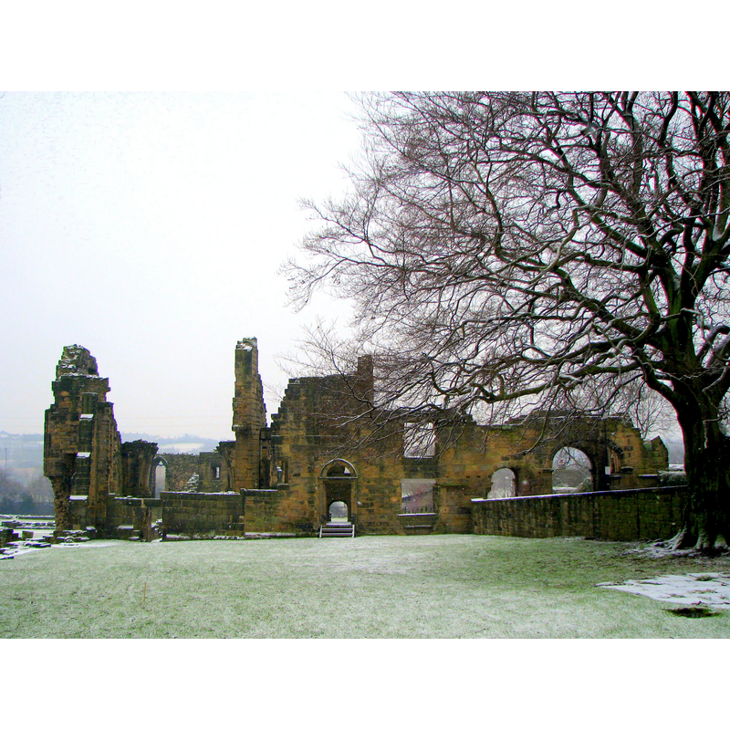
Scene Description: the ruins of the former priory
Copyright Statement: Image copyright © Badics, 2007
Image Source: digital photograph taken 10 February 2007 by Badics [https://commons.wikimedia.org/wiki/File:The_Monk_Bretton_Priory.JPG] [accessed 16 November 2018]
Copyright Instructions: CC-BY-SA-3.0
INFORMATION
Font ID: 21885MON
Object Type: Baptismal Font1?
Font Date: ca. 1154?
Font Century and Period/Style: 12th century (mid?), Late Norman
Church / Chapel Name: Priory Church of St. Mary Magdalene of Lund [aka Monk Bretton Priory] [in ruins]
Font Location in Church: [disappeared]
Church Patron Saint(s): St. Mary Magdalene
Church Notes: Cluniac priory founded 1154 the Mon Bretton; became Benedictine 1281; dissolved 1538
Church Address: Abbey Ln, Lundwood, Barnsley S71 5QD, UK
Site Location: South Yorkshire, Yorkshire and the Humber, England, United Kingdom
Directions to Site: The priory ruins site is located off (E) the A628-A633 crossroads, just S of Lundwood, SE of Monk Bretton, 3-4 km E of Barnsley
Ecclesiastic Region: [Diocese of Leeds]
Historical Region: Hundred of Staincross -- formerly WRYrks
Additional Comments: disappeared font? (the one from the mid-12thC priory church here)
Font Notes:
Click to view
There is an entry for [Monk] Bretton [variant spelling] in the Domesday survey [http://opendomesday.org/place/SE3607/monk-bretton/] [accessed 16 November 2018] but it mentions neither cleric nor church in it. The entry for the Priory of Monk Bretton in the Victoria County History (York, vol. 3, 1974) notes: "The priory of Monk Bretton was founded early in the reign of Henry II by Adam Fitz Suain for monks of the Cluniac order. [...] Monk Bretton was one of the greater houses, which escaped dissolution under the earlier Act. [...] The house was surrendered on 21 November 1539 [...] by the prior and thirteen monks. Their goods and cattle were sold for £347 3s. 8d., the lead of the church amounted to 39 fodders and there were seven bells." The entry for this site in Historic England [Listing NGR: SE3731006529] notes: "Priory remains. C12- late C15. Coursed, squared rubble and ashlar. The complex consists of the church to the north with cloister to the south side of the nave. To the west of the cloister is a north-south range with a gatehouse to west of this. A north-south range to the east of the cloister and the refectory to the south with kitchens further south. To the south-east is the reredorter and guest house and to the east the separate infirmary. Most of the remains are only a few feet high and show the plan only, but the west range and gatehouse survive, in part, to two storeys. The church is mainly of later C12 date,the north and west walls rebuilt in the mid C14. The Cistercian type plan consists of a 4-bay aisled nave, north and south transepts each with 2 east chapels, and an aisless presbytery with C15 sacristy to south."
COORDINATES
UTM: 30U 603451 5935037
Latitude & Longitude (Decimal): 53.554013, -1.438372
Latitude & Longitude (DMS): 53° 33′ 14.45″ N, 1° 26′ 18.14″ W
REFERENCES
- Victoria County History [online], University of London, 1993-. URL: https://www.british-history.ac.uk.