Loversall / Loureshale
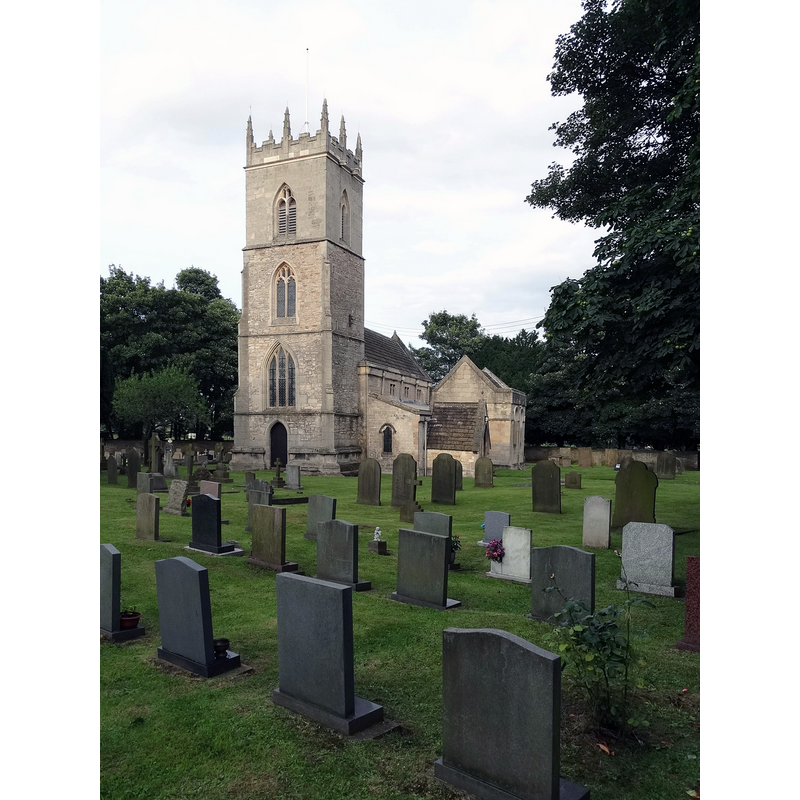
Image copyright © Neil Theasby, 2014
CC-BY-SA-2.0
Results: 3 records
view of church exterior - southwest view
Scene Description: Source caption: "St Katherine's Church, Loversall. Associated with a pre-Christian well close by, a church has existed here since the late thirteenth century and probably earlier than that."
Copyright Statement: Image copyright © Neil Theasby, 2014
Image Source: digital photograph taken 9 August 2014 by Neil Theasby [www.geograph.org.uk/photo/4112721] [accessed 15 November 2018]
Copyright Instructions: CC-BY-SA-2.0
view of church interior - looking east
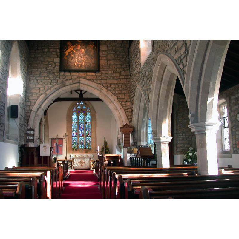
Copyright Statement: Image copyright © Anthony Wilding, 2006
Image Source: digital photograph taken 26 January 2006 by Anthony Wilding [www.geograph.org.uk/photo/112541] [accessed 15 November 2018]
Copyright Instructions: CC-BY-SA-2.0
view of font in context

Copyright Statement: Image copyright © Pinterest, 2018
Image Source: digital photograph listed in pinterest [https://i.pinimg.com/236x/92/3d/17/923d17004d01614ff0157b525cc4bcd4--fonts-church.jpg] [accessed 15 November 2018]
Copyright Instructions: PERMISSION NOT AVAILABLE -- IMAGE NOT FOR PUBLIC USE
INFORMATION
Font ID: 21881LOV
Object Type: Baptismal Font1
Font Century and Period/Style: 11th - 12th century, Norman
Church / Chapel Name: Parish Church of St. Katherine
Font Location in Church: Inside the church
Church Patron Saint(s): St. Catherine of Alexandria [aka Katherine, Katharine]
Church Notes: appears to have been originally a chapel of ease in the parish of Doncaster
Church Address: Bubup Hill, Loversall, Doncaster DN11 9DA, UK -- Tel.: +44 7958 685393
Site Location: South Yorkshire, Yorkshire and the Humber, England, United Kingdom
Directions to Site: Located off the B1257, 4 km S of Doncaster town centre
Ecclesiastic Region: Diocese of Sheffield
Historical Region: Hundred of Strafforth -- formerly WRYrks
Font Notes:
Click to view
There is an entry for Loversall [variant spelling] in the Domesday survey [http://opendomesday.org/place/SE5798/loversall/] [accessed 15 November 2018]; it reports a priest and a church in it. Noted in Morris (1932): "Cup font, probably Norm[an]." Mee (1941) has: "the font may be Norman." The entry for this church in Historic England [Listing NGR: SK5761398733] notes: "Church. c1300, C15 and c1530; nave and south aisle rebuilt 1855 by Sir George Gilbert Scott. [...] Font: round base to bowl on chamfered shaft." Harman & Pevsner (2017) report a "Norman tub" font here.
COORDINATES
UTM: 30U 623853 5927521
Latitude & Longitude (Decimal): 53.482071, -1.13354
Latitude & Longitude (DMS): 53° 28′ 55.46″ N, 1° 8′ 0.74″ W
MEDIUM AND MEASUREMENTS
Material: stone
Font Shape: round, mounted
Basin Interior Shape: round
Basin Exterior Shape: round
REFERENCES
- Harman, Ruth, Yorkshire West Riding: Sheffield and the South, New Haven; London: Yale University Press, 2017, p. 393
- Mee, Arthur, The King's England, Yorkshire, West Riding, London: Hodder & Stoughton, 1941, p. 250
- Morris, Joseph Ernest, The West Riding of Yorkshire, London: Methuen & Co., 1932, p. 345