Kellington / Chellinctone
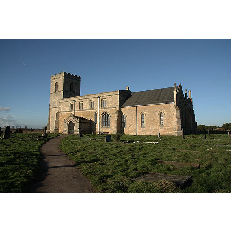
Image copyright © Richard Croft, 2009
CC-BY-SA-2.0
Results: 4 records
view of church exterior - southeast view
Scene Description: Source caption: "St.Edmund's church. Remotely situated away from the village".
Copyright Statement: Image copyright © Richard Croft, 2009
Image Source: digital photograph taken 4 December 2009 by Richard Croft [www.geograph.org.uk/photo/1612360] [accesed 13 November 2018]
Copyright Instructions: CC-BY-SA-2.0
view of church interior - nave - looking west
![with the 1663 partially visible on the left [south]](/static-50478a99ec6f36a15d6234548c59f63da52304e5/compressed/1181114002_compressed.png)
Scene Description: with the 1663 partially visible on the left [south]
Copyright Statement: Image copyright © Whitley Parish, 2018
Image Source: digital photograph in the Whitley Parish site [http://kellingtonwithwhitley.org.uk/HistoryKellington.php] [accessed 13 November 2018]
Copyright Instructions: No known copyright restriction -- Fair Dealing
view of base

Scene Description: the broken up lower base of the medieval font
Copyright Statement: Image copyright © CRSBI, 2018
Image Source: digital photograph 9 August 2014 by Rita Wood, in the CRSBI [www.crsbi.ac.uk/site/1427/] [accessed 13 November 2018]
Copyright Instructions: PERMISSION NOT AVAILABLE -- IMAGE NOT FOR PUBLIC USE
view of base
Scene Description: the broken up lower base of the medieval font
Copyright Statement: Image copyright © CRSBI, 2018
Image Source: digital image of a 10 September 1996 B&W photograph by John McElheran, in the CRSBI [www.crsbi.ac.uk/site/1427/] [accessed 13 November 2018]
Copyright Instructions: PERMISSION NOT AVAILABLE -- IMAGE NOT FOR PUBLIC USE
INFORMATION
Font ID: 21878KEL
Object Type: Baptismal Font1
Font Date: 1663
Font Century and Period/Style: 17th century(mid?), Restoration
Church / Chapel Name: Parish Church of St. Edmund
Font Location in Church: Inside the church
Church Patron Saint(s): St. Edmund the Martyr [aka Edmund of East Anglia]
Church Notes: late-Saxon wooden building discovered in 1990s excavations; present church probably ca. 1100; documented since 1185;
Church Address: Church Ln, Kellington, Goole DN14 0SB, UK
Site Location: North Yorkshire, Yorkshire and the Humber, England, United Kingdom
Directions to Site: Located off (N) the A645, W of the A19, roughly equidistant between Pontefract and Selby
Historical Region: Hundred of Osgodcross -- formerly WRYrks
Additional Comments: fragment of a font (only the broken-up base of a 12thC (?) font remains)
Font Notes:
Click to view
There are two entries for Kellington [variant spelling] in the Domesday survey [http://opendomesday.org/place/SE5524/kellington/] [accessed 13 November 2018] neither of which mentions cleric or church in it. Noted in Morris (1932): "Font, dated 1663, but probably mediaeval." [NB: this could be another case of a rejected earlier font that was restored to its use and the date of the restoration added to it]. Pevsner (1986 c1967), however, has no problem with the inscription-based dating: "Font. Plain, low, octagonal bowl, dated 1663." Harman & Pevsner (2017) note: "Font. Plain, low, octagonal bowl dated 1663." The entry for this church in Historic England [Listing NGR: SE5479324563] notes: "Church. Norman origins to nave, with mid C12 reconstruction including south door, chancel and lower stages of tower. Mid C14 alterations to chancel and addition of belfry stage to tower. C15 south porch, clerestory, north chapel and buttresses to tower. North aisle and further restorations of 1866-70. [...] Font has octagonal base, square plinth and octagonal top inscribed 1663 / MWW / IS / PV / GR / ZI / CW / WS." The Kellington with Whitley Parish site [http://kellingtonwithwhitley.org.uk/HistoryKellington.php] [accessed 13 November 2018] notes: "The font dates from 1663". There remains of an earlier font here, the lower base, a fragment, mentioned and illustrated in the entry for this church in the CRSBI (2018): "This is in six pieces. A circular base, plain upright at the bottom, chamfered angle."
COORDINATES
UTM: 30U 620677 5953348
Latitude & Longitude (Decimal): 53.71484, -1.17137
Latitude & Longitude (DMS): 53° 42′ 53.42″ N, 1° 10′ 16.93″ W
MEDIUM AND MEASUREMENTS
Material: stone
Font Shape: octagonal, mounted
Basin Interior Shape: round
Basin Exterior Shape: octagonal
Height of Base: 23 cm* [83 cm in diameter]*
Notes on Measurements: * CRSBI (2018) [measurements for the old broken-up base of the medieval font]
INSCRIPTION
Inscription Language: numbers and letters
Inscription Location: on the basin sides
Inscription Text: "1663 / MWW / IS / PV / GR / ZI / CW / WS"
Inscription Notes: [cf. FontNotes]
Inscription Source: Morris (1932), Pevsner (1986)
REFERENCES
- Corpus of Romanesque Sculpture in Britain and Ireland, The Corpus of Romanesque Sculpture in Britain and Ireland, The Corpus of Romanesque Sculpture in Britain and Ireland. URL: http://www.crsbi.ac.uk.
- Morris, Joseph Ernest, The West Riding of Yorkshire, London: Methuen & Co., 1932, p. 282
- Pevsner, Nikolaus, Yorkshire: the West Riding, Harmondsworth: Penguin Books, 1986 c1967, p. 44, 283