Hooton Roberts / Hotun
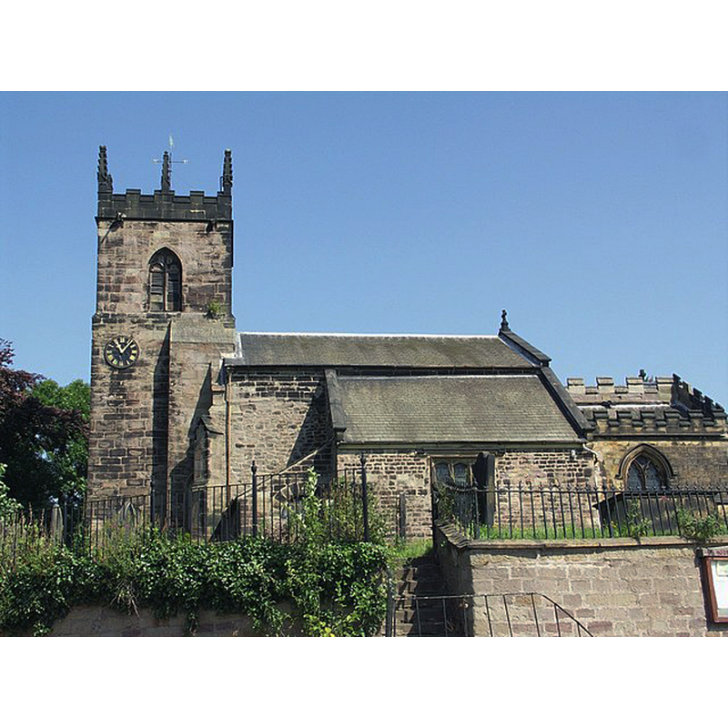
Image copyright © Mike Smith, 2007
CC-BY-SA-2.0
Results: 1 records
view of church exterior - south view
Scene Description: Source caption: "Church of St John the Baptist. This church, on the main A630 Doncaster Road at Hooton Roberts, is of Norman origin and contains 13th Century stained glass. The tower dates from the 15th Century."
Copyright Statement: Image copyright © Mike Smith, 2007
Image Source: digital photograph taken 5 August 2007 by Mike Smith [www.geograph.org.uk/photo/521315] [accessed 12 November 2018]
Copyright Instructions: CC-BY-SA-2.0
INFORMATION
Font ID: 21877HOO
Object Type: Baptismal Font1?
Font Century and Period/Style: 12th century, Late Norman
Church / Chapel Name: Parish Church of St. John the Baptist
Font Location in Church: [cf. FontNotes]
Church Patron Saint(s): St. John the Baptist
Church Address: 4PJ, Doncaster Rd, Rotherham S65, United Kingdom
Site Location: South Yorkshire, Yorkshire and the Humber, England, United Kingdom
Directions to Site: Located off (N) the A630-B6093 crossroads, 7-8 km NE of Rotherham, 12-13 km SW of Doncaster
Ecclesiastic Region: Diocese of Sheffield
Historical Region: Hundred of Strafforth -- formerly WRYrks
Additional Comments: disappeared font? (has the ancient font reported in Kelly in 1881 disappeared?)
Font Notes:
Click to view
There is an entry for Hooton [Roberts] [variant spelling] in the Domesday survey [http://opendomesday.org/place/SK4897/hooton-roberts/] [accessed 12 November 2018] but it mentions neither cleric nor church in it. Kelly's Directory of the West Riding of Yorkshire (1881) [https://forebears.co.uk/england/yorkshire/hooton-roberts] [accessed 12 November 2018] reports "a very ancient font" in it. The entry for this church in Historic Enland [Listing NGR: SK4840397066] notes: "Church. C12 core, rebuilt C15, extensive C19 restoration" but mentions no font in it. [NB: did the 'extensive' restoration of 1875-1876 remove the font reported in Kelly's Directory of 1881? It is quite posible Kelly's information was not up to date and the old font had already been replaced].
COORDINATES
UTM: 30U 614703 5925775
Latitude & Longitude (Decimal): 53.46846, -1.272
Latitude & Longitude (DMS): 53° 28′ 6.46″ N, 1° 16′ 19.2″ W