Hooton Pagnell / Hooton Pagnall / Hoton / Hotone / Howton / Hutton Pagnall
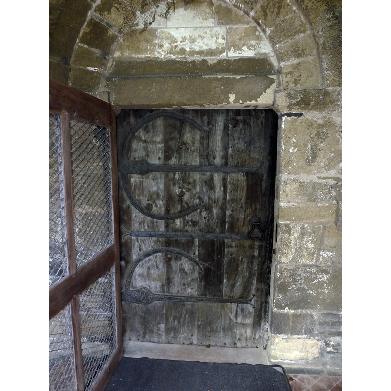
Image copyright © Lee Davidson, 2018
CC-BY-SA-2.0
Results: 5 records
view of church exterior - south portal
Scene Description: Source caption: "Medieval South Door, All Saints Church, Hooton Pagnell. British Listed Buildings site says of the door "South doorway within has ancient oak door with some medieval ironwork"" -- or, is the ironwork a 19thC replica of the original?
Copyright Statement: Image copyright © Lee Davidson, 2018
Image Source: digital photograph taken 13 May 2018 by Lee Davidson [www.geograph.org.uk/photo/5773076] [accessed 12 November 2018]
Copyright Instructions: CC-BY-SA-2.0
view of church exterior - south view
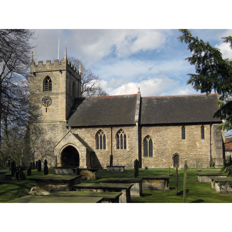
Copyright Statement: Image copyright © Chemical Engineer, 2013
Image Source: digital photograph taken 15 April 2013 by Chemical Engineer [whttps://commons.wikimedia.org/wiki/File:All_Saints_Hooton_Pagnell_2013_view_01.jpg] [accessed 12 November 2018]
Copyright Instructions: CC-BY-SA-3.0
view of font

Copyright Statement: Image copyright © CRSBI, 2018
Image Source: digital photograph 23 July 2012 by Rita Wood [www.crsbi.ac.uk/site/3359/] [accessed 12 November 2018]
Copyright Instructions: PERMISSION NOT AVAILABLE -- IMAGE NOT FOR PUBLIC USE
view of basin - interior
Scene Description: The whole visible surface, except for a couple of small tears at the upper rim, is the old lead lining.
Copyright Statement: Image copyright © CRSBI, 2018
Image Source: digital photograph 23 July 2012 by Rita Wood [www.crsbi.ac.uk/site/3359/] [accessed 12 November 2018]
Copyright Instructions: PERMISSION NOT AVAILABLE -- IMAGE NOT FOR PUBLIC USE
design element - motifs - panel
Scene Description: all around the underbowl; the section below has been badly damaged, and there is damage also to the upper rim, patched up now
Copyright Statement: Image copyright © CRSBI, 2018
Image Source: digital photograph 23 July 2012 by Rita Wood [www.crsbi.ac.uk/site/3359/] [accessed 12 November 2018]
Copyright Instructions: PERMISSION NOT AVAILABLE -- IMAGE NOT FOR PUBLIC USE
INFORMATION
Font ID: 21876HOO
Object Type: Baptismal Font1
Church / Chapel Name: Parish Church of All Saints
Font Location in Church: [cf. FontNotes]
Church Patron Saint(s): All Saints
Church Address: 2 Hall Cottages, Hooton Pagnell, Doncaster DN5 7BW, UK
Site Location: South Yorkshire, Yorkshire and the Humber, England, United Kingdom
Directions to Site: Located off the B6422, 15-16 km NW of Doncaster
Historical Region: Hundred of Strafforth -- formerly WRYrks
Additional Comments: damaged font? / replaced font? [cf. FontNotes]
Font Notes:
Click to view
There is an entry for Hooton [Pagnell] [variant spelling] in the Domesday survey [http://opendomesday.org/place/SE4807/hooton-pagnell/] [accessed 12 November 2018] but it mentions neither cleric nor church in it. The entry for this church in Visit Doncaster [http://www.visitdoncaster.com/things-to-do/all-saints-church-hooton-pagnell] [accessed 12 November 2018] notes: "In August 1897 the church was struck by lightning, one of the roof beams was set on fire, one of the pinnacles was thrown from the roof, and the font was broken and its bowl hurled across the church. The font was mended and continued in use for some time, but it is now in the churchyard near the south wall." This font may have been replaced by one from another [nearby?] church, as the entry for this church in the CRSBI (2018) notes: "Perhaps the lower part of a 12thc cylindrical font was reshaped with eight faces to fit onto an octagonal plinth or stem. [...] The font is located in the N aisle towards the E end. It was moved to Hooton Pagnell around 1900 from an unnamed neighbouring church, where it had been discarded, by Mrs Julia Warde-Aldam: Whiting (1938), 20." [ref.: C. E. Whiting, All Saints’ Church, Hooton Pagnell, Yorkshire, 2nd edition revised, H. R. Wilson, Dewsbury 1967.] "The plain drum font is set on a weathered sandstone chamfered plinth on a modern four-sided plinth. In its lower third, the cylinder has been worked into eight facets or panels which taper to meet the eroded plinth. The basin tapers down to a flat bottom."
COORDINATES
UTM: 30U 614705 5936620
Latitude & Longitude (Decimal): 53.5659, -1.268
Latitude & Longitude (DMS): 53° 33′ 57.24″ N, 1° 16′ 4.8″ W
MEDIUM AND MEASUREMENTS
Material: stone
Font Shape: cylindrical, mounted
Basin Interior Shape: round
Basin Exterior Shape: round
Drainage System: centre hole in basin
Drainage Notes: lead-lined
Rim Thickness: 5.5 cm [calculated]
Diameter (inside rim): 54 cm*
Diameter (includes rim): 65 cm*
Height of Basin Side: 34 cm*
Basin Total Height: 49 cm*
Height of Base: 44 cm [18+26 as given in the CRSBI]
Notes on Measurements: * CRSBI (2018)
REFERENCES
- Corpus of Romanesque Sculpture in Britain and Ireland, The Corpus of Romanesque Sculpture in Britain and Ireland, The Corpus of Romanesque Sculpture in Britain and Ireland. URL: http://www.crsbi.ac.uk.