Holmfirth
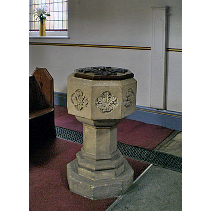
Image copyright © Alexander P Kapp, 2009
CC-BY-SA-2.0
Results: 4 records
view of font and context
Scene Description: the modern font; the late-medieval font was probably destroyed by the flod that demolished the church
Copyright Statement: Image copyright © Alexander P Kapp, 2009
Image Source: digital photograph taken 20 August 2009 by Alexander P Kapp [www.geograph.org.uk/photo/1461448] [accessed 12 November 2018]
Copyright Instructions: CC-BY-SA-2.0
view of church exterior - northeast view
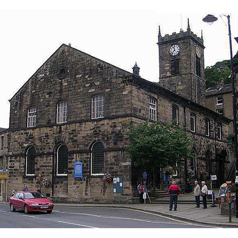
Scene Description: the modern church; the late-medieval building was destroyed by a flood
Copyright Statement: Image copyright © Betty Longbottom, 2007
Image Source: edied detail of a digital photograph taken 20 July 2007 by Betty Longbottom [www.geograph.org.uk/photo/500165] [accessed 12 November 2018]
Copyright Instructions: CC-BY-SA-2.0
view of church exterior in context
![Source caption: "View of Holmfirth from Cliffs above Cliff Road, view is taken facing southwest. The A6024 (Woodhead Road) goes from the centre of the village to the top left of the photo" [the church is visible to the right of the A6024]](/static-50478a99ec6f36a15d6234548c59f63da52304e5/compressed/1181112016_compressed.png)
Scene Description: Source caption: "View of Holmfirth from Cliffs above Cliff Road, view is taken facing southwest. The A6024 (Woodhead Road) goes from the centre of the village to the top left of the photo" [the church is visible to the right of the A6024]
Copyright Statement: Image copyright © Richard Harvey, 2016
Image Source: digital photograph taken 31 May 2006 by Richard Harvey [https://commons.wikimedia.org/wiki/File:Holmfirth_20060521(RLH).JPg] [accessed 12 November 2018]
Copyright Instructions: CC-BY-SA-3.0
view of church interior - nave - looking east
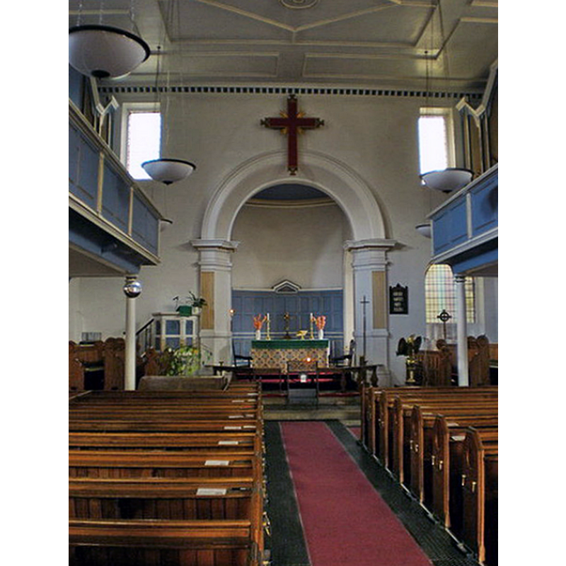
Scene Description: the modern church; the late-medieval building was destroyed by a flood
Copyright Statement: Image copyright © Alexander P Kapp, 2009
Image Source: digital photograph taken 20 August 2009 by Alexander P Kapp [www.geograph.org.uk/photo/1461446] [accessed 12 November 2018]
Copyright Instructions: CC-BY-SA-2.0
INFORMATION
Font ID: 21873HOL
Object Type: Baptismal Font1?
Church / Chapel Name: Parish Church of the Holy Trinity
Font Location in Church: [disappeared]
Church Patron Saint(s): The Holy Trinity
Church Notes: late-15thC church destroyed by flood; present church late-18thC
Church Address: 6A Town Gate, Holmfirth HD9 1HA, UK
Site Location: West Yorkshire, Yorkshire and the Humber, England, United Kingdom
Directions to Site: Located off the A6024 Woodhead Road, 10 km S of Huddersfield, 21 km NE of Glossop
Ecclesiastic Region: Diocese of Leeds
Historical Region: formerly WRYrks
Additional Comments: destroyed font? (the font of the destroyed late-15thC church here)
Font Notes:
Click to view
No individual entry found for Holmfirth in the Domesday survey. The present font in this church is modern. [NB{ we have no information on the font of the destroyed late-15th century church here]
COORDINATES
UTM: 30U 580465 5936407
Latitude & Longitude (Decimal): 53.57035, -1.7849
Latitude & Longitude (DMS): 53° 34′ 13.26″ N, 1° 47′ 5.64″ W