Chapelthorpe / Chapelthorp / Schapelthorpe
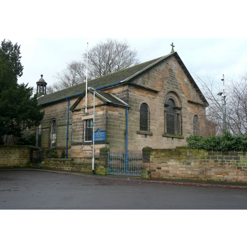
Image copyright © Humphrey Bolton, 2011
CC-BY-SA-2.0
Results: 1 records
view of church exterior - southeast view
Scene Description: Source caption: "St James's Church, Chapelthorpe. It was built in 1771, extended by William Swinden Barber in 1882, burned down in 1951, and was rebuilt using the same materials to the original plans."
Copyright Statement: Image copyright © Humphrey Bolton, 2011
Image Source: digital photograph taken 6 January 2011 by Humphrey Bolton [www.geograph.org.uk/photo/2227683] [accessed 1 November 2018]
Copyright Instructions: CC-BY-SA-2.0
INFORMATION
Font ID: 21858CHA
Object Type: Baptismal Font1?
Font Century and Period/Style: 13th century, Early English
Church / Chapel Name: Parish Church of St. James the Great
Font Location in Church: [disappeared]
Church Patron Saint(s): St. James the Greater [aka James the Great, James the Elder]
Church Notes: a chapelry of Sandal Magna; ruinous in 1771, demolished and re-built on same site and foundations; 1843 became vicarage; traces of a 13thC building uncovered in the 1881-2 renovations; burned down 1951; re-built soon thereafter
Church Address: 19 Church Ln, Chapelthorpe, Newmillerdam, Wakefield WF4 3JG, UK -- Tel.: 01924 256031
Site Location: West Yorkshire, Yorkshire and the Humber, England, United Kingdom
Directions to Site: Located E of the M1, 1 km W of Newmillerdam, 4-5 km SSW of Wakefield
Ecclesiastic Region: Diocese of Leeds
Additional Comments: disappeared font? (the one from the 13thC chapel/church here)
Font Notes:
Click to view
No individual entry found for Chapelthorpe in the Domesday survey. No mention of a font here in Harman & Pevsner (2017) [NB: we have no information on the font of the 13th-century chapel/church here].
COORDINATES
UTM: 30U 598016 5944240
Latitude & Longitude (Decimal): 53.637746, -1.517499
Latitude & Longitude (DMS): 53° 38′ 15.89″ N, 1° 31′ 2.99″ W