Horbury / Orberie
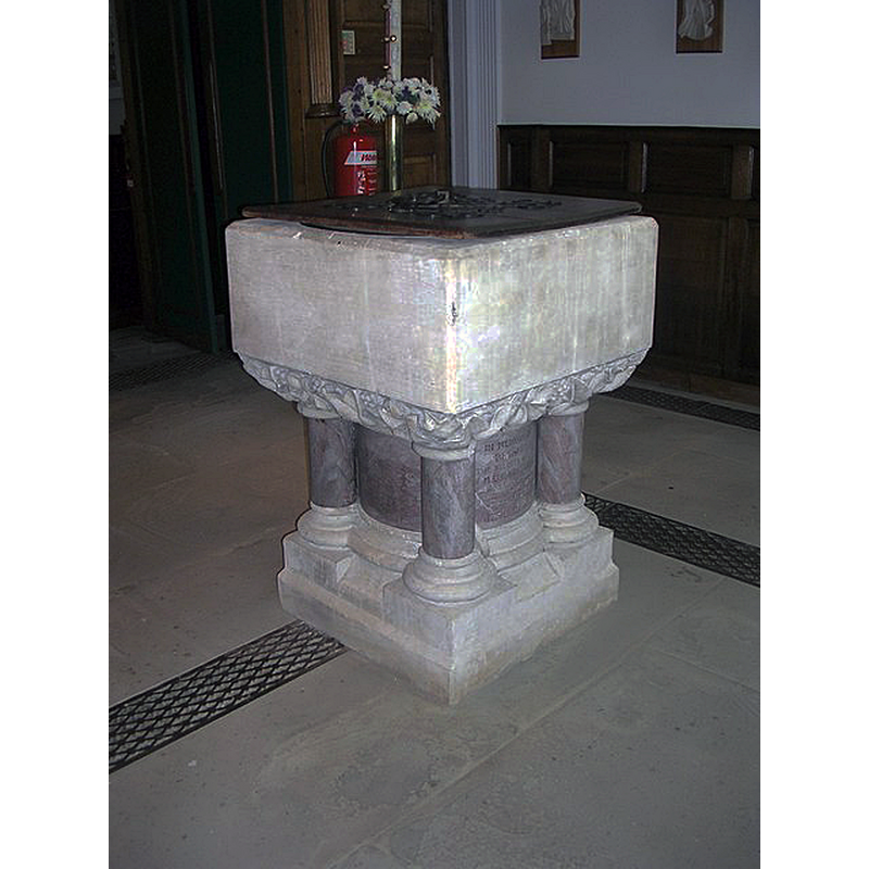
Image copyright © Betty Longbottom, 2010
CC-BY-SA-2.0
Results: 4 records
view of font and cover
Scene Description: the font and cover in this 18thC are modern
Copyright Statement: Image copyright © Betty Longbottom, 2010
Image Source: digital photograph taken 1 June 2010 by Betty Longbottom [www.geograph.org.uk/photo/1891677] [accessed 18 October 2018]
Copyright Instructions: CC-BY-SA-2.0
view of church exterior - north view
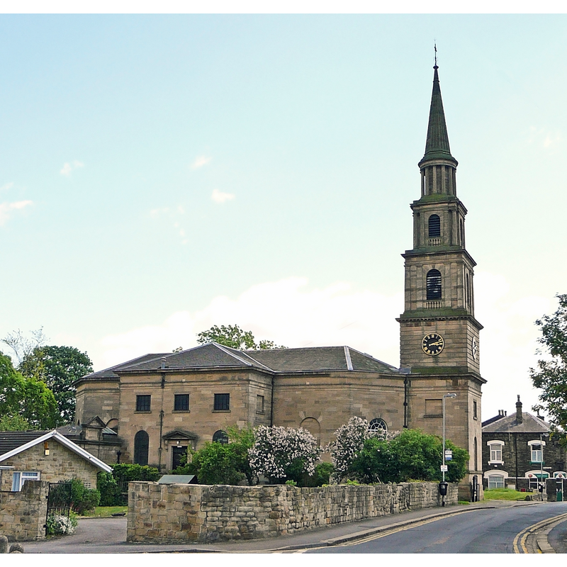
Scene Description: the present church is late-18thC
Copyright Statement: Image copyright © Tim Green, 2010
Image Source: digital photograph taken 30 May 2010 by Tim Green [www.flickr.com/photos/93416311@N00/4666735554] [accessed 18 October 2018]
Copyright Instructions: CC-BY-2.0
view of church exterior - southwest view
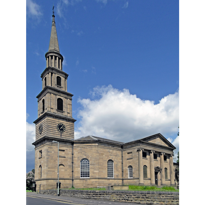
Scene Description: the present church is late-18thC
Copyright Statement: Image copyright © Tim Green, 2010
Image Source: digital photograph taken 30 May 2010 by Tim Green [www.flickr.com/photos/93416311@N00/4666737890] [accessed 18 October 2018]
Copyright Instructions: CC-BY-2.0
view of church interior - nave - looking east
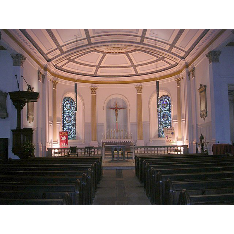
Scene Description: the present church is late-18thC
Copyright Statement: Image copyright © Betty Longbottom, 2010
Image Source: digital photograph taken 1 June 2010 by Betty Longbottom [www.geograph.org.uk/photo/1891660] [accessed 18 October 2018]
Copyright Instructions: CC-BY-SA-2.0
INFORMATION
Font ID: 21845HOR
Object Type: Baptismal Font1?
Font Century and Period/Style: 11th century, Pre-Conquest? / Norman
Church / Chapel Name: Parish Church of St. Peter and St. Leonard
Font Location in Church: [cf. FontNotes]
Church Patron Saint(s): St. Peter & St. Leonard
Church Notes: ancient chapel [Pre-Conquest?] was chapelry of Wakefield; re-built ca. 1100; demolished 1790; replaced by large new church 1794
Church Address: Northgate, Horbury, Wakefield WF4 6AS, UK -- Tel.: +44 1924 576745
Site Location: West Yorkshire, Yorkshire and the Humber, England, United Kingdom
Directions to Site: Located off (N) the B6128, N of the A642, SW of Wakefield
Ecclesiastic Region: Diocese of Leeds [formerly Wakefield]
Historical Region: Hundred of Agbrigg -- formerly WRYrks
Additional Comments: disappeared font? (the one(s) from the Domesday-time church(es) here)
Font Notes:
Click to view
There is an entry for Horbury [variant spelling] in the Domesday survey [http://opendomesday.org/place/SE2918/horbury/] [accessed 18 October 2018]; it reports three priests and two churches in it. The entry for this church in Historic England [Listing NGR: SE2951918372] mentions no font in it. The present church and its font are modern. Harman & Pevsner (2017) inform that the font here was removed by Carr in his restoration of 1790, and that the font introduced by Carr was itself removed by Canon Sharp's own restoration and replaced with one of "Portland stone with marble columns c. 1864". [NB: we have no information on the font(s) of the medieval church(es) here].
COORDINATES
UTM: 30U 595497 5946776
Latitude & Longitude (Decimal): 53.661, -1.5548
Latitude & Longitude (DMS): 53° 39′ 39.6″ N, 1° 33′ 17.28″ W
REFERENCES
- Harman, Ruth, Yorkshire West Riding: Sheffield and the South, New Haven; London: Yale University Press, 2017, p. 334-335