Bolton-le-Moors / Bolton St. Peter
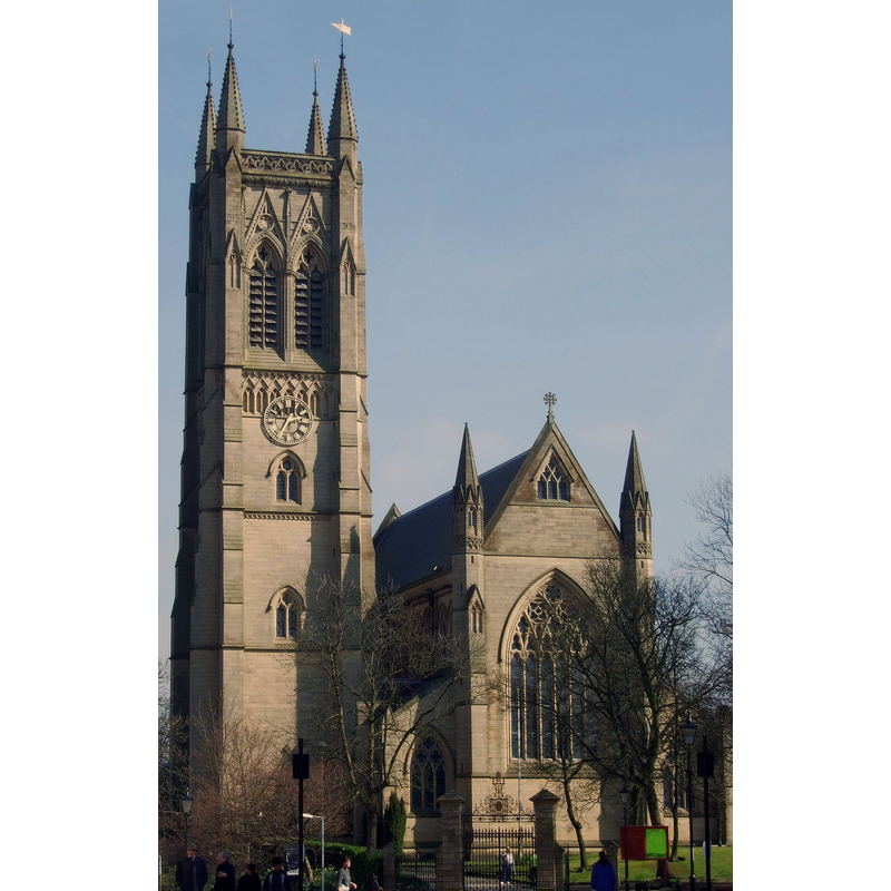
Image copyright © Austen Redman, 2007
CC-BY-SA-2.0
Results: 4 records
view of church exterior - northwest view
Copyright Statement: Image copyright © Austen Redman, 2007
Image Source: digital photograph taken 5 April 2007 by Austen Redman [https://commons.wikimedia.org/wiki/File:Bolton_Parish_Church_2007.jpg] [accessed 12 October 2018]
Copyright Instructions: CC-BY-SA-2.0
view of church exterior - south view
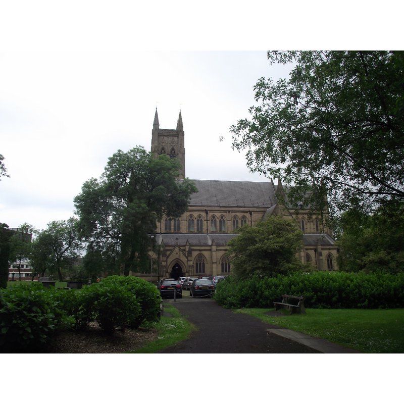
Copyright Statement: Image copyright © Philip Platt, 2013
Image Source: digiital photograph taken 30 June 2013 by Philip Platt [www.geograph.org.uk/photo/3533685] [accessed 12 October 2018]
Copyright Instructions: CC-BY-SA-2.0
view of church exterior - southwest view
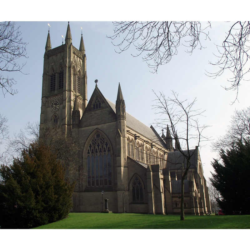
Copyright Statement: Image copyright © Philip Platt, 2012
Image Source: digiital photograph taken 22 March 2012 by Philip Platt [www.geograph.org.uk/photo/2860367] [accessed 12 October 2018]
Copyright Instructions: CC-BY-SA-2.0
view of church interior - nave - looking east
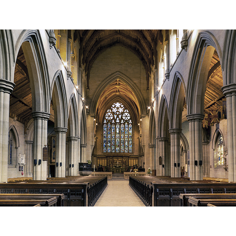
Scene Description: Source caption: "Bolton Parish Church, Nave. Fragments of stone are all that remain of the earliest church buildings (believed to be Saxon) on this site. The remains of cross, reputedly of seventh century origin, were discovered when the foundations of the present church were being excavated in 1868. A new church was built in the 15th century and this was demolished after a closing service on April 8th 1866, making way for the construction of the present church which was consecrated on June 29th 1871."
Copyright Statement: Image copyright © David Dixon, 2012
Image Source: digital photograph taken 8 September 2012 by David Dixon [www.geograph.org.uk/photo/3123663] [accessed 12 October 2018]
Copyright Instructions: CC-BY-SA-2.0
INFORMATION
Font ID: 21839BOL
Object Type: Baptismal Font1?
Font Century and Period/Style: 11th century, Pre-Conquest
Church / Chapel Name: Parish Church of St. Peter
Font Location in Church: [cf. FontNotes
Church Patron Saint(s): St. Peter
Church Notes: recent excavations discovered Anglo-Saxon remains; re-built Norman; re-built 15thC; demolished 1860s; present church is 19thC
Church Address: Churchgate, Bolton BL1 1PS, UK
Site Location: Greater Manchester, North West, England, United Kingdom
Directions to Site: Located off St Peter's Way, NE of the A575-A579 crossroads, NW of Manchester, now in Greater Manchester
Ecclesiastic Region: Diocese of Manchester
Historical Region: formerly Lancashire
Additional Comments: disappeared font? (one from the Anglo-Saxon church here? / a later one from the 15thC re-building? a stone font was reported here in 1665 [cf. FontNotes])
Font Notes:
Click to view
No individual entry for this Bolton found in the Domesday survey. The entry for this parish in the Victoria County History (Lancaster, vol. 5, 1911) notes: "The church [...] is a handsome building in the style of the 14th century erected in 1867–71 [...] The former church, which stood on the same site, then at the extreme end of the town, was a low 15th-century building, consisting of chancel, nave with north and south aisles, south porch, and west tower [...] The old church was taken down in 1866. During the demolition several pre-Norman stones were found under the tower, including a cross in three pieces. [...] There were also fragments of two other crosses, part of another cross shaft, and two stones with rude carvings, probably belonging to the 11th century, together with fragments of 12th and 13th-century work, [...] a sepulchral slab, a stone coffin, and the remains of a recumbent female figure, apparently of the 14th century, showing that at least two stone churches of earlier date had existed on the same site"; a footnote in the VCH entry reports that a stone font was mentioned in a reply to the episcopal inquiry of 1665. The entry for this church in Historic Egnland [Listing NGR: SD7205209288] notes: "Parish church. 1867-71, replacing an earlier church", but mentions no font in it, probably implying that the one from the earlier church is not present in this building. [NB: according to the parish page [http://boltonparishchurch.co.uk/the-history-of-bolton-parish-church] [accessed 12 October 2018] the parish church of Bolton is St. Peter's, in Bolton-le-Moors, of which an early Anglo-Saxon edifice is known to have existed before the stone Norman building; this was re-built in the 15th century and demolished in the 1860s; we have no information on its early font(s)].
COORDINATES
UTM: 30U 538156 5936882
Latitude & Longitude (Decimal): 53.5794, -2.4237
Latitude & Longitude (DMS): 53° 34′ 45.84″ N, 2° 25′ 25.32″ W
REFERENCES
- Victoria County History [online], University of London, 1993-. URL: https://www.british-history.ac.uk.